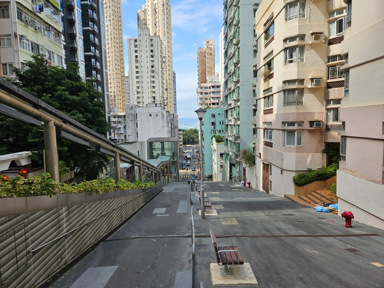

Sands Street, Hong Kong
In 1867, a ship captain named George Underhill Sands built a dock at the western edge of Hong Kong Island, in the area that would become Kennedy Town. The dock occupied a rectangle defined by the waterfront to the north, Holland Street to the east, Tai Pak Terrace to the south, and the street that would take his name to the west. Captain Sand's Slip, as it was originally known — 山市船臺 in Chinese — eventually became simply Sands Street, and the dock became the neighbourhood. That is how most of Kennedy Town's geography got made.
The Street and Its Slope
Sands Street runs north to south in Kennedy Town, connecting the newer reclaimed waterfront — the Kennedy Town New Praya — through the older Kennedy Town Praya and Catchick Street to Belcher's Street. That northern stretch is flat, utilitarian, built on land that was not there in Captain Sands's time. The interesting part of the street lies to the south.
At the southern end, the road meets Rock Hill Street at a right angle, forming a one-way lane. The pedestrian path on the east side continues steeply uphill, climbing through the Sai Wan Seven Terraces — Tai Pak Terrace, Hee Wong Terrace, Ching Lin Terrace, To Li Terrace, and others — connected by a wide, steep staircase. The climb is real. Kennedy Town sits at the foot of hillsides that rise sharply from the reclaimed shore, and the terraces that step up those slopes preserve a scale of urban life that the lower streets have mostly lost. Tenement buildings here retain what the sources describe as their "ancient style," sheltered from the noise of Belcher's Street below, perched above the harbour traffic.
The Fight for Escalators
The staircase on Sands Street is steep. After rain, it becomes slippery. For elderly residents and anyone carrying anything heavy, it has long been a source of inconvenience and the occasional accident.
For years, the Democratic Party and the Liberal Party pressed the government to install hillside escalator links and elevator systems — HEL, as the infrastructure is abbreviated. Progress was slow. In October 2007, the MTR Corporation's latest West Island Line proposal mentioned that the Corporation would fund an elevator on Rock Hill Street connecting to Sands Street, along with escalators on Sands Street itself.
An earlier episode illustrates how these decisions get made in Hong Kong: the MTR's West Island Line plan in 2005 had included two station exits on Sands Street for the Kennedy Town Station. By 2006, those exits had been quietly cancelled in the final design. The escalators and elevators that remained on the agenda were the non-MTR alternatives. On 28 December 2012, the Hillside Escalator Links and Elevator Systems on Sands Street were officially completed and opened. The climb became, for those who choose it, optional.
A Street for Filming
Kennedy Town has long served Hong Kong's film and television industry as a location stand-in for an older city. The streets here — Sands Street among them — retain something of the texture of mid-century Hong Kong that the denser commercial districts of Central and Mong Kok have largely replaced. ATV's television series *Chameleon* (變色龍) was filmed in and around Sands Street, using the tenement buildings and steep lanes as a backdrop.
The appeal is the specificity. The stone staircase, the hillside terraces, the old buildings untouched by the traffic noise of Belcher's Street — these are not generic Hong Kong but a particular neighbourhood at a particular altitude, where the city shows its older face. Restoration projects nearby have tried to preserve this quality while making the buildings functional again. The tension between preservation and renovation is not unique to Sands Street, but the street makes it visible in a compact stretch of hillside.
From the Air
Sands Street is located in Kennedy Town at the western tip of Hong Kong Island, at approximately 22.283°N, 114.130°E. From the air, Kennedy Town appears as the rounded westernmost point of Hong Kong Island, with the densely packed grid of streets visible against the steep hillside behind. The reclaimed waterfront of the New Praya runs along the northern shore. Sands Street itself is a short north-south road near the base of the Sai Wan hillside terraces, identifiable from above by the steep staircase connections running upslope. Hong Kong International Airport (VHHH) is approximately 20 nautical miles to the northwest. Approaching from that direction, the western tip of Hong Kong Island provides a clear landmark. Recommended viewing altitude: 1,500–2,000 feet for the urban texture; the slope of the terraces is best appreciated from slightly offshore to the north.
Nearby Stories
- Lok Ma Chau Loop 2.3 km away
- Portas do Cerco 2.3 km away
- Kweilin Incident 17 km away
- Wanshan Archipelago Campaign 34 km away
- Nanxiong Formation 115 km away
- Battle of Nanpeng Island 148 km away
- Heyuan 169 km away
- Cape Maobitou 632 km away