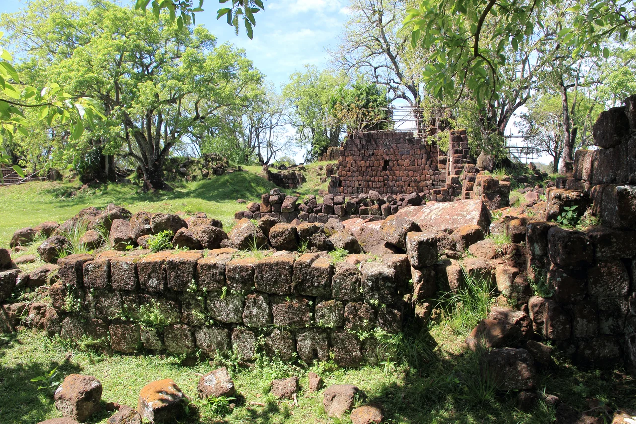

São Lourenço Mártir Archaeological Site
Seven thousand people once lived here. Today the grass grows tall between the sandstone walls, and a visitor walking the site of São Lourenço Mártir can put a hand on the cool stone of a church that has had no roof for more than two centuries. This was one of the Sete Povos das Missões, the seven Guaraní towns the Spanish Jesuits built across what is now the far south of Brazil. São Lourenço was among the largest of them, and like all of them, it ended not in slow decline but in catastrophe.
A Town Founded by Refugees
The reduction took shape in 1690, when Father Bernardo de la Vega led a group of Guaraní here from the Argentine mission of Santa María la Mayor. Many of them were descendants of families who had already fled once, refugees from Guairá to the north, where Portuguese slave raiders called bandeirantes had broken up the earlier missions decades before. They settled near São Luiz Gonzaga, on land reached today by the BR-285 highway, roughly thirty kilometers from town. What grew here was not a village but a small city: a stone church at its heart, a school, a cemetery, workshops, and the surrounding farmland that fed everyone. By the standards of colonial South America, it was an experiment without parallel, a self-governing Indigenous town shaped by Catholic priests and Guaraní hands together.
Yerba Mate and the Rhythm of the Day
Daily life in the missions ran on a logic the Jesuits had to negotiate rather than impose. The Guaraní who came here valued generosity and the giving of gifts; they had little use for the grinding, repetitive labor European economies demanded. So the priests adapted. They turned work into competition and ceremony, organized teams and contests, and leaned on the deep Guaraní instinct for collective effort. Yerba mate threaded through it all. The priests encouraged the bitter green infusion as a substitute for alcohol, and the habit took hold across the missions so completely that mate became, and remains, the defining drink of the entire region. Walk into any home in Rio Grande do Sul today and you will likely be handed a gourd.
The Treaty That Doomed Them
In 1750 a line drawn on a map in Europe sealed the towns' fate. The Treaty of Madrid handed the land of the Sete Povos from Spain to Portugal, with Spain receiving Colonia del Sacramento in exchange. The Guaraní were ordered to abandon the towns their grandparents had built and march west across the Uruguay River. They refused. Their leader, Sepé Tiaraju, gave the resistance its enduring cry: *Esta terra tem dono* - this land has an owner. He was killed in a skirmish on 7 February 1756. Three days later, at the Battle of Caiboaté, a combined Spanish and Portuguese force of around 3,000 men met the Guaraní in open ground. The official count records 1,511 Guaraní dead against four European casualties. It was not a battle so much as an erasure.
What the Grass Keeps
The towns emptied. The Society of Jesus was expelled from Spanish and Portuguese lands in the years that followed, and the elaborate world of the missions dissolved into ruin. At São Lourenço, the walls stayed. Visitors today can trace the footprint of the church, the cemetery, the farmhouse, all of it half-swallowed by vegetation, while a small exhibition near the entrance lays out what archaeologists have recovered from the ground. Brazil now protects São Lourenço alongside the ruins of São Miguel Arcanjo, São Nicolau, and São João Batista as national heritage. The roofless stone is the point. It refuses to let the story be tidied away, and it keeps insisting on the seven thousand who once called this place home.
From the Air
São Lourenço Mártir sits at 28.46°S, 54.71°W in the rolling missions country of northwestern Rio Grande do Sul, about 30 km from São Luiz Gonzaga along the BR-285. From a few thousand feet the terrain reads as a quilt of soy and wheat fields broken by gallery forest along the rivers, with the low sandstone ruins easy to lose against the grass unless the light rakes low. The nearest airport is Sepé Tiaraju Airport at Santo Ângelo (ICAO SBNM, IATA GEL), roughly 60 km east-northeast, itself named for the Guaraní leader who died resisting the treaty that destroyed these towns. Larger fields and the major gateway lie at Porto Alegre's Salgado Filho International (ICAO SBPA) some 440 km southeast. Clear, dry winter days offer the best visibility over the open highlands.
Nearby Stories
- Battle of Mbororé: The Day the Guaraní Turned the Tide 51 km away
- São Borja 79 km away
- João Goulart's House 85 km away
- Jesuit Missions Among the Guaraní: Utopia, Refuge, and Ruin 102 km away
- Paleontological and Archaeological Museum Walter Ilha 115 km away
- Santa Maria, Rio Grande do Sul 119 km away
- Kiss Nightclub Fire 148 km away
- Blumenau 518 km away