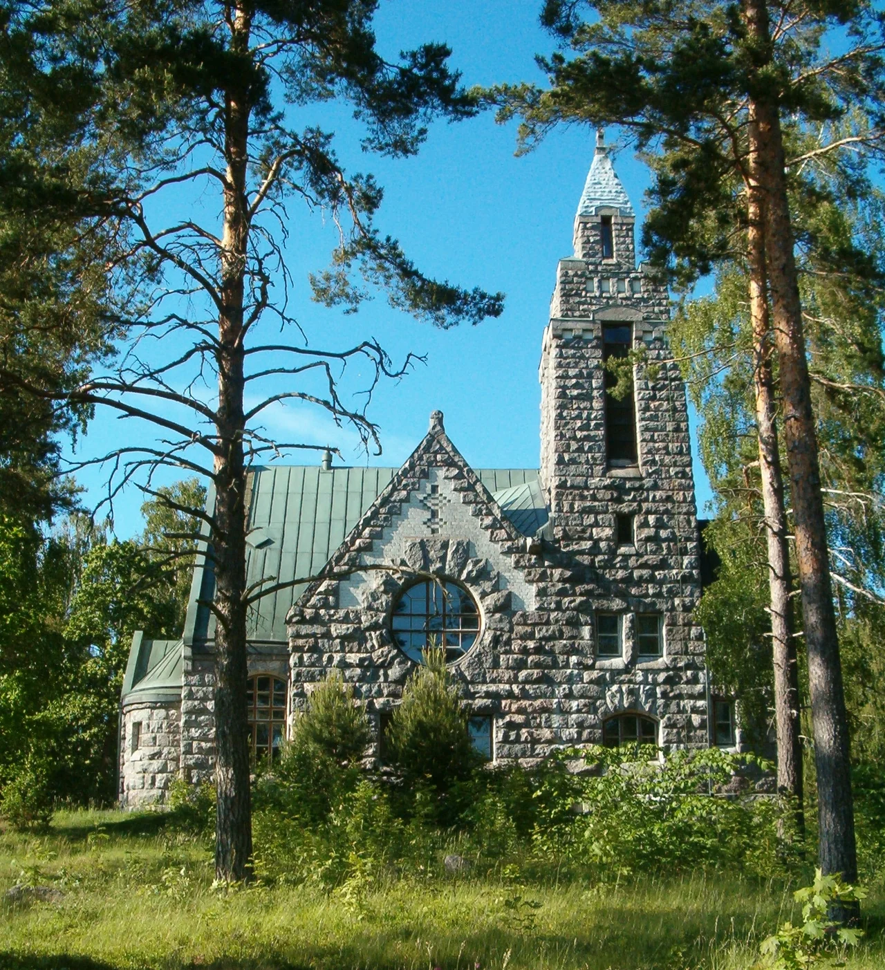

Sauvo
On 2 August 1808 the water east of Sandö island filled with gunsmoke. A Russian squadron, heavily the stronger, forced its way westward through a Swedish naval detachment while Swedish troops tried simultaneously to strike inland at Västankärr, where the Russian commander-in-chief, General Friedrich Wilhelm von Buxhoevden, was staying. The landing came to nothing. Finland changed hands anyway. Traces of the earthworks thrown up that summer still sit in the woods of what is now Sauvo, a quiet farming municipality of fewer than three thousand people on a blunt peninsula where the mainland runs out into the Archipelago Sea.
Farmers With a Shipping Licence
Long before the war, Sauvo's living came off the water as much as off the fields. In 1652 the parish won a sailing permit - a licence for ordinary farmers to trade by sea on their own account, a right the crown handed out sparingly and which covered Karuna as well. In 1726 locals were confirmed in the right to carry agricultural and forest produce and fish to Stockholm. The key harbour was at Sandö, deep enough that salt ships drawing serious water could come alongside. Picture a working coastline of small sloops loaded with grain, tar, planks and dried fish, run by men who spent the winter behind a plough. Today the same shores carry summer cottages instead, thousands of them, and the population swells every June before draining away again in August. The parish village itself sits six kilometres inland, in the middle of the peninsula, as if hedging its bets.
Spurs on the Coat of Arms
Sauvo was noble country, and the municipal arms designed by Ahti Hammar and confirmed in 1957 carry spurs to say so. The manors are documented absurdly early: Paddainen appears in the record in 1326, Ruona in 1350. Karuna manor was granted säteri rights - the tax exemption that marked a true noble seat - in 1562, when Henrik Simoninpoika, bailiff of Turku Castle, was ennobled; his family held it for a century. Its two-storey main house of brick and stone was finished in 1566, which makes it one of the oldest strata of Finnish manor architecture still standing. The walls are 120 centimetres thick, and a coat-of-arms slab carved by the stonemason Antonius Timmerman sits above the front door to this day. Sixteen further buildings from the eighteenth to twentieth centuries share the grounds. Up on the church hill, meanwhile, jackdaws have nested in the tower structures for something close to seven centuries. Locals call them hakkinen, a word you will not hear in the next parish over.
The Village That Named a Power Company
Karuna, in the southwest, spent a hundred years as its own municipality - split off from Sauvo at the start of 1869, officially bilingual until 1933, folded back in at the start of 1969, with only the village of Santasaari going to Kemiö instead. It has one unlikely legacy. In 1912 a handful of local manor owners founded the Karuna-Sauvo Electricity Company for their own convenience; it grew into Lounais-Suomen Sähkö, whose first great project was harnessing three rapids on the Paimionjoki river to the north. Renamed Länsivoima in 1995, absorbed into Fortum in 2000, sold off again in 2014, the business is now Caruna - and the name, spelling drift aside, is still the name of this village. It carries electricity to about 1.5 million people.
After the Wars, and Since
When the Second World War ended and the Karelian Isthmus went to the Soviet Union, families evacuated from the parish of Uusikirkko were resettled here, on land carved out of the old estates - Karuna manor alone was divided to make eight farms for them. They arrived having lost everything they could not carry, and they became Sauvo people. The municipality took its own losses too, and its war dead lie in the military cemetery beside the medieval church. Modern Sauvo is small and getting smaller: 2,957 residents across 300 square kilometres, one built-up area, a couple of supermarkets and a pharmacy in the church village. The Rungonsalmi bridge, opened in 1972, finally replaced two ferries and put Kemiönsaari within easy reach. Karuna was voted village of the year in Southwest Finland in 2013, largely on the strength of a community that refuses to fade quietly - and, it must be said, of a village shop in Rantola whose hamburgers people drive a very long way for.
Room to Disappear
The best of Sauvo is not listed anywhere. Under Finland's right of access you can walk into almost any wood here and sleep in it, provided you keep clear of houses, cottages, fields and reserves, light no fire, disturb no wildlife and leave nothing behind. Carry water; what you find in the forest is not guaranteed. The Tapilanlahti area at the mouth of the Sauvonjoki is the municipality's one Natura site, rich in birds, its grazed shore meadows and small dry hills holding a plant community that repays slow walking. There are islands to the south, the largest of them Kupiluoto, joined to the mainland by a bridge. Everything else is mainland, fields, granite and pine - which is to say, it is the ordinary Finnish countryside, and the ordinary Finnish countryside is the point.
From the Air
60.3431°N, 22.6931°E, on the peninsula between Paimionlahti and Halikonlahti bays, north of Kemiönsaari. Best viewed from 2,000-3,500 ft AGL. Navigate by the two long bays flanking the peninsula and by the Rungonsalmi bridge crossing the Kemiönsalmi strait to the south; road 181 runs the length of the peninsula from Paimio down to Kemiönsaari. The church village is the only concentration of buildings, roughly in the middle. Nearest airport is Turku (EFTU), about 35 km northwest; Kiikala gliding field (EFIK) lies roughly 40 km northeast in Salo, and Helsinki-Vantaa (EFHK) about 125 km east. Expect scattered low cloud over the archipelago in spring and autumn, and excellent visibility on clear winter days when the bays freeze.
Nearby Stories
- Nådendal Abbey 13 km away
- Dalsbruk 14 km away
- Kurjenrahka National Park 18 km away
- Ekenäs, Finland 20 km away
- Jokioinen 24 km away
- Archipelago National Park 27 km away
- Paikkari Croft 33 km away
- Valmet Automotive 42 km away