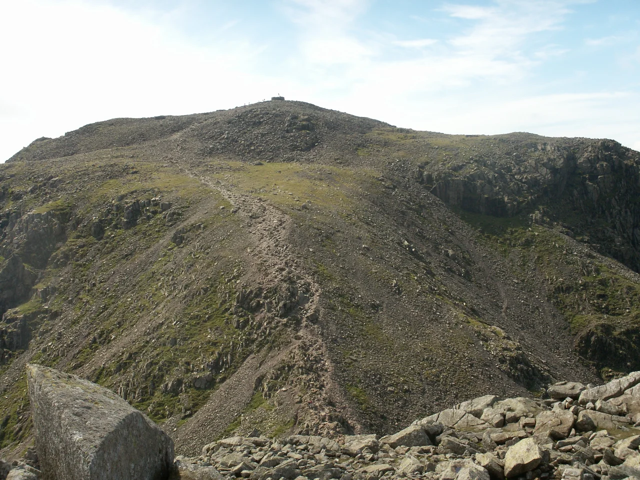

Scafell Pike
Until the early 1800s, England's highest mountain did not have a name of its own. The Ordnance Survey, mapping Cumbria in the first decade of the 19th century, simply labelled it "Sca-Fell Higher Top" - a descriptive marker for a peak that nobody had yet bothered to distinguish from its neighbour. The realisation that this rocky plateau was actually the highest ground in the country came late, and the name Scafell Pike was adopted, in the words of guidebook writer Jonathan Otley, "by common consent" shortly before the 4th edition of his guide appeared in 1830. England, in other words, had not noticed its own summit for most of recorded history.
The Pike, the Massif, the Volcano
Scafell Pike stands at 978 metres - the highest and the most topographically prominent mountain in England, though both records depend slightly on definition. The actual summit is buried beneath a massive cairn over three metres tall, and nobody knows exactly how much of the cairn is mountain and how much is loose stone piled by walkers. The traditional figure of 3,210 feet has the satisfying memorability of a number invented for a quiz answer. The Pike sits on the western side of a great cirque - a glacier-carved amphitheatre - at the head of Eskdale, with Scafell itself to the south and Great End to the north. North of Ill Crag, the ridge drops into the saddle of Calf Cove at 853.4 metres before climbing again to Great End at 909.5 metres. Geologically, the whole Scafell massif is part of the Borrowdale Volcanics: 400 to 450 million years old, the eroded remains of an extinct volcano that was already ancient when the dinosaurs evolved.
A Summit Given for the Dead
On a clear day at the top, there is a small bronze plaque and the awareness of standing on a war memorial. In 1919, Charles Wyndham, the 3rd Baron Leconfield, donated the summit of Scafell Pike to the National Trust "in perpetual memory of the men of the Lake District who fell for God and King, for freedom peace and right in the Great War 1914-1918." It was an extraordinary gift in scale, a mountain peak given to the nation as cenotaph. The better-known war memorial nearby - the bronze plaque on the summit of neighbouring Great Gable - commemorates the Fell and Rock Climbing Club's own dead. Both peaks, both gifts, both made out of the same impulse to inscribe collective grief onto landscape. As of 2014, over 100,000 people a year climbed Scafell Pike from Wasdale Head alone, many as part of the National Three Peaks Challenge that links Britain's highest mountains. By 2022 the total reaching the summit by any route had risen to 250,000.
Piers Gill and the Hidden Killer
On the western side of the ridge, draining into Wast Water through a spectacular ravine, runs Piers Gill - one of the most dramatic stream gorges in the Lake District and one of the most dangerous. In rain, the gill rises fast and unpredictably. In winter, freezing transforms it into a sheet of ice with deadly exposure should a foot slip. Several walkers and climbers have died here over the years - some from falls, some by becoming trapped on ledges they could neither climb up nor descend. The Wasdale Mountain Rescue Team treats Piers Gill as one of the patch's most consistent accident spots. The danger has nothing to do with technical difficulty in the climbing sense. It is the simpler, harder danger of a landscape that punishes overconfidence: a clear day, a slight diversion off the main path, the ground steeper than it looked from above. The Pike does not have to try to kill you. It just has to be itself.
Surveyors on the Roof
In 1826, surveyors from the Ordnance Survey hauled equipment to the summit as a station in the Principal Triangulation of Britain - the great mathematical project that fixed the relative positions of every major point on the British landmass. Standing here, they sighted across more than a hundred miles of open air to Snowdon in Wales and Slieve Donard in Northern Ireland, the long-range observations only possible during rare windows of perfect visibility. The surveyors camped on the summit for much of a summer waiting for those windows. The Ordnance Survey's high-precision theodolite did not actually reach the top until 1841, fifteen years after the first survey work began here. From the summit, on a properly clear day, more than thirty other Marilyn peaks are visible - the Mourne Mountains 111 miles south-west in Ireland, Snowdonia 100-odd miles south, the Cheviot 83 miles east, the closer hump of Great Gable a mere two miles north, marking the war memorial that the climbing club tend more often than most people tend the Cenotaph in London. From a 19th-century survey point to a 21st-century memorial, the Pike has remained, mostly, the same lump of Ordovician volcanic rock - it is only the meanings we have given it that have changed.
Flight Context
Scafell Pike summit sits at 54.45 degrees north, 3.21 degrees west, elevation 978 metres (3,209 feet) - the highest point in England. From the air the peak is identifiable as the highest of a horseshoe of fells at the head of Eskdale, with the rocky summit cairn and ring of boulder fields making it visible as a barren patch above the green flanks. Best viewed from 6,000 to 8,000 feet AGL; lower altitudes risk strong mountain wave and rotor effects. Cloud frequently obscures the summit even on otherwise clear days, and the leeward side of the massif generates significant turbulence in westerly winds. Nearest airfields: Carlisle Lake District (EGNC) about 30 nm north, Walney Island Barrow (EGNL) about 25 nm south.
From the Air
Scafell Pike summit at 54.45 N, 3.21 W, elevation 978 m (3,209 ft) - England's highest point. From above: the highest of a horseshoe of fells at the head of Eskdale, identified by the summit cairn and rocky boulder fields above green flanks. View from 6,000-8,000 ft AGL; lower altitudes risk mountain wave and rotor effects. Frequent summit cloud and significant lee-side turbulence in westerlies. Nearest fields: Carlisle Lake District (EGNC) about 30 nm N, Walney Island Barrow (EGNL) about 25 nm S.
Nearby Stories
- Isel Hall 3.3 km away
- Walney Island 7.1 km away
- Kendal 9.7 km away
- Lancaster Priory 10 km away
- Raeberry Castle 15 km away
- Cross Fell 21 km away
- Ramsey Bay 29 km away
- Santon Railway Station 47 km away