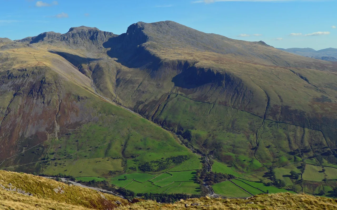

Scafell
For most of recorded history, this was the highest mountain in England. Or so people believed. Scafell rises 964 metres above the western valleys of the Lake District, and from many directions it looks unmistakably dominant - bigger, bolder, more theatrical than anything around it. Only after Jonathan Otley and others put surveyors' chains and barometers to work in the early nineteenth century did the truth emerge: the three modest-looking peaks immediately to the north - now called Scafell Pike, Ill Crag and Broad Crag - were actually taller. The mountain that had given the whole massif its name was, by a few decisive metres, the runner-up.
A Ridge Between Two Valleys
Scafell stands like a wall between Wasdale to the west and upper Eskdale to the east. Its summit ridge runs south from the narrow saddle of Mickledore down towards Slight Side, and the broad upland tapers away into the moorland top called Great How. To the north, separated by Mickledore, sits Scafell Pike - close enough to touch, yet maddeningly hard to reach. The col between the two summits is guarded by the dark cliffs of Scafell Crag, one of the most consequential pieces of rock in British mountaineering history. Climbers chasing the obvious route between the peaks face Broad Stand, a series of sloping steps that look manageable from above but steepen suddenly into a death trap above Mickledore. Wasdale Mountain Rescue Team know this place well. It is not a walker's route, no matter how the perspective tempts.
The View Wordsworth Borrowed
From the main cairn on its short rocky ridge, Scafell hands over a panorama its higher neighbour cannot match. Wastwater glints below, the coastal plain runs to the Irish Sea, and the Western Fells, Bowfell and the Coniston Fells fill the southern horizon. William Wordsworth knew this view well - he wrote a popular guidebook to the Lake District in the years before his poetry became canonical. Harriet Martineau eventually supplanted his book with her own, and Jonathan Otley and John Dalton measured the heights of the surrounding fells with the patient instruments of the early nineteenth century. They all stood near where you might stand now. The northward saddle, marked by a large cross of stones, leads to Symonds Knott, the lower north top, which looks straight down into Mickledore.
How a Mountain Lost Its W
Until 1867, English maps and guidebooks were split almost evenly between Scawfell and Scafell. The longer, phonetic spelling matched how people actually said the name. The shorter form crept in through the Donald Map of 1774, a document riddled with placename errors, and the Ordnance Survey perpetuated the mistake from 1867 onwards. Survey crews had careful procedures for recording correct local names - procedures developed after their Irish work between 1824 and 1838 - but because Sca Fell was an essential triangulation station, used to take bearings on Slieve Donard in Ireland and Snowdon in Wales, surveyors knew the mountain too well to bother with the Name Book paperwork. The error stuck. Locals were still saying Scawfell well into the 1950s. The hotel keepers at Wasdale Hall Estate were using it in 1920 sales particulars. The mountain had a name; the maps just stopped listening.
Pikes of Scawfell
There was a time, Wainwright wrote, when the whole mass south of Sty Head was simply Scaw Fell. The three sharper peaks to the north were known collectively as the Pikes of Scawfell, treated as subsidiary summits of the parent mountain. The Ordnance Survey's 1811 report called them "Sca-Fell Higher Top" and "Sca-Fell Lower Top" - language that captures how people thought about the massif before height became the measure of everything. Dorothy Wordsworth climbed the Pikes in 1818 and, presumably consulting Otley's new measurements, realised the smaller-looking peak was actually taller. Once Scafell Pike was crowned England's highest, the range needed individual names, and the old gathered identity broke apart. The fells became plural where they had been singular, and Scafell became, slightly grudgingly, the lower top.
From the Air
Scafell summit at 54.448 N, 3.225 W, elevation 964 metres (3,163 ft). Recommended viewing altitude 5,000-7,000 ft to clear surrounding fells. Visual landmarks: Wastwater immediately west, Scafell Pike one mile north across Mickledore col, the Irish Sea on the western horizon. Nearest airports: Carlisle Lake District (EGNC) 35 nm north, Blackpool (EGNH) 50 nm south, BAE Systems Warton (EGNO) 55 nm south. Lake District weather is famously volatile - low cloud frequently obscures the summit ridge, and lenticular cloud over the fells indicates strong upper winds. The mountain is part of Britain's wettest region; expect rapid changes in visibility.
Nearby Stories
- Isel Hall 3.3 km away
- Walney Island 7.1 km away
- Kendal 9.7 km away
- Lancaster Priory 10 km away
- Raeberry Castle 15 km away
- Cross Fell 21 km away
- Ramsey Bay 29 km away
- Santon Railway Station 47 km away