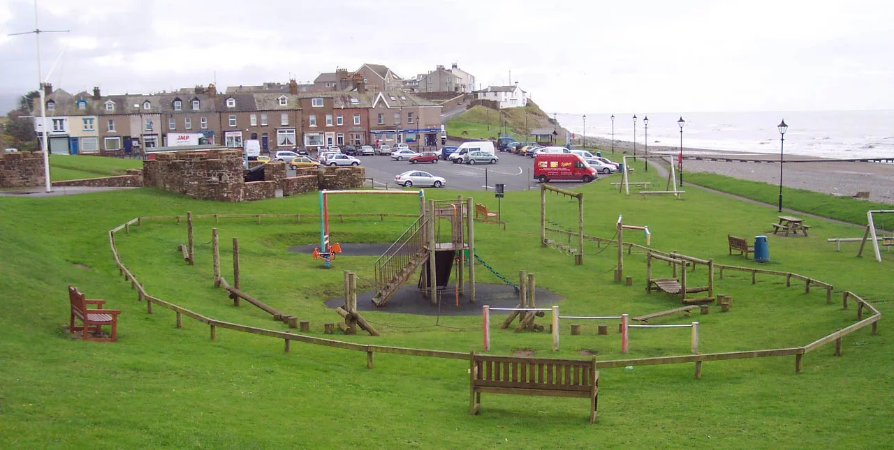

Seascale
In the 1950s, this small Irish Sea village was sometimes called "the brainiest town in Britain." Seascale, population a couple of thousand, had drawn an unusual concentration of physicists, chemists and engineers - the people who ran the reactors at Windscale and Calder Hall just three miles up the coast. They sent their children to local schools, drank in the same pubs as the farmers, and made Seascale a dormitory community for the most secretive industrial complex in the country. The name on the road sign, though, is much older than the science. It comes from the Old Norse skali, a wooden shelter, given by settlers who arrived sometime after AD 885.
Norse Names, English Soil
King Harold Fairhair had vowed revenge on the many Norsemen who had settled in Ireland and the Isle of Man, and his pressure sent a wave of them fleeing across the sea to the Cumbrian coast. They built shelters near the water - skalar - and as they pushed inland and built more, each one needed a distinguishing name. The shelter near the sea became Sea-skali, then Seascale. Other Norse names cluster around it: Seascale How is Skala Haugr, the hill near the shelter; Whitriggs is hvitihrgger, the white ridge. The earliest written reference to the village comes from 1154-1181, when an Aldwin de Seascale witnessed a deed at Wetheral priory. By 1200, Roger de Beauchamp was granting nearby land to the priory of St. Bees and identifying it as adjacent to Leseschalis. The name has scarcely changed in a millennium.
A Holiday Resort That Almost Was
For most of the next seven centuries, Seascale was a string of farms. The Furness Railway arrived in 1850, connecting Whitehaven to Barrow in Furness, and a guidebook in 1869 noted that "there was not a shop in the place." That changed in 1879 when Sir James Ramsden of the Furness Railway hired Edward Kemp of Birkenhead to design Seascale as a Lakeland seaside resort. The plans called for a large hotel, marine walks and villas stretching 1.5 miles along the coast. Most of the scheme was never built, but the Scawfell Hotel rose beside the railway station and advertised its bathing machines and fine beach in Victorian newspapers. The hotel was demolished in 1997. The Iron Church of St Cuthbert, built in 1881, was blown down in 1884 - rebuilt, then replaced in 1890 by the stone church that still stands. George Gissing visited as a young man in 1868 and drew on the village for his novel The Odd Women three decades later.
The Atomic Years
When the Royal Ordnance Factories opened at Sellafield and Drigg in 1939, accommodation for munitions workers transformed the village. After the war ended, the ordnance site became Windscale, then Calder Hall, and eventually the combined nuclear complex called Sellafield. Seascale absorbed the workforce - scientists, technicians, riggers, drivers - and the population grew with the salaries. For a generation, Seascale children grew up with parents who could not always say what they did at work. The Guardian later collected reminiscences under the title "Reminiscences of an atom kid." In 1990, researchers began to confirm what some families had long suspected: children born in Seascale between 1950 and 2006 had significantly elevated rates of childhood leukemia and non-Hodgkin lymphoma compared to the national average. The Committee on Medical Aspects of Radiation in the Environment, after careful study, concluded the excess was "unlikely to be due to chance" but could not identify a convincing cause. For the families involved, the statistics described something already lived: small coffins, hospital corridors, the relentless arithmetic of grief. Studies continue.
June 2010
On 2 June 2010, Seascale became the centre of a manhunt. Derrick Bird, a 52-year-old Whitehaven taxi driver, drove through West Cumbria shooting people he encountered. By the time he took his own life in Boot, in upper Eskdale, he had killed twelve and wounded eleven. Three of the dead were shot in Seascale itself; another in the surrounding fields near Gosforth, where a further person was seriously wounded. The village - a few streets, a railway station, a beach - became, briefly, the focus of national news for the worst reasons imaginable. Most years, Seascale does not appear in newspapers. The Cumbrian Coast Line trains still call there on the way to Barrow, the parish ward stretches inland to the summit of Scafell Pike, and the population sits a little under two thousand. It is a quiet place. It has had loud history.
From the Air
Located at 54.396 N, 3.480 W on the Cumbrian coast. Recommended viewing altitude 2,500-4,000 ft. Visual landmarks: Sellafield nuclear site 3 miles north-northwest (recognisable concrete structures and chimneys), the open Irish Sea to the west, and the Lake District fells rising sharply inland - Wasdale and Scafell visible to the northeast on clear days. Nearest airports: Carlisle Lake District (EGNC) 35 nm north-northeast, Isle of Man Ronaldsway (EGNS) 60 nm west, Blackpool (EGNH) 50 nm south. Restricted airspace around Sellafield - check NOTAMs for the prohibited area EG-P611.
Nearby Stories
- Isel Hall 3.3 km away
- Walney Island 7.1 km away
- Kendal 9.7 km away
- Lancaster Priory 10 km away
- Raeberry Castle 15 km away
- Cross Fell 21 km away
- Ramsey Bay 29 km away
- Santon Railway Station 47 km away