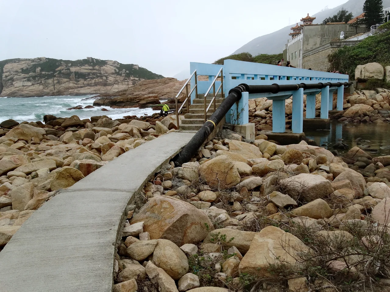

Shek O
The name says it plainly: Shek O means rocky bay. Standing at the peninsula's edge, waves breaking against the headland below and the South China Sea stretching to the horizon, the name feels exactly right. Hong Kong is one of the world's great cities, but Shek O — tucked behind country park on the island's south-eastern corner — exists at a remove from all of that. Getting here requires navigating Shek O Road's winding coastal curves, and the journey itself signals that you have left the city behind.
Two Hundred Years at the Water's Edge
Shek O Village has roughly 200 years of history, though the land beneath it carries evidence of much older habitation. The community was once known for its lobster fishing — a reminder that this corner of Hong Kong Island supported working people long before it attracted weekenders. That working-class history was disrupted when the majority of the original population was forcibly removed from the land that now forms the Shek O Country Club grounds. By 1841, the village, together with neighbouring Hok Tsui and Tai Long Wan, had a combined population of around 200 people.
The Tin Hau Temple in the village, built in 1891, is a Grade III historic building and one of the peninsula's oldest surviving structures. Tin Hau — goddess of the sea — was a natural patron for a fishing community. The memorial archway near the main entrance to the village bears the calligraphy of R.C. Lee (利銘澤), a prominent Hong Kong figure who lived from 1905 to 1983. Nearby stands the Shek O Bus Terminus building, a modernist structure completed in 1955 and designed by Hsin Yieh Architects, the firm founded by Chinese architect Su Gin Djih (徐敬直) — an unexpected piece of architectural history at the edge of a country lane.
Where the Surf Comes In
Shek O Beach is a sandy public beach facing the South China Sea, gazetted Grade 2 for water quality. On weekends and public holidays it fills with Hong Kong residents seeking something simpler than the urban intensity they left behind — barbecue areas, food stalls, and the particular pleasure of swimming in open sea. About a mile north, past the country club, Big Wave Bay earns its name: the swell comes in unimpeded from the South China Sea, making it the destination for surfers on Hong Kong Island. Paragliders launch from the Dragon's Back ridge above, riding thermal lift and landing at nearby Rocky Bay.
Big Wave Bay Beach is also the site of prehistoric rock carvings, similar to those found on Cheung Chau Island, cut into the rock by hands that worked centuries before the first fishing village was established here. The carvings are a quiet reminder that this coastline has been meaningful to people for a very long time.
The Golf Club and the Camera
The Shek O Country Club occupies the most dramatic land on the peninsula. Its history dates to 1919, with the clubhouse completed in 1925 — the course plays to a par 65 with no par 5s, a short layout that makes the most of clifftop terrain. That it exists alongside a public beach, a fishing village, and a country park says something about the layered social geography that has always defined Hong Kong.
Shek O's scenery has drawn filmmakers as reliably as it draws weekend hikers. Directors Stephen Chow and Lee Lik-chi chose the peninsula as a location for their 1999 film King of Comedy (喜劇之王), and the village's streets and beaches have appeared in numerous Cantopop music videos. The isolation that makes Shek O feel different from the rest of Hong Kong — the limited bus service, the single road in and out — is precisely what makes it photogenic. The environment near the beach stays unusually quiet for a place accessible to millions of people.
Getting In and Getting Out
Shek O's connection to the rest of Hong Kong is deliberately slender. Bus route 9 and red minibuses run from Shau Kei Wan — itself a 30-minute bus ride from Central — making the journey feel proportionate to the destination. Shek O Road connects eventually to Tai Tam Road and from there to Stanley and Chai Wan, but it is a winding coastal road that demands attention. Parking near the beach is limited. This is not accidental. The combination of country park, coastal topography, and minimal infrastructure keeps Shek O's character intact. It is, against all odds, still a village.
From the Air
Shek O sits at 22.2306°N, 114.2519°E on the south-eastern tip of Hong Kong Island. The peninsula is easily identified from the air: a narrow finger of land extending into the South China Sea, with the pale crescent of Shek O Beach on its western side and rugged headland on the east. Dragon's Back ridge is visible running north-west from Shek O Peak above the peninsula. Hong Kong International Airport (VHHH) is approximately 28 kilometres to the west on Lantau Island. Cape D'Aguilar lighthouse lies 2 kilometres south-west, marking the island's southern extremity. Recommended viewing altitude is 1,500–2,500 feet for a clear view of the full peninsula and coastal geometry.
Nearby Stories
- Lok Ma Chau Loop 2.3 km away
- Portas do Cerco 2.3 km away
- Kweilin Incident 17 km away
- Wanshan Archipelago Campaign 34 km away
- Nanxiong Formation 115 km away
- Battle of Nanpeng Island 148 km away
- Heyuan 169 km away
- Cape Maobitou 632 km away