_(July_2025)_(5).jpg)
Shepshed
Until 1888 the spelling was Sheepshed, and before that Sheepshead, and before that, in the Domesday Book of 1086, Scepeshefde Regis - the King's hill where the sheep graze. There are not many English towns whose entire identity is fixed by their name as squarely as that. Shepshed sat on a Leicestershire hilltop, kept sheep, sold their wool, and built itself slowly around the trade. A medieval Cistercian abbey two miles south did the same on a grander scale. The wool stopped being king centuries ago. The name kept its grammar.
Domesday and the Royal Lodge
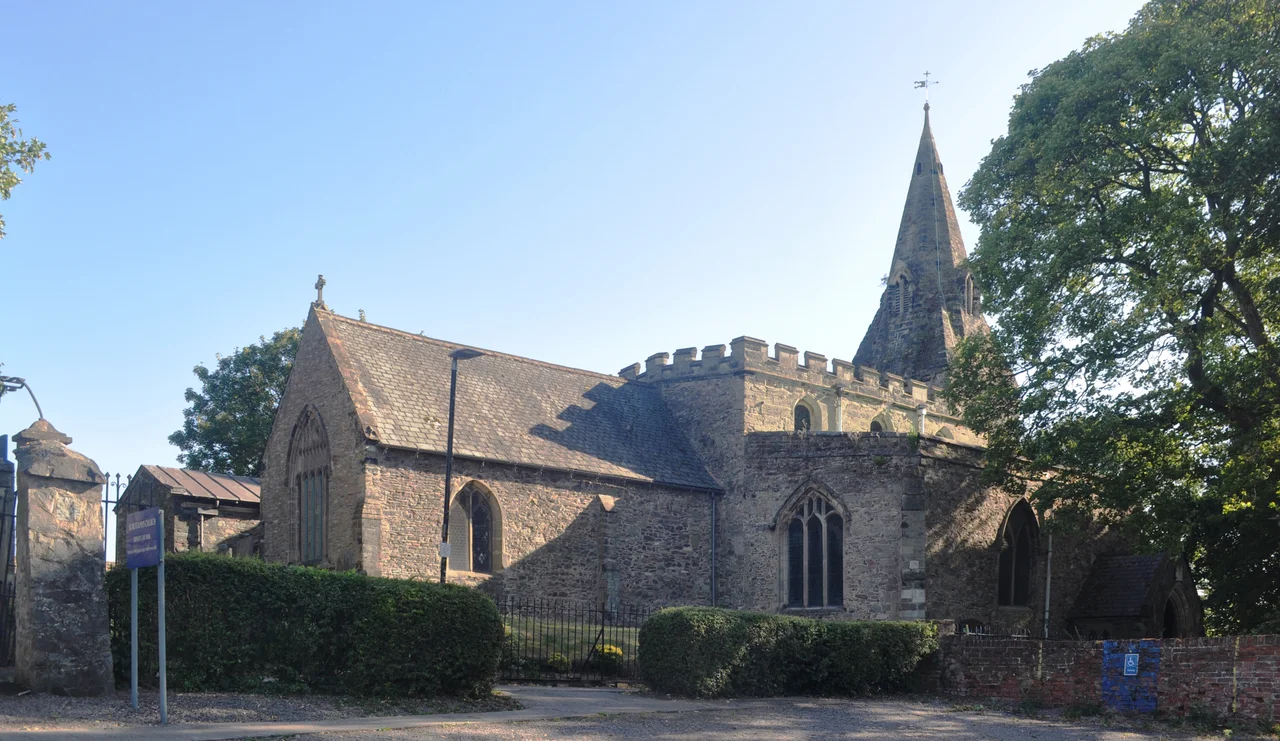
The suffix Regis in the Domesday entry implies that there was once a royal hunting lodge on the high ground above the village, although no one has ever turned up its footings. Whatever it was, it lent the town the King's stamp on its name. Local antiquarians point to two roads they think predate the Domesday survey - Ring Fence and Sullington Road, the latter named, they say, after a British goddess called Solina. The eleventh-century parish church of St Botolph is the westernmost church in England to bear that saint's name. After 1066 William the Conqueror gave Shepshed and the surrounding Oakley Wood to his half-brother Odo of Bayeux, the warrior bishop who appears with a club on the Bayeux Tapestry. A wood carving inside St Botolph's depicts Queen Elizabeth I visiting the church, though whether the Queen herself ever came this far north is uncertain. If she did, this would have been her northernmost stop in England.
The Cistercians of Garendon
Two miles south of the town sat Garendon Abbey, founded in 1133 by Robert de Beaumont, 2nd Earl of Leicester, and run by Cistercian monks who - like Cistercians everywhere in medieval Europe - turned out to be very good at sheep farming. Garendon Abbey accumulated granges across Leicestershire and became one of the most important monastic landholders in the county. The wool that built the abbey's prosperity flowed through Shepshed's Well Yard on Forest Street, where Bradford wool merchants congregated to buy direct from local producers. (Some scholars suspect Well Yard is a corruption of Wool Yard.) Henry VIII's dissolution shut the abbey in 1536. The buildings were quarried and Garendon Hall rose on the site, eventually passing in 1683 to Sir Ambrose Phillips, whose family held the manor until well into the twentieth century. Garendon Hall came down in 1964; the deer park remains.
Earthquakes, Fires, and a Failed Canal
On 30 September 1750, while the Reverend Thomas Heath of St Botolph's was administering Communion, an earthquake shook the church. He recorded the event in the parish register with the words this day, while I was administering the Sacrament, between the hours of 12 and 1 o'clock, I and the congregation were very terrible of the shock of an earthquake. Three years later, on 30 June 1753, fire destroyed eighty-five bays of buildings in the area now called Hall Croft. The nineteenth century was kinder to most places than to the canal scheme that briefly linked Shepshed to Loughborough and the West Leicestershire coalfield. The Charnwood Forest Canal opened in 1794; in 1799 the dam at Blackbrook Reservoir, part of the same scheme, collapsed and flooded both Shepshed and Loughborough. By 1804 the canal was abandoned. The Charnwood Forest Railway, nicknamed the Bluebell Line for the flowers along its embankments, opened in 1883 and lasted longer - passenger services to 1931, freight to 1963 - but Shepshed's station is gone now. Part of the old line is a bridleway.
Mid-Twentieth Century
The 18th-century enclosures parcelled out roughly 2,000 acres of common land among the village's principal commoners and ended a way of life that had run for centuries. The town that emerged kept its small wool-and-market character into the twentieth century, then expanded around junction 23 of the M1 when the motorway opened. East Midlands Airport sits seven miles east. The Roman Catholic parish church of St Winefride's was built on Charnwood Road in 1928 - the spelling is an Anglicised version of the Welsh Gwenffrewi - and serves the area's Catholic families alongside St Winefride's Catholic Voluntary Academy. The town's secondary education is concentrated at Iveshead School, formed in 2014 by merging Hind Leys Community College with Shepshed High School.
Charnwood from the Air
Shepshed sits on the edge of Charnwood Forest, the ancient upland of Precambrian volcanic rock that pushes through the Leicestershire plain. From cruise altitude the town reads as a compact triangle of streets between the M1 to the west and the green sweep of Garendon Park to the south. Population at the 2021 census was 14,875, second-largest in the Charnwood borough after Loughborough four miles to the east. The fire station opened in 2002, replacing the 1951 combined police-fire station on the same site, and bears a memorial in front to two Shepshed police officers murdered in 2002 - one was Bryan Moore, the other Bill Barker, killed in the line of duty - and two long-serving firefighters, including one who died on his way to a fire call in 2006. The names matter. The hill where the sheep grazed has buried its dead under the same sky for a thousand years.
From the Air
Shepshed is at 52.77°N, 1.30°W on the western edge of Charnwood Forest, two miles west of Loughborough. From cruise the town is a triangle of streets between the M1 motorway to its west and the wooded mass of Charnwood Forest to its south. East Midlands Airport (EGNX) is 5 nm north, Birmingham (EGBB) is 25 nm southwest. Recommended viewing altitude 2,500-4,000 ft AGL. The M1 junction 23 immediately west of the town is the most prominent landmark from the air.
Nearby Stories
- Sherwood Observatory 3.2 km away
- Woolsthorpe Manor 5.1 km away
- Sudbury Hall 7.1 km away
- Corby 7.5 km away
- Nechells 9.4 km away
- RAF Waddington 15 km away
- Nuneaton Rail Crash 16 km away
- Litton Mill 19 km away