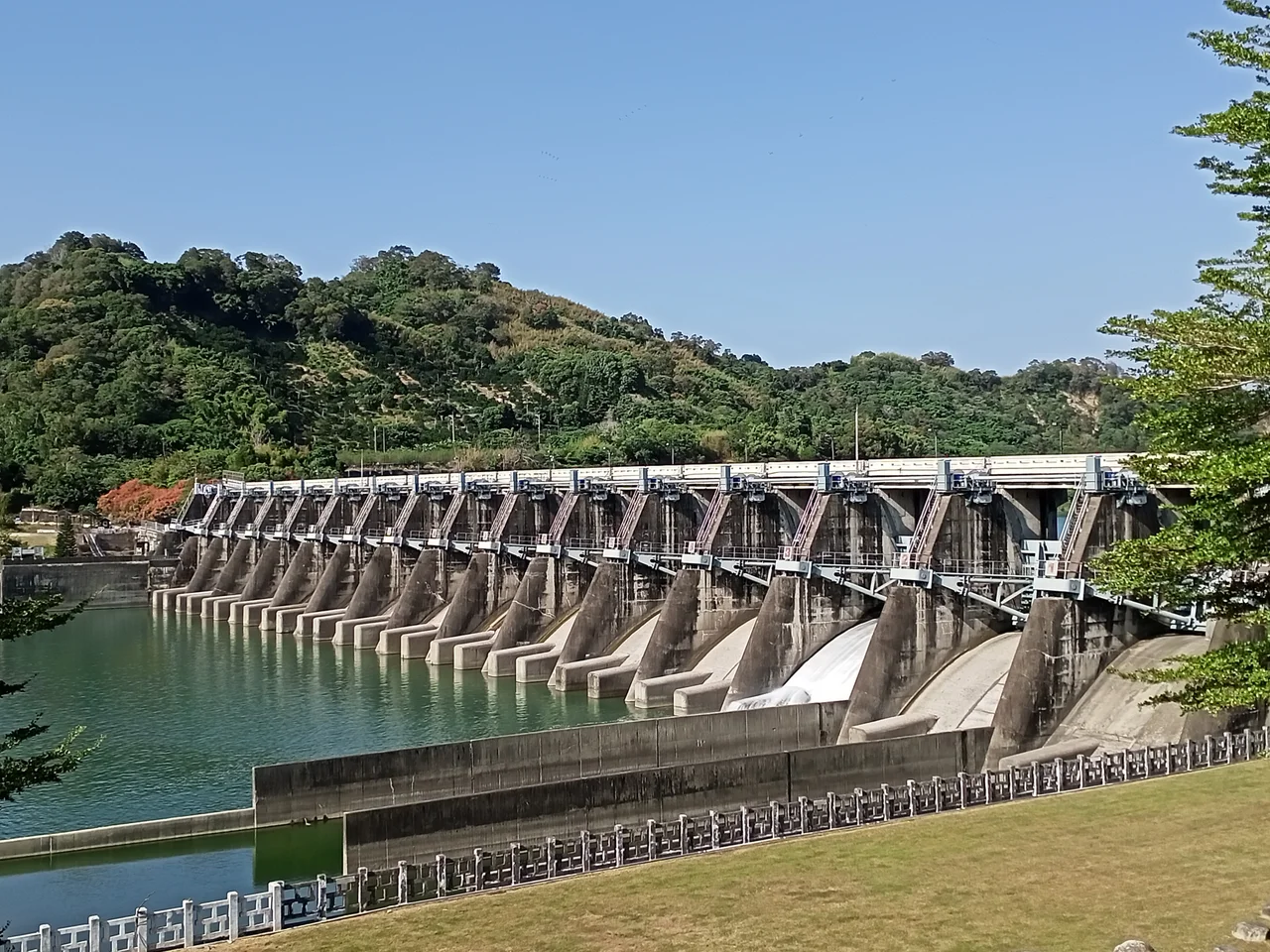

Shigang Dam
On the morning of September 21, 1999, at 1:47 a.m., the earth beneath central Taiwan moved so violently that a dam split open. The 921 earthquake — named for its date — ruptured the Chelungpu Fault and killed approximately 2,400 people across the island. At the Shigang Dam on the Dajia River, the northern end of the structure simply collapsed, dropping several meters as the ground beneath it lurched. The broken section was never repaired. Instead, the twisted concrete was preserved exactly as the earthquake left it, an open wound in the landscape that now draws visitors from across Taiwan who want to understand, in physical terms, what seismic force actually looks like.
Built to Last, Then Broken
Construction of Shigang Dam began in 1974 and was completed in 1977, a concrete gravity barrage dam stretching 357 meters across the Dajia River and standing 35.2 meters high. Its reservoir, originally capable of holding 3.38 million cubic meters of water, served two purposes: flood control during Taiwan's intense typhoon seasons, and reliable irrigation for the farmland downstream in Taichung's fertile basin. For more than two decades, the dam performed exactly as designed. Then came September 1999.
The Chelungpu Fault runs close to the dam site, and when it ruptured in the early hours of that September morning, the ground displacement was dramatic — not just shaking, but actual vertical and horizontal offset of the land itself. The northern end of the dam, caught directly in this movement, gave way. The breach was too large and the structural damage too severe for conventional repair to make sense.
The Memorial That Stayed
After the collapse, engineers built an embankment cofferdam to prevent water from flowing uncontrolled through the gap. That practical solution allowed the reservoir to continue functioning for agricultural use, even though the original flood-control capacity was gone. What it did not do was remove or rebuild the broken northern section.
That decision — to leave the rupture visible — transformed a disaster site into something rarer: a landscape that tells its own story without explanation. Visitors today can stand at the edge of the intact dam and look across to where the structure drops away, concrete fractured and displaced, the river flowing where the dam wall once stood. The juxtaposition is stark and deliberate. One section holds water; the other is simply absent, a gap that represents both the violence of the earthquake and the scale of what was lost in those few seconds.
Water That Still Flows
Despite the damage, Shigang Dam continues to serve the region. It is no longer rated for flood control — the breach means that function is impossible — but water still collects in the reduced reservoir and still supplies irrigation channels that feed Taichung's agricultural districts. The Dajia River watershed is central to the region's rice cultivation and fruit orchards, and the dam, diminished as it is, remains a meaningful piece of that infrastructure.
The Central Region Water Resources Office maintains the site, managing both the operational remnant and the preserved memorial section. It is a practical arrangement that accepts the earthquake's permanence. The dam will not be fully restored to its original capacity; what remains is what the fault allowed to remain.
Reading the Fault
The 921 earthquake registered 7.6 on the moment magnitude scale. Beyond the approximately 2,400 people who died, more than 100,000 homes were damaged or destroyed across central Taiwan. The economic and psychological impact on the island was enormous. In the years that followed, Taiwan invested heavily in seismic retrofitting, building codes, and earthquake preparedness — changes driven directly by the lessons of that night.
At the Shigang Dam, those lessons are visible in concrete and stone. The displacement of the northern section illustrates something that maps and numbers cannot quite convey: that the earth itself can move horizontally and vertically at the same time, that solid structures can become rubble in moments, and that what engineers build is always, ultimately, subject to what the earth beneath intends. The memorial is not sentimental. It is simply honest about what happened here.
From the Air
Shigang Dam sits at 24.281°N, 120.769°E in central Taiwan, spanning the Dajia River between Shigang District and Dongshi District in Taichung. From the air at 3,000–5,000 feet, the dam is visible as a pale concrete line across the river valley, with the notable gap at the northern end distinguishable in good visibility. The surrounding terrain is river valley floor transitioning to low hills to the north and east. Nearest major airport is RCMQ (Taichung International Airport), approximately 25 km southwest. Flying southeast from RCMQ, follow the Dajia River upstream through Fengyuan District — the dam appears where the valley narrows slightly. Weather in this inland valley is typically clearer than the coast, with morning haze common in summer months.
Nearby Stories
- Wufeng Lin Family Mansion and Garden 6.5 km away
- Tapung Old Fort 9.4 km away
- 1991 Miaoli Train Collision 9.7 km away
- Taroko National Park 20 km away
- China Airlines Flight 204 21 km away
- Taiwan Strait 38 km away
- Taixi, Yunlin 43 km away
- China Airlines Flight 611 69 km away