
Siege of Plymouth
Two men came to demand Plymouth's surrender during the English Civil War, and both were turned away. The first was a messenger sent in the summer of 1642, who carried a polite request to capitulate and was told never to return. The second, two years later, was the King of England himself - Charles I, fresh from defeating the Earl of Essex at Lostwithiel - and Charles's blockade lasted only a few weeks before the urgent demands of his crumbling cause pulled him away. Plymouth held. For nearly four years, from August 1642 to January 1646, a town surrounded on land and ravaged by typhus refused every Royalist attempt to break it. The reason was simple and almost unanswerable: the Royalists never managed to take the sea.
An Island Holding the Sea Lane
Plymouth's strategic value was less about the town itself and more about its harbour. When the Civil War began in August 1642, Parliament secured most of southern and western England, including the great ports of Plymouth and Exeter, and crucially, the bulk of the Royal Navy. That single fact crippled the Royalist war effort: they could not freely import the arms, men, and money they needed from sympathetic European courts. Plymouth was cut off by land almost immediately, the Royalists setting up headquarters at nearby Plymstock. They blocked supplies, they blocked the freshwater conduits, and as refugees from the countryside crammed inside the walls the population swelled past 10,000. Typhus broke out. The town suffered. But every effort to take it by storm failed, and ships kept arriving in the harbour, bringing food, ammunition, and reinforcements that no Royalist cannon could reach.
The Scottish Mercenaries Who Stayed
Plymouth's first real piece of luck was an accident of shipping. In early October 1642, a contingent of experienced Scottish mercenaries under Colonel William Ruthven called into the port for supplies on their way back from service in Ireland. The Parliamentary town council, faced with an inexperienced militia and a real war on the doorstep, simply hired them. While the rest of England was fighting with poorly trained county levies, Plymouth had professionals on its walls. Every man in the town was required to swear an oath to defend the place to the last, and the garrison set about constructing defensive lines along the high ground to the north: strongpoints at Lipson, Holiwell, Maudlyn, Pennycomequick, and New Worke. Self-supporting forts at Lipson Mill and Stonehouse closed off the approaches that the main works could not cover. Plymouth became, in effect, one of the most heavily fortified towns in England outside London.
The Treason of Sir Alexander Carew
Royalist success elsewhere in 1643 - Hopton's victory at Roundway Down in July, Prince Rupert's storming of Bristol, Prince Maurice's capture of Exeter in September - left Plymouth isolated as the last Parliamentary enclave in the West Country, and isolation tempted defection. The most damaging defector was Sir Alexander Carew, commander of St Nicholas Island (now Drake's Island) in the middle of Plymouth Sound. Carew secretly agreed to hand the island over to the Royalists. The capture of Mount Batten on the harbour's eastern arm had already prevented ships entering the inner pool; losing Drake's Island as well might have closed the Sound entirely. In August 1643 Carew ordered his men to open fire on a Parliamentary warship entering the harbour. They refused. He allegedly only escaped lynching when the ship's captain intervened, and was taken to London, tried for treason, and executed in December 1644.
Freedom Fields
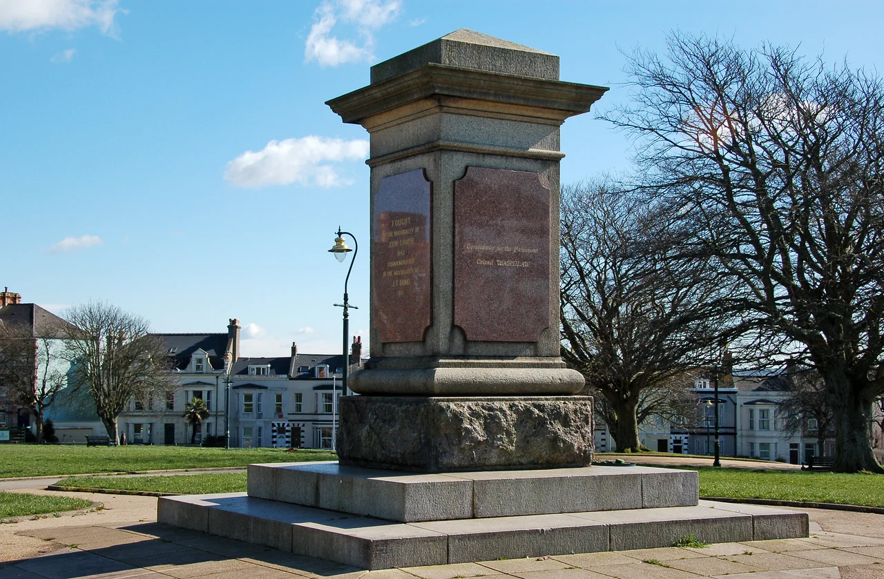
The most serious Royalist assault came on 3 December 1643. Led by a local guide who knew the ground, Royalist troops took advantage of a low tide to capture an outpost at Laira Point. Parliamentary reinforcements tried to retake it but were driven back into what is now Freedom Fields Park, where they held their ground for several hours under heavy attack. The delay mattered. It let additional troops form up behind them, and as the morning wore on the Royalists found themselves outnumbered. They withdrew - and much of their rearguard was cut off by the rising tide, trapped between the incoming sea and the Parliamentary musket fire. The siege was lifted on Christmas Day. The Royalists held onto Fort Stamford and kept the blockade going, but they had lost their best chance to take the town by force. A memorial in Freedom Fields Park still marks where the Parliamentary line held.
The King Comes In Person, and Leaves
After defeating the Earl of Essex at Lostwithiel in September 1644 the main Royalist field army under Charles I himself arrived outside Plymouth and demanded its surrender. The garrison again refused. Reinforcements continued to arrive by sea, including a regiment under Colonel John Birch, an experienced and aggressive officer. The king's army was needed elsewhere, and Charles soon marched east, leaving only a smaller force under Sir Richard Grenville to maintain the blockade. Grenville launched one more major attack in January 1645, captured some of the outlying forts, and was beaten off. In February 1645 the garrison retook Mount Batten, which effectively ended any serious chance of capturing the town. The blockade dragged on until December 1645, when the New Model Army arrived in the West Country and swept it aside. Plymouth was formally relieved in February 1646. The town that nobody had been able to take had finally been allowed simply to breathe.
From the Air
The siege lines surrounded Plymouth at roughly 50.371 deg N, 4.142 deg W. The main siege features survive only as place names and a single monument in Freedom Fields Park, near the modern city centre. From the air, the city's natural defensive geography is very visible: the Hoe and the long peninsula between Stonehouse Creek and the Plym estuary are clearly bounded by water on three sides. Best viewed from 3,000-4,000 ft. Exeter (EGTE), 40 nm to the northeast, is the nearest active commercial airport.
Nearby Stories
- Davidstow Circuit 3.7 km away
- Golden Hind 3.9 km away
- Powderham Castle 4.4 km away
- Fowey Lifeboat Station 5.1 km away
- Okehampton Castle 12 km away
- Battle of Plymouth (1652) 19 km away
- Goonhilly Satellite Earth Station 44 km away
- German Submarine U-672 73 km away