.JPG)
Sint-Oedenrode
According to the saga, a blind Scottish princess named Oda - daughter of a king called Eugenius VII - was sent on a continental pilgrimage around the year 700. At the tomb of Saint Lambert in Liege her sight was miraculously restored. She wanted to spend the rest of her life as a nun. Her father had other plans, so she fled. Wherever she stopped to worship, magpies disrupted her, and she would move again. Eventually she came to a small clearing in the Brabant woods called Rode, and the villagers built her a hut on the heath. She died there in 726. The pilgrims who came after gave the settlement the name it still carries: Sint-Oda's-Rode, the rode of Saint Oda - Sint-Oedenrode.
Vlek, Rode, Rooi
By 1232 Sint-Oedenrode had been granted vrijheidsrechten, a kind of medieval precursor to city rights, which it would keep for more than six centuries. In the old feudal vocabulary it was a vlek, a market town - small enough to be a village, important enough to host fairs and to send its goods on to the larger cities. The old centre still tells the story: a wedge-shaped market square anchored by a town hall and a linden tree, with the river Dommel cutting the town diagonally from southeast to northwest. The locals call the town Rooi. During the three days of Carnaval they call it Papgat instead. There are 23 Carnaval associations in a town of fewer than 19,000 people.
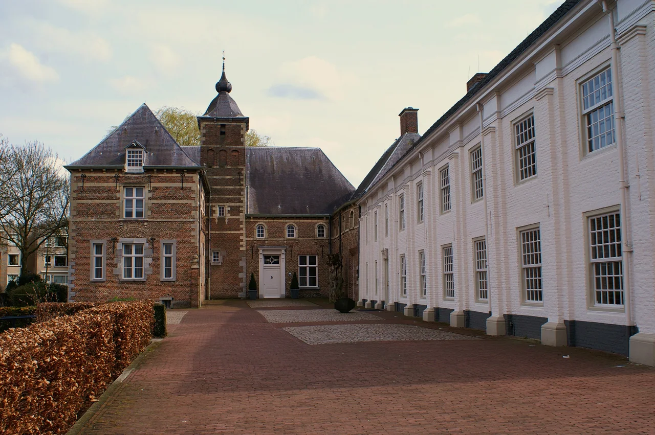
Layers of Stone and Cloth
The notable buildings stack up centuries on top of each other. The Knoptoren is the truncated stump of a tower from around 1400, attached to the old Eerschot church, which lost its steeple in 1800. The Sint-Paulusgasthuis hospice dates to 1434, characterised by chalk-white walls; until 1972 it sheltered single women of good character, and one of its small houses now displays the local collection of Brabantian poffers - the elaborate lace-and-ribbon headdresses once worn by farmers' wives. Castle Henkenshage, originally a 14th-century fortified farmstead called Strijpe, was rebuilt by Peter Jacob Girard de Mielet van Coehoorn in 1850 into a country house, and is now a wedding venue. Castle Dommelrode, built in 1605 by the sheriff of the Peelland quarter, serves as town hall.
September 1944, on the Corridor
When Operation Market Garden began on 17 September 1944, Sint-Oedenrode found itself in the middle of one of the most ambitious airborne operations of the war. American paratroopers of the US 101st Airborne Division dropped into the fields around the town and liberated it from the German occupation. The British XXX Corps followed up the road. The whole point of Market Garden was to drive a narrow corridor of road northward from Eindhoven through Veghel, Grave, and Nijmegen to Arnhem. Sint-Oedenrode sat on that corridor. For a brief, intense period Henkenshage castle became an Allied headquarters. The British left 150 dead in the area, the Americans 125. Twenty-two British soldiers are still buried in the General Cemetery; the rest were reburied at Uden War Cemetery, Mierlo, Margraten, or back home in the United States.
A Monument from the Veterans
Half a century later, on 16 September 1994, veterans of the 101st Airborne came back to Sint-Oedenrode to unveil a memorial. They called it Monument for the Dutch, and they made it themselves - a gift from the surviving paratroopers to the civilians who had fought alongside them. The inscription, in English, reads: "Dedicated to the people of the Corridor by the veterans of the 101st Airborne Division, in grateful appreciation of their courage, compassion and friendship." The monument stands on a road called, simply, Corridor - laid out after the war between the key points of the actual liberation route from Eindhoven to Nijmegen. The Dutch, the veterans said at the unveiling, had taken risks for them that they had not expected; the inscription was the surprise gesture that closed the circle decades later.
Clogs, Poplars, and a Quiet River
Long before Market Garden, Sint-Oedenrode made its living from clogs. Between 1760 and 1780 the area saw the largest silvicultural boom in the Meierij, with poplars planted on the loamy soils to feed the clog industry. The pattern of sand paths and stream-valley copses that still characterises the Meierij's Poplar Landscape dates from that century of harvesting wooden shoes. A giant clog now stands in the Dommel park on the Corridor road as a reminder; the original was wooden, but it kept getting vandalised, so the current version is concrete. The river itself, between Eindhoven and Boxtel, still meanders in its medieval bed - one of the few stretches of the Dommel that was never straightened. In 2000 Sint-Oedenrode won the Entente Florale award for the greenest village in Europe.
From the Air
Sint-Oedenrode lies at 51.5636 degrees north, 5.4608 degrees east, roughly 13 km north of Eindhoven and on the corridor between Eindhoven Airport (EHEH, 14 km southwest) and Volkel Air Base (EHVK, 15 km northeast). From cruise the town is a compact cluster on both banks of the Dommel, with the Operation Market Garden Corridor road - now the N620 - running through it on the historic Eindhoven-to-Nijmegen axis. Best viewed at 3,000-10,000 ft in clear conditions.
Nearby Stories
- Rivierenland 6.2 km away
- Wire of Death 7.5 km away
- Breda 9.6 km away
- Battle of Tolhuis 9.7 km away
- Schoonhoven 11 km away
- Hillenraad Castle 13 km away
- Weeze 16 km away
- Malle 16 km away