Rivierenland
On New Year's Eve in the orchards south of Tiel, farmers haul old milk churns into empty fields, scoop in a fistful of calcium carbide, splash water on top, and seal the lid. A match held to a small hole at the back lights what is essentially a giant grain-silo cannon - the carbid heats, the gas ignites, and the lid blasts twenty or thirty metres across the grass with a boom that rattles windows kilometres away. This is carbidschieten, the unofficial sport of Rivierenland, and it is loud precisely because the people who invented it lived too close to their wooden farmhouses to risk fireworks. In the land between the rivers, even the celebrations are practical.
Land Between the Rivers
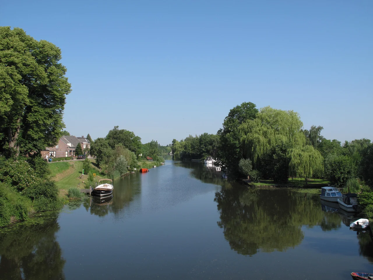
Rivierenland - also called the Betuwe - is a long, low strip of central Netherlands hemmed in by water. The Waal cuts through its middle, the Nederrijn marks its northern edge, the Maas runs along the south. The Amsterdam-Rhine Canal slices in near Tiel. The name probably derives from a Germanic word meaning good soil, in pointed contrast to the sandier Veluwe to the north, whose name means terrible soil. Both regions earned their reputations honestly. The Romans knew this ground too: the Old Rhine and Nederrijn formed the empire's northern frontier, and at the village of Elst alone, archaeologists have uncovered three Roman temples. The Germanic Batavi tribe lived here when the legions arrived, and one theory traces the modern name straight back to them.
The Blossom Weeks
For most of the year Rivierenland looks like a quiet patchwork of dikes, ferries, and farms. Then in late April the orchards detonate. Apple, pear, and cherry trees bloom in overlapping waves of pink and white that stretch from Geldermalsen to Tiel and beyond, drawing cyclists from across the Netherlands. From 1992 to 2022 the Dutch Red Cross organised the Bloesemtocht - the Blossom Tour - a charity ride that looped through the orchards at peak bloom, drawing up to 30,000 walkers at its peak before the event was discontinued. Geldermalsen, founded in 850 and one of the oldest towns in the region, is often the starting line. The flowers give way, by September, to the harvest, and the city of Tiel celebrates with Fruitcorso - a parade of enormous floats covered entirely in fruit, running since 1961. Tiel is also home to Appelpop, billed as the largest free music festival in the Netherlands, held the second weekend of September while the cherries and apples still scent the air.
Towns with Histories
The cities here are small but stubborn. Culemborg was founded as a duchy, independent of the surrounding Duchy of Guelders, and that medieval autonomy still shows in the tight old centre. Buren earned a royal flavour through marriages into the House of Orange and now keeps several museums devoted to its dynastic connections. Druten, on the south bank of the Waal, has held its own identity since the Middle Ages. Zaltbommel was once a fortified river town defending the crossing, and its star-shaped earthworks still trace the old walls. Then there is Acquoy, a tiny village whose church tower leans noticeably to one side. The Linge river kept flooding and washing out the soil beneath the foundations; rather than let the whole tower topple, restorers shortened it by removing layers from the top. The leaning church of Acquoy is now Rivierenland's quietest tourist attraction.
The Bible Belt and the Beer
Rivierenland sits on the eastern edge of the Dutch Bible Belt, the strip of villages where the conservative Reformed political party SGP routinely wins enough votes to colour the electoral map. The Neder-Betuwe and West-Betuwe in particular tend more religious and traditional than the country as a whole - Sunday quiet, modest dress, a long view of time. The same villages, paradoxically, also stock the local liquor stores. Brouwerij de Betuwe, based in Maurik, produces beers named for the region and sold across Gelderland. Roadside Landwinkels - small farm shops, often just a vending machine in a barn - sell raspberries, cherries, apples, and pears straight from the trees behind. Tiel turns its raspberries into jam under the mascot Flipje, a cartoon raspberry-man who has somehow remained the town's official ambassador since 1935.
Living with Water
The rivers that gave Rivierenland its name also threaten it. In January 1996, after weeks of rain across western Europe, the Waal and the other rivers rose so dangerously that authorities ordered the evacuation of about 140,000 people - the largest peacetime evacuation in modern Dutch history. The dikes held, the waters fell, and everyone went home. The episode prompted the national Room for the River programme, which since then has widened floodplains and lowered groynes along the Waal precisely so that the next flood will have somewhere to go. The Betuwe response to this constant negotiation with the rivers is, characteristically, neither panic nor protest. People mend the dikes, plant another orchard, and on the last evening of the year, walk out into a wet field with a milk churn and a packet of carbide to make the loudest noise they can.
From the Air
Coordinates 51.862°N, 5.359°E, central Netherlands province of Gelderland. The region is an elongated lozenge of land between the Waal river (south) and the Nederrijn/Lek (north), with the Maas as its southern frontier. From altitude the patchwork of orchards, dikes, and river bends is instantly readable, especially in late April when the blossoms whiten the fields. Tiel sits roughly in the centre. Nearest major airport is Amsterdam Schiphol (EHAM) about 75 km northwest; Eindhoven (EHEH) is about 55 km south; Niederrhein (EDLV) lies roughly 90 km east across the German border. Recommended viewing altitude 3,000-6,000 ft. The flat landscape and frequent low cloud demand reasonable VFR conditions; clearest views typically late spring through early autumn.
Nearby Stories
- 2015 Women's European Volleyball Championship 1.3 km away
- Nijkerk 2.6 km away
- Schoonhoven 5 km away
- Kamp Sint-Michielsgestel 8.6 km away
- Gelders Arcadië 11 km away
- Amstelveen 11 km away
- Breda 14 km away
- Weeze 16 km away