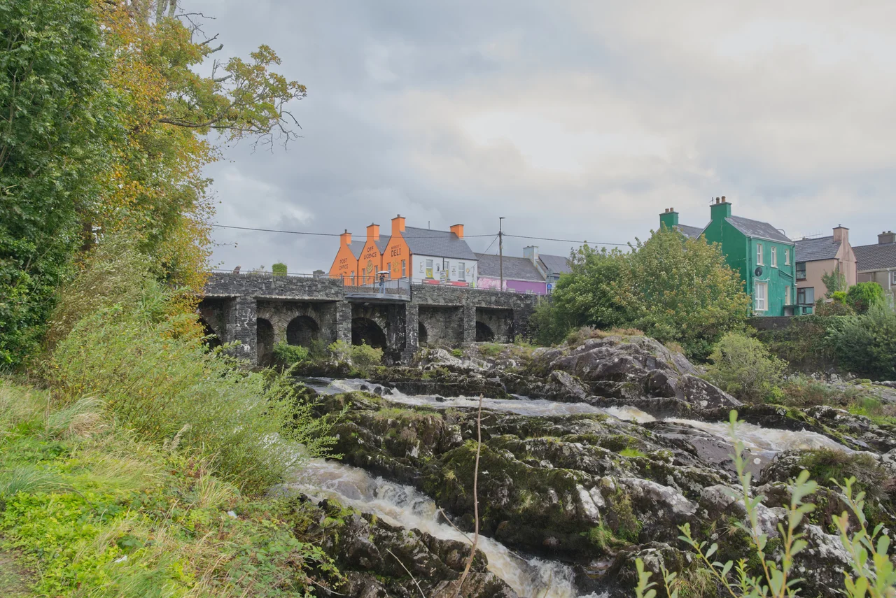

Sneem
The name means knot, and Sneem really does look like one when you see it from above. The village sits on the estuary of the River Sneem, where the freshwater currents meet the incoming tides of Kenmare Bay in a swirl of opposing flows. Above the estuary the village is built around two squares - North and South - connected by a single bridge in the middle. Pick the metaphor you prefer. The Irish name An tSnaidhm covers all of them. Two squares tied together by a bridge. A river twisting into a bay. A village that holds the loose middle of the Ring of Kerry.
The Two Squares
Sneem's layout is unusual. Irish villages are usually a single street or a square with a street running off it. Sneem has two squares, a few hundred metres apart, separated by the river and joined by a stone bridge. North Square has a monument to Charles de Gaulle, who came here on holiday in May 1969 immediately after resigning the French presidency. He stayed at the Heron's Cove (now the Parknasilla Resort nearby) and walked the village and gave the locals something to talk about for the rest of the century. South Square has a life-size bronze statue of John Egan, the Kerry footballer who won six All-Ireland medals - four of them consecutive - and five GAA All-Star awards before his death in 2012. Two squares, two statues, two reasons to walk between them.
The Wrestling Champion from Direenaclaurig
Steve Casey was born near Sneem in 1908 and grew into one of the largest men anyone in the area had ever seen. He and his brothers Tom and Jim were Irish athletes in the 1930s, competing in single scull rowing at the Charles River in Boston. Steve also took up professional wrestling. Between 1938 and 1947 he was either the NWA or AWA world heavyweight wrestling champion six different times. There is a statue of him in the village now, alongside Egan. Wrestling in the 1940s was a sport partly real and partly performance, and Casey was apparently both - a genuinely powerful athlete who could also play the part required. He came home to Sneem when his career ended and lived there until his death in 1987.
The Spy and the President
Two other Sneem natives are buried in the village's history. William Melville, born at nearby Direenaclaurig Cross in 1850, became the first head of the British Secret Service - the original 'M', the position later mythologised by Ian Fleming in the James Bond novels. Melville built the modern British intelligence service essentially from scratch, recruited the first agents, and ran operations that included tracking anarchists and German spies in the early 20th century. Cearbhall Ó Dálaigh, who served briefly as President of Ireland in the 1970s, retired to a house near Sneem and was given a state funeral here in March 1978. A small Kerry village does not need a long list of famous sons. Sneem has more than its share.
The Ruined Castles
Near Sneem stand the remains of two grand houses that did not survive the 20th century. Derryquin Castle, an 18th-century mansion designed by James Franklin Fuller with battlements and an octagonal tower and machicolations - the works - was demolished after years of decline. Rossdohan House, on Rossdohan Island just out in the bay, was built in the late 1870s for a retired British Raj surgeon named Samuel Thomas Heard. It burned in 1922 during the Civil War, was rebuilt in 1946 in a Dutch Cape style that resembled Groot Constantia in Cape Town, and burned again in 1955. It has been a ruin ever since. The tree ferns Dr Heard planted in the 1880s are still alive, though, threading through the ruined walls.
The Time Capsule
In 2000 the village buried a time capsule in the centre of town, to be opened in 2100. What is in it, the public is mostly not supposed to know. The book Sneem, The Knot in the Ring tells the village's story up to about that point, and presumably parts of it are in the capsule too. Whatever else is down there will be opened by people none of the present residents will live to meet. It is the kind of gesture small villages make occasionally to remind themselves they are part of a longer story than the present moment. Sneem has 386 people now, by the 2022 census. In 2100 it might have more, or fewer, or a different language spoken in the pubs. The knot will probably still be there, though - the river still twisting into the bay, the bridge still tying the two squares together.
From the Air
Sneem sits at 51.838°N, 9.900°W, on the south coast of the Iveragh Peninsula about 22 km west of Kenmare town. From the air the village is identifiable by its location on the Sneem River estuary just before it widens into Kenmare Bay, with the N70 (Ring of Kerry) road threading through. Rossdohan Island is visible just offshore to the south. Approach altitude 1,500-2,500 ft AGL for visual identification. Nearest airfields: Kerry (EIKY) about 30 nm north, Cork (EICK) about 60 nm east. The mountains north of Sneem rise sharply toward MacGillycuddy's Reeks - mind the terrain on northbound tracks.
Nearby Stories
- Farranfore–Valentia Harbour line 3.3 km away
- Heir Island 4.1 km away
- Inishvickillane 4.4 km away
- Kealkill stone circle 8.7 km away
- Headford Ambush 10 km away
- Dunlough Castle 13 km away
- SM U-68 27 km away
- Sao Miguel 1923 km away