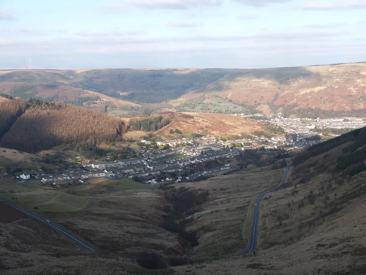

The South Wales Valleys
From the air, the South Wales Valleys read like fingers laid down on a map. They run roughly north to south, parallel to each other, each one its own narrow world. From the coastline at Cardiff, Newport and Swansea, they climb into the hills, every valley a separate community connected by roads to the towns above and below, but separated from its neighbours by ridges. They are the towns where the British Empire was fuelled. They are also home to the highest proportion of Welsh-identifying population anywhere in Wales. To understand the Valleys you have to know that the topography wrote everything else: industry, language, politics, even how rugby was played.
Two Waves of Industry
Until the mid-nineteenth century, the Valleys held very few people. Fewer than a thousand lived in the Rhondda in 1851. Then two waves of industry crashed through. The first wave was iron, which began in the late eighteenth century along the northern edge of the coalfield: Merthyr Tydfil, Dowlais, Ebbw Vale, Tredegar. By the 1850s, South Wales was the most important ironmaking region in Britain. The second wave was the South Wales Coalfield itself, developed from about 1850 to power the steam ships and railways and houses of an empire. People came in from rural Wales, from Ireland, from England and beyond. The Rhondda's population went from one thousand in 1851 to seventeen thousand by 1870 to one hundred and fifty-three thousand by 1911. The villages strung along the valley floor were a hand-and-fingers pattern, never quite becoming a city, kept apart by the ridges between them.
Aberfan and What Followed
By the middle of the twentieth century, the coalfield was in decline. Domestic coal use was falling. The Clean Air Act of 1956 changed how Britain heated its homes. Exports to Europe, once thirty-three percent of Welsh coal output, fell to about five percent by 1980. And then in October 1966, the village of Aberfan in the Taff Valley suffered the disaster that no one in the Valleys can hear named without flinching: a colliery spoil tip slid down the mountain into the village school, killing 144 people, 116 of them children. The Aberfan disaster became the symbol of what the coal industry had done to the places that worked for it. By the 1980s, Margaret Thatcher's government and the National Coal Board collided in the year-long Miners' Strike of 1984 and 1985. The strike broke, and so did most of the remaining pits. The last deep coal mine in the Valleys, Tower Colliery in the Cynon Valley, closed in 2008. The miners themselves had bought it from the government in 1994 and kept it running for fourteen years after that.
The Welshest Part of Wales
The Valleys hold roughly thirty percent of Wales's population, and they carry an unusually high proportion of people born in Wales itself, over ninety percent in Blaenau Gwent and Merthyr Tydfil. Merthyr Tydfil reported in the 2021 census the highest rate of Welsh-identifying population of any local area in Wales, seventy percent. The same census found the Valleys also had the highest proportion of people reporting no religion, the chapels that once stood at every other street corner now mostly closed, converted, or quietly demolished. The first Labour MP ever elected to the British Parliament, Keir Hardie, represented Merthyr Tydfil in the Valleys from 1900 until his death. So did Aneurin Bevan, the architect of the National Health Service, born in Tredegar. The Valleys remain a Labour stronghold today. Rugby pitches mark the valley floors, visible from the air as bright green rectangles between terraces.
Geography Wrote Culture
The shape of the Valleys still shapes the lives lived in them. Roads run north and south along each valley, connecting the settlements that share a river. Crossing east or west to a neighbouring valley means going up over a ridge, which most people rarely do by car and almost never by foot. A child in Tredegar grows up with closer ties to Ebbw Vale, twelve miles down the same valley, than to Bargoed, six miles east over the hill. The A465 Heads of the Valleys road, finally being upgraded to dual carriageway in stages between 2002 and now, is the rare road that runs across the valleys rather than down them, connecting the heads of the Sirhowy, Ebbw, Rhymney, Cynon and Taff valleys with a continuous east-west route. It is changing what it means to live up here, slowly, in a place that has always been shaped by the way water flows downhill.
After the Pits
The unemployment of the 1980s and 1990s is, slowly, becoming something else. Employment rates have risen in recent years, growing faster in the Valleys than anywhere else in Wales. Billions of pounds in investment have come from EU structural funds, the UK government, and the Welsh government. The Ebbw Vale steelworks site has become a new hospital and a learning campus and an archive. The Taff Trail follows the line of the old Glamorganshire Canal as a cycle path the length of the Taff. The Welsh language, especially in the upper Valleys around Merthyr, is being taught in primary schools again. The Valleys are still places shaped by what happened to them in the eighteenth and nineteenth and twentieth centuries: by the iron, the coal, the chapels, the strikes, the disaster at Aberfan. But they are also still places where people live, and the work of figuring out what comes next is being done.
From the Air
The South Wales Valleys spread across an area roughly from 51.45 N to 51.85 N and from 4.0 W to 3.0 W. Best traced from 4,000 to 5,000 feet, looking south or north along the parallel valley lines. From a southbound approach to Cardiff (EGFF), the A465 Heads of the Valleys road and the A470 corridor down the Taff are useful navigation references. Bristol (EGGD) is 30 nm east of the valleys; Cardiff Airport (EGFF) sits at the southern edge. Be alert for orographic cloud over the heads of the valleys, particularly on south-westerly flows.
Nearby Stories
- Portishead Point Lighthouse 3 km away
- St Fagans National Museum of History 5 km away
- Museum of Cider 6.5 km away
- Monmouth 8.3 km away
- Carreg Cennen Castle 11 km away
- Builth Castle 14 km away
- Craig Gwrtheyrn 29 km away
- Ilfracombe Lifeboat Station 37 km away