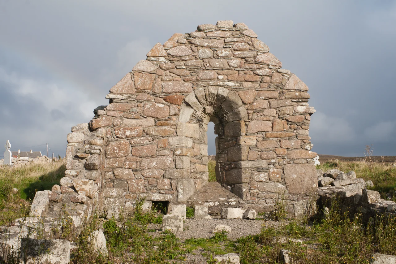

St. Dairbhile's Church
She tore out her own eyes rather than be loved. That is the story Mullet Peninsula has carried for fourteen centuries, and the proof of it stands at the very tip of the land where the Atlantic begins. St. Dairbhile, daughter of Meath royalty, had fled west to escape a man whose attention she could not return. When he tracked her to this lonely shore, she made the only refusal she had left. She blinded herself. The horrified suitor turned for home. Dairbhile knelt at a nearby well, scooped the cold water to her face, and her sight came back.
Stone That Outlived a Saint
The ruin you see today is not the church she knew. Dairbhile arrived here in the 6th century, and whatever shelter she built then has long since dissolved into the bog and the salt wind. The walls still standing belong to the 12th century, raised on the same consecrated ground by hands that knew her story already as ancient. The structure is a single-cell gabled church, small enough to count its stones. Ashlar lines the deeply-splayed east window, and a narrow west doorway with inclined jambs greets the visitor like an exhale. Above each opening sits an arcuated lintel, a single curved stone bridging the gap. There is no roof now. There has not been one for centuries. The sky finishes the building.
The Window That Cheats Death
Local belief holds that anyone who can squeeze themselves through the east window three times will never drown. On the Mullet Peninsula, where every working life once touched the sea, this was not a parlor trick. The men who fished Blacksod Bay and Broadhaven, who rowed out into Atlantic swells with nothing between them and Greenland, took the promise seriously. Children were lifted through. Old men inched through with breath held and ribs scraping. The window is narrow, designed to let in only the thinnest blade of dawn light, but generations have passed through it the way pilgrims pass through any threshold that promises to make them whole. Whether or not the dead were saved, the living kept squeezing.
St. Deirbhile's Well
A short walk from the church, the well that restored her sight still flows. The annual pattern, an old Irish word for a saint's day gathering of prayer and procession, is held here every 15 August. People come from across Erris and beyond. They circle the well, leave coins or scraps of cloth tied to nearby bushes, dip their fingers, sometimes their faces. The water is cold and clear and tastes of stone. A heritage centre in nearby Aughleam, named for the saint, tells her story in fuller form. But the well needs no interpretation. It does what wells have always done in Ireland: it holds the place where the natural world and the sacred meet, and it does not explain itself.
The Edge of the Mainland
Stand here at sunset and you understand why a woman fleeing her old life chose this spot. There is nowhere further to go. The townland of Fallmore sits 2.4 km south of Aughleam, on the very fingertip of the Mullet Peninsula, which is itself the westernmost finger of County Mayo, which is itself the western edge of Ireland. Achill Island floats to the south across Blacksod Bay, dark against the water. The Inishkea Islands lie offshore to the west, abandoned since 1934. Photographer David Loftus once captured the ruin at sunset with Achill behind it, the stones glowing copper while the sea behind went lavender. Looking at the image, or standing on the spot, the geography itself feels like a refusal, a way of saying that this far is far enough.
From the Air
St. Dairbhile's Church sits at 54.10°N, 10.11°W, near the southern tip of the Mullet Peninsula in the townland of Fallmore. Approach low from Belmullet Aerodrome (EIBT, 2 NM west of Belmullet town) for the best view of the church ruin and St. Deirbhile's Well, with Achill Island visible to the south across Blacksod Bay. Ireland West Airport (EIKN) at Knock lies about 70 km east-southeast. Atlantic conditions can change rapidly here; clear evening light dramatizes the ruin against the sea.
Nearby Stories
- Aughagower 3.4 km away
- Caher Island 8 km away
- Enaghbeg 10 km away
- Action of 7 May 1794 21 km away
- Lissadell House 59 km away
- RMS Carinthia (1925) 64 km away
- Glencolmcille 95 km away
- Inishtooskert 214 km away