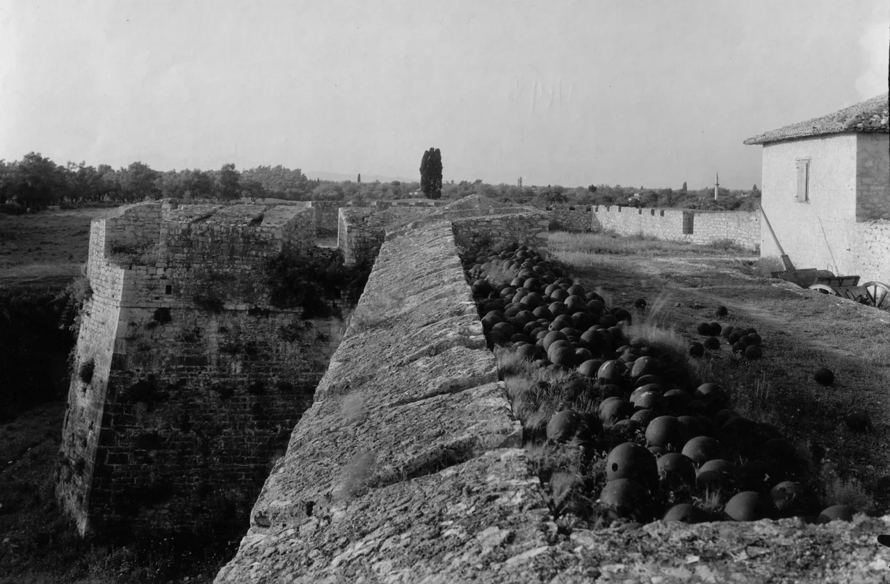

St. George's Castle, Preveza
In the winter of 1807, hundreds of Greek workers and stonemasons were marched to the southern edge of Preveza and put to work building a fort. They came from across the territory of Ali Pasha Tepelena, the semi-autonomous Ottoman governor of Epirus, and they worked without pay — compulsory labor for a man who brooked no refusals. The design came from a French military engineer, Frédéric François Guillaume de Vaudoncourt, aged thirty-four, who had been dispatched from Napoleon's network of officers at Ali Pasha's insistence. Ali Pasha had pressed the French consul in Ioannina for engineers who could help fortify his growing domain. He got de Vaudoncourt and Captain Ponceton. By autumn 1807 the fort was complete. Ali Pasha then declined to credit de Vaudoncourt's designs and claimed the military works as his own creation.
The World That Built This Fort
St. George's Castle sits at the junction of three colliding historical currents. Ali Pasha Tepelena was building a personal empire within the Ottoman Empire, using European expertise to fortify his positions against European rivals — specifically Russian troops still stationed on the nearby island of Lefkada after the wars of the 1790s. De Vaudoncourt was one of the many French officers whose careers had been scattered across Europe and the Near East by the Napoleonic upheaval. The Greek stonemasons who actually built the thing had no stake in any of this — they were simply compelled. The fort was built to defend the narrow water channel at the mouth of the Ambracian Gulf, the passage between the Ionian Sea and what the source material here calls the Gulf of Arta. Whoever held Preveza held this channel, and whoever held this channel controlled access to the protected waters beyond.
Architecture of Calculated Defense
The castle's design reflects the military engineering conventions of the Napoleonic era. Its enclosure is protected by high polygonal bastions — the polygonal trace, as engineers called it, was standard for the period, designed to eliminate the blind spots of older square or circular fortifications. The outer walls of the enceinte were set at a slight angle to better deflect artillery fire, a detail that looks subtle from outside but represents a mature understanding of ballistic physics. Within a few years of its construction, the fort changed names twice. The Ottomans initially called it one name, then renamed it the 'green castle' (after the figure of Khidr, associated with the color green in Islamic tradition), and finally 'barracks castle.' The name St. George's Castle came only after the Greek liberation in 1912.
A Fort That Kept Working
Most fortifications from the Napoleonic era have decayed into picturesque ruins. St. George's Castle instead kept being used. The Greek military adapted it into the twentieth century, which meant modifications: battery platforms were excavated, bastions were pierced to create casemates with better protection against modern weapons. The service buildings inside the enclosure are entirely twentieth-century in construction. Only one original element survives — a small masonry building that leads down to the powder magazine, preserving a direct architectural link to 1807. The main entrance at the north-eastern corner of the enclosure still faces the town center, as it did when the fort was first built. Historical photographs — some taken by the Swiss photographer Frédéric Boissonnas in May 1913, just months after Greek forces entered Preveza — show a guardhouse above the entrance that has since been lost.
What the Walls Still Say
St. George's Castle is not a ruined monument. It survives as a functional structure, its high walls still enclosing the southern end of the city, its bastions still projecting at careful angles toward the channel. To walk around its exterior is to read the accretion of events it has witnessed: the forced labor of Greek workers under an Ottoman warlord; the strategic thinking of a French engineer who couldn't get credit for his own design; the Greek military's pragmatic adaptations over more than a century of service; the gradual retirement into civic memory that gives old forts their second lives. The name St. George was given to it after liberation, replacing an Ottoman designation with a Greek saint. Even the renaming is part of the story — a small act of reclamation in a city that has been renamed, refounded, and reconquered more times than most.
From the Air
St. George's Castle sits at the southern tip of the Preveza peninsula at approximately 38.949°N, 20.750°E, directly at the water's edge where the Ambracian Gulf narrows toward the Ionian Sea. From the air, the castle's polygonal bastions are the defining geometric feature at the city's southern margin. The channel it was built to defend is clearly visible — barely a kilometer wide at this point, now crossed by the undersea Aktio-Preveza tunnel. Aktion National Airport (LGPZ) is on the Actium peninsula directly across the channel, less than 2 km to the south-southeast. Best viewed at 1,000–2,000 feet on approach from the west, when the castle's relationship to the channel narrows into focus.
Nearby Stories
- Lake Trichonida 15 km away
- Battle of Karpenisi 17 km away
- Phaneromeni Monastery, Lefkada 19 km away
- Paxos 19 km away
- 2015 Lefkada Earthquake 28 km away
- Lake Plastiras 29 km away
- Italian Destroyer Angelo Bassini 30 km away
- SM UC-38 47 km away