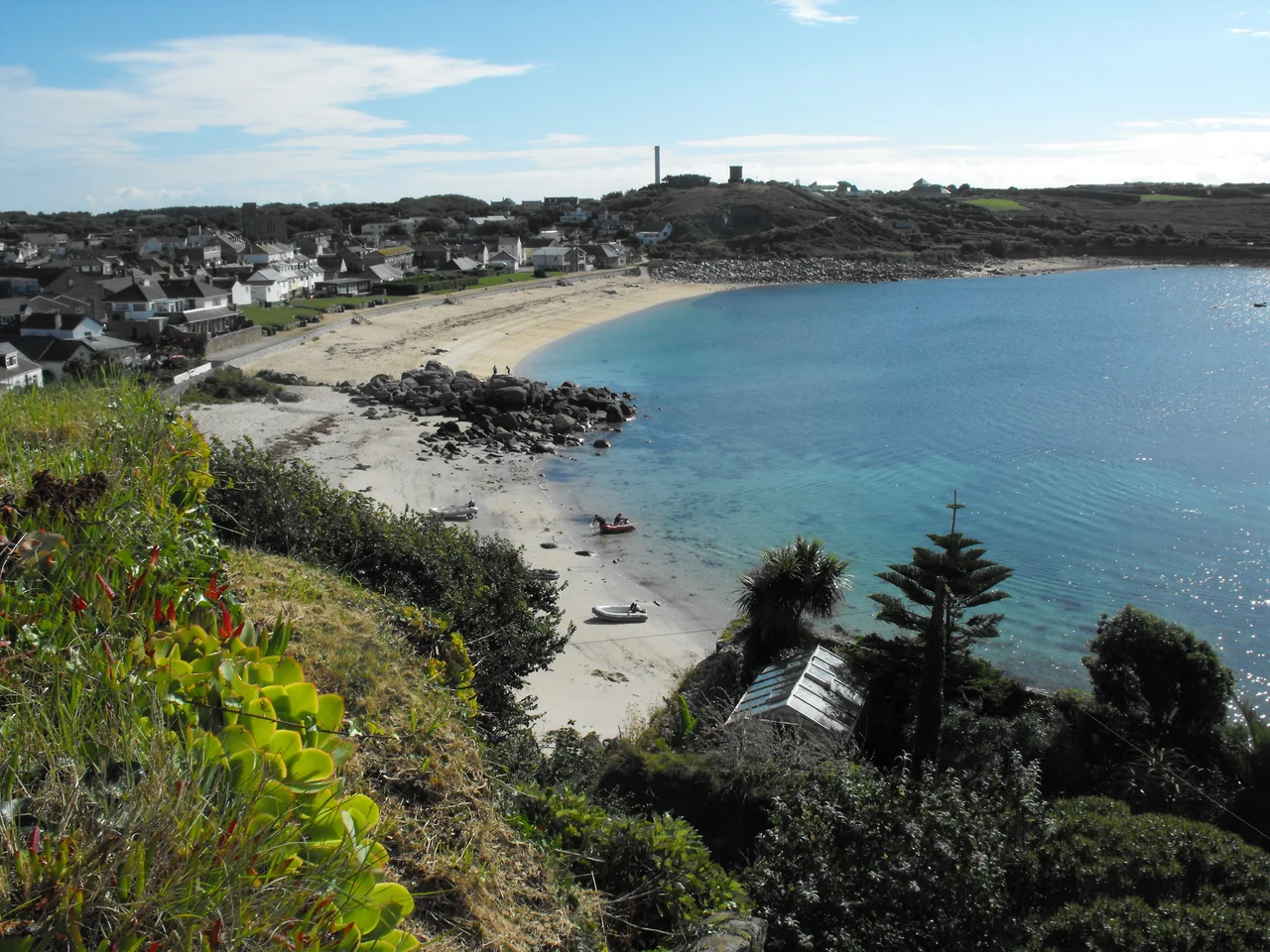

St Mary's, Isles of Scilly
Six and a half square kilometres of granite, gorse and white sand sit thirty miles off Land's End - that is the largest island of the Isles of Scilly. St Mary's is small enough to walk around in a day and busy enough to feel like a working town, with a harbour at Hugh Town, an airport carved out of a farm, an eight-pointed star castle on the western headland, and a lifeboat station that has been launching crews into the Atlantic since 1837. The Cornish name means island of Saint Mary, but the place feels older than any saint: prehistoric burial chambers at Innisidgen, a coastguard tower where Marconi caught radio signals from Cornwall in 1898, and a quiet cove at Porthellick where an Admiral of the Royal Navy was found dead in the surf after one of the worst maritime disasters in British history.
Hugh Town and the Harbour
Hugh Town occupies a narrow sandy isthmus at the western end of St Mary's, with Porth Cressa beach on one side and St Mary's Harbour on the other. From the harbour the Scillonian III - a passenger ferry operated by the Isles of Scilly Steamship Company - leaves for Penzance every weekday morning between March and November, and the smaller Gry Maritha shifts cargo year-round. Inter-island launches tie up at the same quay, ferrying day-trippers to Bryher, Tresco, St Martin's and St Agnes. The town itself is a tight cluster of granite cottages, fishing-net sheds, a Methodist church built in 1899, and the kind of pubs where every pint comes with a story about weather. Around it lie smaller natural anchorages - Old Town, Pendrathen, Watermill Cove, Porthloo - any of which would have been the main harbour somewhere else.
The Garrison and Star Castle
On the high western headland called the Hugh, an eight-pointed stone star rises out of the gorse. Star Castle was built in 1593 by Robert Adams, the Queen's Surveyor of the Royal Works, on the orders of Queen Elizabeth I. The Spanish Armada had been beaten back in 1588 and English commanders feared a second invasion fleet. The walls take the shape of an eight-pointed star because that geometry let cannon fire cover every approach. A perimeter wall called the Garrison wraps around the headland with gun batteries placed at regular intervals, including Colonel Boscawen's Battery, rebuilt in 1740 by Master Gunner Abraham Tovey. The castle is now a hotel - visitors sleep inside the same granite walls that once watched for Spanish sails - but the Garrison still feels like what it was: a stone fence around an island that knew it might be attacked.
The Lifeboat and the Bravery Medals
St Mary's has had a Royal National Lifeboat Institution station since 1837 - one of the earliest in Britain. The first crews kept their boats on the town beach at Hugh Town. After a closure between 1855 and 1874 the station reopened, moved to Porth Cressa, then in 1899 to a purpose-built boathouse and slipway at Carn Thomas. The first motor lifeboat arrived in 1919. In nearly two centuries of service the crews of St Mary's have earned twenty-six RNLI medals for bravery: one gold, nine silver, and sixteen bronze. The most recent was awarded in 2004 to Coxswain Andrew Howells and his crew for rescuing an injured yachtsman in the dark on 29 October 2003. The Atlantic on this corner of England has never been merciful, and the lifeboat has been called out for everything from grounded freighters to the 1983 British Airways helicopter crash in the sea off the island.
Porthellick Cove and the Admiral
At Porthellick Cove on the southeast coast, a simple stone memorial marks the spot where Admiral Sir Cloudesley Shovell's body washed ashore on 22 October 1707. The night before, four Royal Navy ships - HMS Association, HMS Eagle, HMS Romney and HMS Firebrand - struck the Western Rocks in fog and a gale, and nearly two thousand sailors drowned in a few hours. It was one of the greatest maritime disasters in British history, and it was a direct cause of the Longitude Act of 1714, which would eventually fund John Harrison's marine chronometers and revolutionise navigation. Shovell was buried in Westminster Abbey, but the memorial here marks where Scilly itself remembers him: a quiet patch of sand and gorse where the sea once gave back what it had taken.
Telegraph Tower and Marconi
On Newford Down stands a stubby stone tower built in 1814 as an Admiralty Telegraph Station - a relay in the semaphore chain meant to get news from Plymouth to London faster than a horse could ride. It closed by 1816, was reused by the Coastguard, then by the Marconi Wireless Telegraph Company. Around 1898 Guglielmo Marconi himself stood here and listened to wireless signals transmitted from Porthcurno, thirty miles across open water on the mainland. It was one of the earliest practical demonstrations that radio could carry intelligence across the sea. The tower is now a private home, and the wireless masts that once crowded the site are mostly gone, but the view from Newford Down remains what it was: the whole archipelago laid out in granite and turquoise, with the curvature of the Atlantic on the horizon.
From the Air
St Mary's lies at 49.914 N, 6.292 W, the largest island of the Isles of Scilly archipelago, 28 nautical miles southwest of Land's End and roughly 45 nm southwest of Newquay. The whole island is 6.58 km squared and easily framed in a single window pass. St Mary's Airport (EGHE, IATA: ISC) sits one nautical mile east of Hugh Town with a single 600 m asphalt runway. From above the island reads instantly: Hugh Town and the Garrison on the western headland, the airfield to the east, Porthellick Cove on the southeast coast, and Peninnis Lighthouse marking the southern tip. Surrounding waters are usually clear and turquoise over white sand. Watch for VFR traffic from Skybus and small charter operations.
Nearby Stories
- Penlee Lifeboat Station 5.5 km away
- Black Swan Project 20 km away
- Tater Du Lighthouse 25 km away
- The Brisons 31 km away
- 1979 Fastnet Race 54 km away
- SM U-27 110 km away
- HMS Affray 149 km away
- Tower of Hercules 700 km away