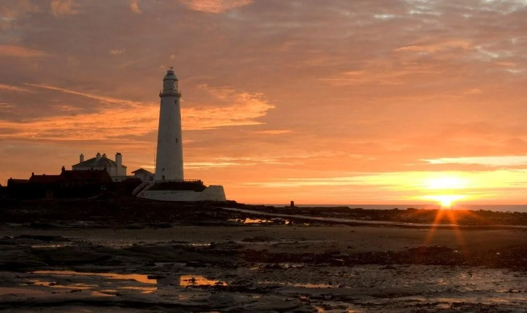

St Mary's Lighthouse
Twice a day the causeway disappears under the rising tide and the lighthouse on Bait Island becomes unreachable. Twice a day the water falls and the causeway returns, and the people of Whitley Bay walk out to St Mary's Lighthouse as their grandparents did. The building has stood since 1898, white-washed and unmistakable on its small rocky outcrop. For most of the twentieth century it burned paraffin - the very last Trinity House light to do so, not electrified until 1977. In 1984 it was decommissioned. By then it had become something more than a navigational aid. It was a place people walked to.
Before the Lighthouse
The first light on this stretch of coast was in Tynemouth Priory. An 11th-century monastic chapel kept a lantern burning in its tower to warn passing ships of the rocks. After the priory fell, a proper lighthouse was built on the site of the present Tynemouth Coastguard station in 1664, using stone reclaimed from the priory itself. That lighthouse served for two and a third centuries. It was demolished in 1898 when the John Miller company of Tynemouth completed the new lighthouse on St Mary's Island. The construction used 645 blocks of stone and 750,000 bricks. Built into the tower was a first-order bi-valve rotating optic from Barbier and Benard of Paris - very similar to the optic those same makers had installed the previous year at Lundy North Lighthouse. The light flashed twice every 20 seconds, a group-flashing characteristic visible far out into the North Sea.
The Last Paraffin Light
Trinity House electrified its lighthouses gradually through the twentieth century. St Mary's was the last to make the switch, in 1977 - the final light still lit by oil among all of Trinity House's stations. During electrification the original first-order Fresnel lens was removed and sent to the National Lighthouse Museum in Penzance. A four-tier revolving sealed-beam lamp array, manufactured by Pharos Marine, took its place in the tower - powered by two 12-volt batteries kept charged from the mains. Seven years later, in 1984, the lighthouse was decommissioned altogether. The sealed-beam array was reused in a reduced form on the Inner Dowsing light platform in the North Sea, where it became part of the first major lighthouse to run on solar power. When the Penzance museum closed in 2011, the original Fresnel lens was returned to St Mary's and put on display. The lens that had thrown its beam out over the North Sea for nearly eight decades is back in the tower it was made for.
Walking Out at Low Tide
St Mary's became a Grade II listed building in 2012. It is no longer a working lighthouse. The tower contains a small museum, the keepers' cottages house a visitor centre and a cafe, and the whole site is open to the public when the tide is out and the causeway uncovered. In 2014 the cottage was upgraded with a wood-pellet boiler. A 2017 renovation scheme that proposed rooftop viewing platforms and glass-covered extensions was refused by the planning authority for environmental reasons - the surrounding intertidal habitat is protected. A second proposal in 2018, which included rebuilding the original lighting optic in working condition, did not secure Heritage Lottery Fund support. In 2024 the lighthouse and keepers' cottages were repainted and given a 900,000 pound facelift, reopening to the public in November. From the top of the tower you can see Souter Lighthouse to the south, also decommissioned, also a Victorian engineering set piece. The Farne Islands lights flash on the horizon to the north.
From the Air
St Mary's Lighthouse stands at 55.07 degrees north, 1.45 degrees west on Bait Island, just north of Whitley Bay. Newcastle International Airport (EGNT) is approximately ten nautical miles west-southwest. From altitude the white tower is unmistakable against the dark intertidal rocks and seaweed, with the linear concrete causeway visible at low tide and submerged at high. The Tyne estuary opens to the south; the offshore wind farms north of the Tyne are major navigational features. Coastal weather varies sharply - eastern haar can blanket the island while inland Tyneside is clear. Best viewing is on northwesterly flow with low afternoon sun glancing off the masonry.
Nearby Stories
- Alnmouth Lifeboat Station 2.6 km away
- Finchale Priory 4 km away
- Hadrian's Wall Path 8.5 km away
- Allenheads 8.7 km away
- Battle of Nesbit Moor (1355) 9.9 km away
- Saltburn Pier 29 km away
- Saltburn-by-the-Sea 59 km away
- Alexander L. Kielland (Platform) 286 km away