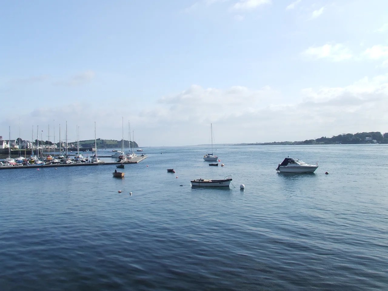

Strangford Lough
Four hundred million gallons of seawater move through one narrow channel here, twice every day. The Vikings, who knew currents the way modern pilots know weather, named this place Strangfjorthr - the strong fjord, the fjord of the strong current. The water they were measuring is still doing what it did then: forcing itself through a kilometre-wide gap between Strangford and Portaferry, then spreading across 150 square kilometres of sheltered lough, then reversing course six hours later. The lough is the largest sea inlet in the British Isles and the busiest marine ecosystem in Ireland. It is also a place where the ordinary sequence of geology, tide and life keeps producing extraordinary results.
A Fjord Carved by Ice
Strangford Lough was carved at the end of the last ice age, when glaciers retreating from County Down left behind a basin that the sea promptly filled. Most of the lough is less than ten metres deep, but the central channel can plunge to fifty. The Ards Peninsula almost completely encloses it, leaving only the Narrows at the southeastern edge as a connection to the Irish Sea. Inside, the lough holds at least seventy named islands and countless smaller islets - locally called pladdies - along with mudflats, salt marshes and tidal creeks. The previous Irish name for this water was Loch Cuan, meaning lough of the harbours. The shift to Strangford, originally just the channel name, only spread to the whole body of water in the seventeenth century. Both names are accurate.
Three-Quarters of the World's Brent Geese
Strangford was designated Northern Ireland's first Marine Conservation Zone in 2013 and is a Special Area of Conservation, an Important Bird Area and a Ramsar wetland. Each autumn, around three-quarters of the world population of pale-bellied brent geese arrive here to feed on the eelgrass beds - sometimes 15,000 birds at once, having flown south from breeding grounds in Arctic Canada. The lough holds Ireland's most important breeding site for common seals. Basking sharks cruise through the Narrows in summer. The Castle Espie wetland reserve, on the western shore near Comber, hosts the Wildfowl and Wetlands Trust's collection and serves as a stopover for migrating ducks and waders. Underwater, the lough is just as rich. More than 2,000 marine species have been recorded here, including extensive beds of maerl - a calcareous red algae that builds slow-growing reef-like structures - and the carpet sea squirt, an invasive species first detected in 2012 that conservation managers are still trying to contain.
Where Engineers Test the Future
The same currents that make Strangford remarkable for wildlife make it irresistible to engineers. In 2008 the lough became home to SeaGen, the world's first commercial tidal stream generator. The 1.2-megawatt turbine fed electricity to the grid for eleven years, with monitoring showing minimal impact on marine mammals. A second device called Evopod, a one-tenth scale floating prototype monitored by Queen's University Belfast, was tested near the Portaferry ferry landing in 2008. SeaGen was decommissioned in stages between 2016 and 2019, but the lough's reputation as a test bed for tidal energy has not faded. Strangford Lough was also, far earlier, the site of the world's oldest known tide mill - the Nendrum Monastery mill, where archaeologists have excavated timber pilings dating from 619 CE. Twelve hundred years separate the monks who built that wheel from the engineers who installed SeaGen, but both were answering the same question.
The Ferry That Never Stopped
A car ferry has connected Portaferry and Strangford across the Narrows for nearly four centuries, without a meaningful break. The crossing takes eight minutes; the alternative road journey around the lough is 47 miles and takes about an hour and a half, which explains why locals view the ferry less as transport and more as essential infrastructure. The service is subsidised and operates at a loss of more than a million pounds a year. It still runs every half hour from 7:30 AM to 10:30 PM. Towns and villages around the lough's shoreline - Killyleagh, Comber, Newtownards, Portaferry, Strangford - each have their own character, but all of them measure distance partly in ferry minutes. In July 2016, Strangford hosted the Skiffie Worlds, an international coastal-rowing championship that brought clubs from Scotland, England, the Netherlands, the United States, Canada, Tasmania and several other countries. Fifty teams raced a 2-kilometre course at Delamont Country Park, with the lough's flat morning water and its dramatic afternoon currents acting as the test conditions.
From the Air
Strangford Lough is centred at approximately 54.48N, 5.58W in County Down, Northern Ireland. From altitude its distinctive shape is immediately recognisable: a long narrow inlet roughly 30 kilometres north-south, almost completely enclosed by the Ards Peninsula on the east, with the Narrows visible as a thin connection to the Irish Sea at the southeastern end. Look for the dark blue water of the lough contrasting against the open Irish Sea, the patchwork of islands in the southern half, and the brown of extensive mudflats at low tide. Nearest airports are Belfast City (EGAC) about 18 nautical miles northwest, and Belfast International (EGAA) further west. Recommended viewing altitude 3,000-6,000 feet for the full sweep. Watch for tidal eddies and standing waves at the Narrows during peak flow.
Nearby Stories
- Silent Valley Reservoir 1.7 km away
- Drummore 3 km away
- Copeland Islands 5.2 km away
- Castle Upton 8.4 km away
- Hillsborough Castle 9.5 km away
- Bradda Head 11 km away
- Pasages (steam trawler) 20 km away
- Chicken Rock Lighthouse 41 km away