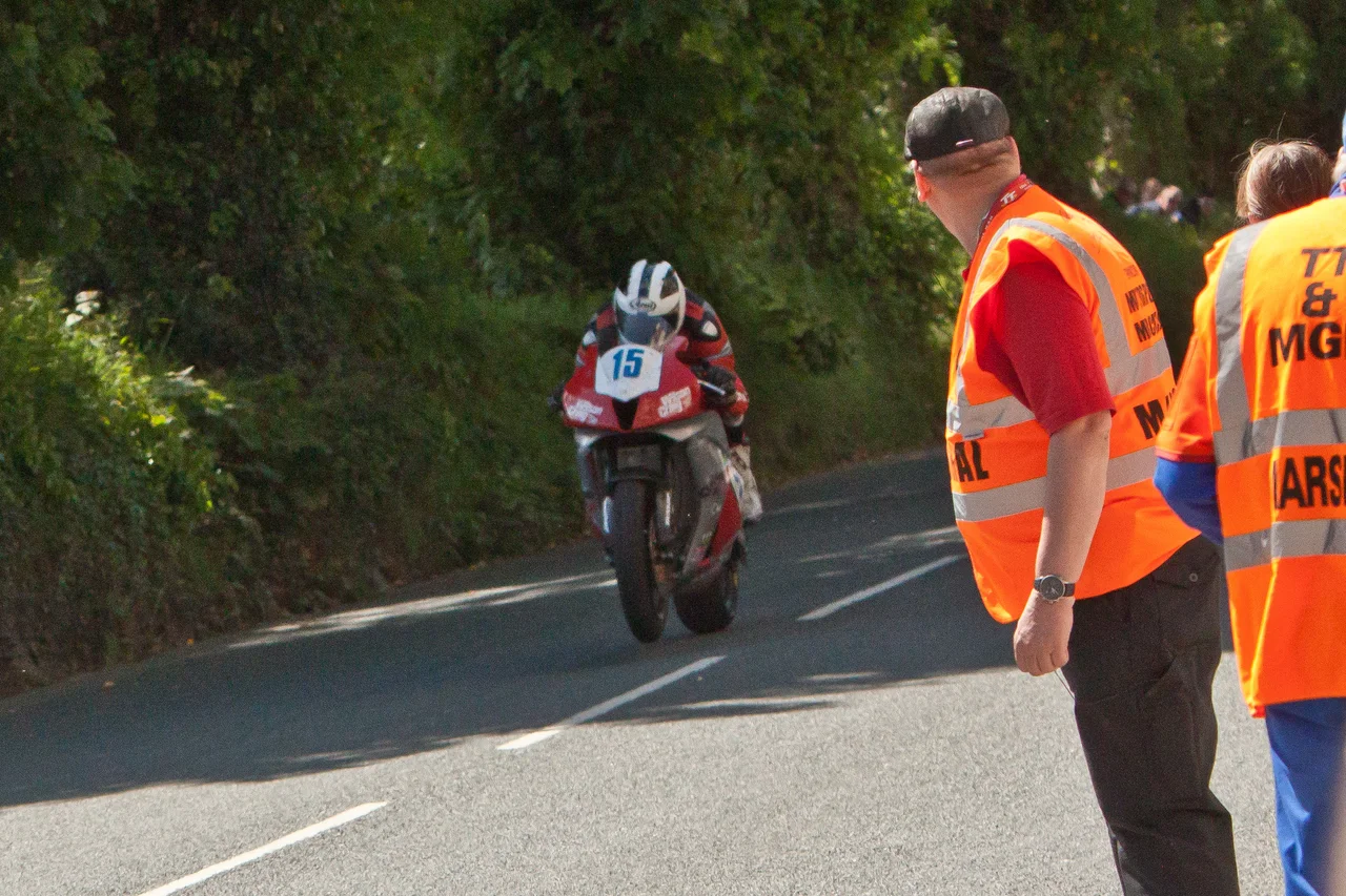

Sulby, Isle of Man
For fifty-one weeks of the year, Sulby is a Manx farming village like any other - a primary school, a couple of churches, a hotel, the river running cold out of the northern hills. Then, for one week in June, the A3 road that bisects it becomes the fastest piece of public highway on the Isle of Man TT Course. Bikes punch past the front gardens at speeds the rest of motorsport reserves for closed circuits. Then the marshals stand down, the barriers come up, and Sulby goes back to being a village again.
Soli's Farm in the Cleft
The name is older than the racing. Linguists trace Sulby to Old Norse - either Súli's bý, the farmstead of someone called Soli, or Súla plus bý, the farm of the cleft - and either way it is a reminder that the Vikings left their mark all over the northern Isle of Man. The village sits at the southern edge of the island's alluvial plain, just where the Sulby River breaks out of the hills and slows into farmland. Two halves make up the place. The old part clusters round the junction of the A14 Tholt-y-Will Road and the B9 Claddagh Road, with a mill and a small green. The newer, longer ribbon stretches along the A3 between Close-e-Volley and Ginger Hall. Walk between them and you cross more than a couple of centuries.
The Treen and the Monks
Long before the racing, this corner of Lezayre parish carried two old land-divisions: the Treen of the Curragh of Kirk Christ Lezayre, and the Land of the Monks of Myrosco. Names like that have a heft to them - they hint at a landscape parcelled out by churchmen and clan custom, layered over the Curragh wetlands that still soak the plain in winter. Above the village, Cronk Sumark rises modestly but carries the remains of an Iron Age fort on its summit. The hill watched centuries of farming go by before anyone thought to time a motorcycle through the bend below. Sulby today still keeps the rhythm of those older years - a campsite in the river meadow at Sulby Claddagh, the Ballamanaugh estate flanking the river, common land at the Claddagh, and on the green a sense that the village green is doing exactly what it has always done.
The Fastest Mile and a Half
The Sulby Straight is 1.55 kilometres long, and on the Isle of Man TT Course it is the longest flat-out section anywhere on the 37.73-mile circuit. The course began life in 1908 as the RAC Tourist Trophy car circuit - the Four Inch Course - then the Auto-Cycling Union borrowed it in 1911 for the motorcycle TT, and it has been used for the TT ever since, with the Manx Grand Prix following from 1923. Through Sulby, the bikes are going as fast as they will ever go. In 2006, during practice, New Zealander Bruce Anstey's onboard data-logging equipment recorded 206 mph at the end of the straight near the Kella crossroads. James Hillier matched it in 2015 on a Kawasaki H2R demonstration bike, captured this time by Strava. The numbers are unofficial - the TT does not run a speed trap on the straight - but they remain the highest figures ever recorded on the course.
The Bridge They Took Apart
At the eastern end of the straight, Sulby Bridge crosses the river. It is the third bridge here, or perhaps the fourth, depending on how you count. The original was built in 1739 as a result of the Bridges Act of that year, when the Isle of Man tried to drag its road network into a more reliable century. A replacement went up around 1815 with a sharp humpback profile - elegant for a horse and cart, lethal for a racing motorcycle. By the early 1920s riders dreaded it. In 1922-23 the Isle of Man Highway Board removed the hump altogether, widened the road, and smoothed the profile for racing. A nearby Five Ton Bridge over the river was built in 1935 after flooding in September 1930 destroyed an older ford and footbridge. Each bridge tells a different story about what the village needed from its river at the time.
Trains, Spirits, and Quiet Months
Sulby once had two railway stations - Sulby Glen up the road towards the hills, and Sulby Bridge near the river - both stops on the Ramsey to St. Johns line, both closed in 1968 when the line shut. The track is long gone but the names persist. Kella Distillers still operate in the village, making ManX Spirit, a clear spirit distilled from whisky and bottled under a Manx name. Outside TT fortnight the village runs at its own slower pace - the hotel, the Methodist and Anglican churches, the campsite filling and emptying with the season, the river falling and rising. Then June comes round, the marshals take their posts, and for a few brief days Sulby reminds everyone how fast a road can be.
From the Air
Located at 54.32°N, 4.49°W on the northern Isle of Man, just south of the island's northern hills where the Sulby River emerges onto the alluvial plain. The village sits roughly 4 miles inland from Ramsey on the A3 road. Visible from cruising altitude in clear weather. Nearest airport is Ronaldsway (EGNS) at the southern end of the island, about 25 nm south; smaller fields at Andreas and Jurby lie within a few miles north. Cruise around 3,500-5,500 ft to keep the whole northern plain and the Sulby Straight in view; on a clear day the Mull of Galloway in Scotland sits across the water to the northwest.
Nearby Stories
- Kirkmaiden 3.2 km away
- Isle of Whithorn 4.1 km away
- Santon Railway Station 13 km away
- Solway Firth 16 km away
- St Bees Lighthouse 19 km away
- Portavogie 34 km away
- Walney Island 40 km away
- German submarine U-1024 55 km away