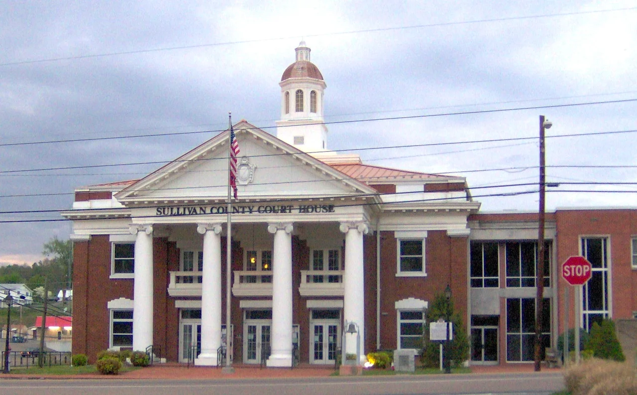

Sullivan County, Tennessee
In 1779, when Sullivan County was carved out of Washington County, Tennessee did not yet exist as anything but a region of western North Carolina. The county was named for John Sullivan, a Patriot general in the Revolutionary War then leading a scorched-earth campaign through Iroquois country in New York. Sullivan would never visit the county that bears his name. But the place stuck with its label, joined the extra-legal State of Franklin from 1784 to 1788, watched Tennessee become a state in 1796, and is now Tennessee's second-oldest county, anchoring the Tri-Cities region near the Virginia line.
Long Island and Fort Robinson
Long Island of the Holston in modern Kingsport was, for the Cherokee, a place of treaties and ceremony. The British recognized its importance, building Fort Robinson there in 1761 after the fall of Fort Loudoun to the south. The fort drew European settlers north up the valleys. Within a generation, Sullivan County had become one of the earliest settled areas of what would become Tennessee. The Cherokee continued to hold the island as a council ground, but pressure on the land grew with every season of settlement. By the early nineteenth century the indigenous Holston Valley had been transformed into an Anglo-American county, the Cherokee themselves pushed further south and west toward the eventual catastrophe of removal.
The Little Confederacy
East Tennessee was, broadly, Union country during the Civil War. Sullivan County was the exception. In the June 1861 secession referendum, the county voted 1,586 to 627 in favor of leaving the Union, an overwhelming margin that earned it the nickname Little Confederacy. After Appomattox, Sullivan stayed Democratic for nearly a century while the rest of upper East Tennessee voted Republican as a matter of identity. The last Democratic presidential candidate to carry Sullivan County was Jimmy Carter in 1976, and the county has been reliably Republican ever since. This regional political deviation is woven into the county's self-understanding. It explains some of the difference in tone you can still hear between Bristol or Kingsport residents and those in surrounding rural areas.
Morrell Cave and Civil War Saltpeter
Morrell Cave, also known as Worleys Cave, runs 4.4 miles underground east of Bluff City, making it the second-longest cave in East Tennessee and the 177th-longest in the country. During the Civil War the Confederacy mined the cave for saltpeter, the potassium nitrate that is the main ingredient of gunpowder. Cave historian Marion O. Smith documented two companies of the Confederate Nitre and Mining Bureau, District No. 7, working Sullivan County deposits. The evidence remains underground: pick marks, removed dirt, and an elaborate trail system the miners established. After the war the cave returned to obscurity, then became a Tennessee State Natural Area. The miners who worked here in 1863 left no monument other than the cave itself, scarred and quiet.
Besse Cooper and Blountville
Besse Cooper was born in Sullivan County in 1896. For 18 months between June 2011 and her death in December 2012, at age 116, she was the world's oldest living person. She had lived through every American president from McKinley to Obama, two world wars, and the entire arc of the twentieth century. Her birthplace, the county seat at Blountville, has its own quirk: it is the only unincorporated county seat in Tennessee, a small village that serves as the legal and administrative center of the county without ever having bothered to incorporate as a town. Sullivan County contains Kingsport, Bristol, and parts of Johnson City, all of them larger and more visible, but its government runs out of an unincorporated village that produced a person who lived almost into a third century.
Flight Context
Centered at 36.51 degrees north, 82.30 degrees west, in upper East Tennessee on the Virginia border. The county sits at the meeting of the Ridge-and-Valley Appalachians (west) and the Blue Ridge Mountains (east). Holston Mountain, on the eastern boundary with Johnson County, rises to 4,280 feet as the county's highest point. Bays Mountain runs in from the southwest. Tri-Cities Regional Airport (KTRI) sits in the southern part of the county and is the primary commercial airport. Bristol-Tennessee's Bristol Motor Speedway is a distinctive visual landmark from the air. Boone Lake and Fort Patrick Henry Lake, both reservoirs on the South Fork Holston, are easy to spot. Recommended altitude 5,500 to 8,500 feet MSL depending on whether you are crossing Holston Mountain.
From the Air
Coordinates 36.51N, 82.30W. The county spans Ridge-and-Valley (W) and Blue Ridge (E) terrain. Holston Mountain (4,280 ft MSL) on the eastern boundary is the highest point. Primary airport KTRI (Tri-Cities Regional) in the southern county with commercial service. Visual landmarks: Bristol Motor Speedway, Boone Lake, Fort Patrick Henry Lake. Recommended altitude 5,500-8,500 ft MSL. Watch for ridge turbulence on Holston Mountain and afternoon convection.
Nearby Stories
- Emory and Henry University 8.2 km away
- Valle Crucis Episcopal Mission 11 km away
- David Crockett Birthplace State Park 19 km away
- Wise County, Virginia 30 km away
- Watauga County, North Carolina 33 km away
- Cumberland Gap 64 km away
- The Titanic Museum: The Ship That Docked in Tennessee 71 km away
- The Kentucky Meat Shower: When Flesh Fell From a Clear Sky 168 km away