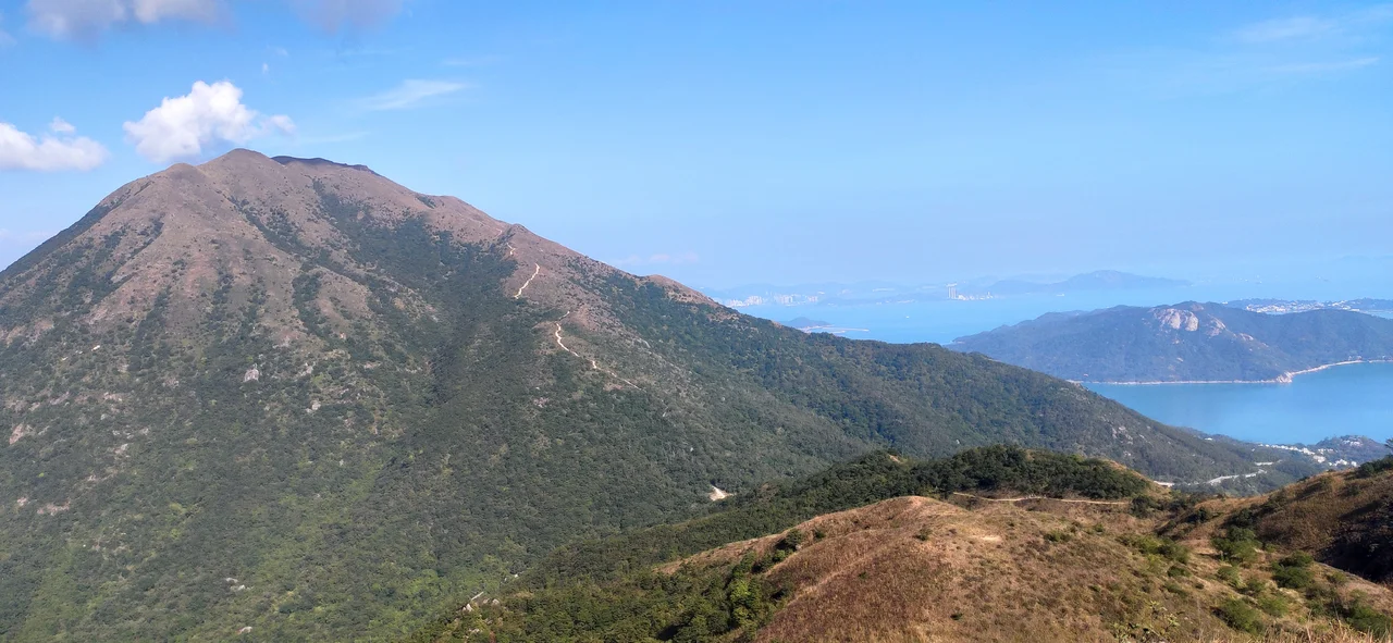

Sunset Peak (Hong Kong)
The name is a promise: Sunset Peak. In Cantonese, it goes by Tai Tung Shan — the Big East Mountain — which is geographically accurate and far less romantic. Both names apply. At 869 metres above the Hong Kong Principal Datum, this is the third-highest point in the entire territory and the second-highest summit on Lantau Island. The highest, Lantau Peak, stands just to the west and casts a long shadow over its neighbour in the hiking rankings. Tai Tung Shan doesn't seem to mind. Its reputation rests on something Lantau Peak cannot always claim: the perfect vantage point for watching the sun go down over the South China Sea.
The Mountain in Winter
Sunset Peak draws its most devoted crowds in the cooler months, from roughly October through February, when two things happen simultaneously. The air clears, scrubbing visibility out to the horizon. And the silvergrass — long, feathery plumes of Miscanthus grass — turns the upper slopes into rippling silver and gold. On a winter afternoon, with low-angle sunlight catching those grasses on a ridgeline at nearly 900 metres, the scene has a quality that feels briefly cinematic. Hikers who come in summer often find cloud, humidity, and haze. Those who come in winter tend to come back. The mountain rewards patience and seasonal timing in a way that few accessible hikes in Hong Kong can match.
Getting Up There
There is no shortcut to the summit. Sunset Peak is only reachable on foot, and both standard routes demand genuine physical effort. The more popular approach starts from Pak Kung Au, a campsite on Tung Chung Road at moderate elevation, and climbs the open ridge toward the top. The less-crowded alternative begins at Nam Shan Campsite, west of Mui Wo on South Lantau Road, and ascends through quieter terrain to reach what hikers generally agree is the best sunset viewpoint on the mountain. Both campsites connect to bus routes serving Mui Wo, Tung Chung, and other parts of Lantau, making the logistics straightforward once you accept that the final stretch belongs entirely to your own legs. The trail itself is part of the long-distance Lantau Trail.
Sitting Between Two Parks
Sunset Peak occupies an unusual administrative position. Its summit lies at the boundary between two protected areas: Lantau South Country Park and Lantau North Country Park. These parks together cover a substantial portion of Lantau Island, protecting it from development and keeping the upper elevations largely as they have been for generations. The division between north and south parks is largely invisible to hikers — there are no fences or signage at the boundary line — but it means the mountain sits within overlapping jurisdictions of conservation. Below the peaks, Lantau is home to Tung Chung new town, Hong Kong International Airport, and Disneyland. The contrast between the developed northern coast and the wild interior ridgelines is stark from any high point.
The Name's Double Life
Tai Tung Shan means "Big East Mountain" in Cantonese — a directional description rooted in the peak's position relative to the island's geography. The English name Sunset Peak is a translation of neither Cantonese word; it is an independent naming that privileges the experience of being there over the cartographic fact of where it stands. Both names have stuck, used interchangeably in trail guides, government maps, and hiking websites. The peak appears on official Hong Kong geographic data sheets as a surveyed point at 869 metres above the Hong Kong Principal Datum, which differs slightly from mean sea level due to the local geodetic datum. The practical difference is 1 metre — the mountain does not change shape, only the number assigned to it.
From the Air
Sunset Peak sits at 22.2583°N, 113.956°E on Lantau Island, rising to 869 metres. From Hong Kong International Airport (VHHH), located on the northern coast of Lantau at approximately 22.31°N, 113.92°E, the peak is visible to the southeast at roughly 10 km. Departing on runway 07R, the summit ridge is prominent off the right side within minutes of takeoff in clear conditions. Pilots should be aware that Sunset Peak and the adjacent Lantau Peak (934 metres) create significant terrain obstacles; minimum safe altitude in the immediate area exceeds 4,000 feet. The Lantau ridge is a navigational landmark for all approaches to VHHH from the west and south.
Nearby Stories
- Lok Ma Chau Loop 2.3 km away
- Portas do Cerco 2.3 km away
- Kweilin Incident 17 km away
- Wanshan Archipelago Campaign 34 km away
- Nanxiong Formation 115 km away
- Battle of Nanpeng Island 148 km away
- Heyuan 169 km away
- Cape Maobitou 632 km away