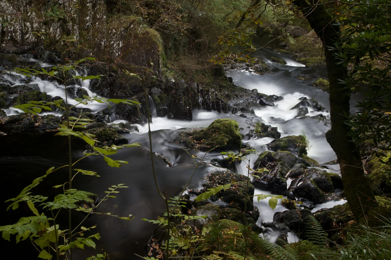

Swallow Falls
Stand on the viewing platform at Swallow Falls in spate after a wet autumn and you can feel the bedrock through your feet. The River Llugwy comes down off the Carneddau and runs past Betws-y-Coed in a series of steps and pools, and at this particular bend, a few miles west of the village, it has carved itself into a multiple waterfall that flows around a central rock and splits into shapes that the eighteenth-century guidebook writers thought looked like a swallow's tail. The Welsh name Rhaeadr Ewynnol means foaming falls. The English name has rather more elegance and less truth to the etymology, but it has stuck for two and a half centuries.
A Question of Name
The name puzzle here is real. The English Swallow Falls and the Welsh Rhaeadr Ewynnol look like translations of each other but do not actually correspond, and neither matches an older Welsh form that might have lurked beneath them both. Place-name scholars have suggested that the Welsh form was coined at the end of the eighteenth century, perhaps in response to the popularity of the English name with tourists. There may have been a desire to demonstrate Welsh linguistic ownership of a popular attraction, and a concern that any straightforward Welsh translation of Swallow would look like deference to the English version. Whatever the truth, the falls have been called something close to their current names since the 1770s onwards, when the picturesque tour of north Wales became a fashionable English pastime and visitors started to come.
Electricity for Betws-y-Coed
By 1899, the falls were already enough of a tourist draw that a local proposal suggested using them to generate electricity for Betws-y-Coed and to illuminate the falls themselves for night-time viewing. The plan, ambitious and a little theatrical, foundered, but the idea showed how central the falls had become to the village's identity. In 1913 the second Lord Ancaster, who owned the land, gave Swallow Falls to the local council. The council saw a way to pay down the £15,000 debt the village had accumulated installing water and electricity supplies, and they began charging an admission fee to see the falls. The fee continued long after the debt was cleared. The council kept the money. Betws-y-Coed enjoyed the lowest rates in the country for decades, a piece of local financial wizardry that lasted until the 1974 local government reorganisation took the arrangement apart.
An Embezzlement
In 1939 Richard Morris, a former chairman of the local council, was charged with making false entries in the upkeep of the tolls. The total deficiency was sixty-seven pounds, fifteen shillings, and sixpence. Morris had already repaid the sum by the time the charge was laid, which the court took into account. The story is unremarkable in the scale of municipal misconduct but worth knowing because it captures the small-town feel of how the falls operated as a revenue source, where the takings were kept in a tin and the chairman of the council had personal knowledge of every shilling that came in and went out. There were no auditors in the modern sense. Morris had paid back what he had taken before anyone had to ask twice.
Visiting Today
The falls remain a paid attraction, accessed from a roadside layby on the A5 between Betws-y-Coed and Capel Curig. A turnstile takes the fee. A path with steps and viewing platforms drops down through the woods to the river, and on a busy summer weekend you queue for the railing space that gives the best photographic angle. In high water, after autumn rain or spring snowmelt, the falls roar audibly from the road and throw spray well up the gorge sides. In low water in late summer, when the Llugwy runs thin, the falls become a series of pools and modest cascades that you can almost step across. The character of the place changes with the river. The Llugwy makes the day, and the Llugwy keeps its own counsel.
The Llugwy and Its Country
Swallow Falls is one feature in a river that produces a string of small wonders along its course through Snowdonia. The Llugwy rises near Capel Curig under the shadow of the Glyderau, threads through Tryweryn and past Pont-y-Pair in Betws-y-Coed, and joins the Conwy at the village. Anglers fish for brown trout in the deeper pools. Kayakers run the gorges in winter when the water is high enough. Walkers on the Llugwy Trail follow the river upstream from the falls toward Capel Curig and the open ground of the Ogwen valley beyond. The falls are not the destination so much as a stopping point on a route that has been bringing visitors into the heart of Snowdonia for two and a half centuries. They will go on doing so.
From the Air
Swallow Falls lies at 53.10 north, 3.85 west, on the River Llugwy a few miles west of Betws-y-Coed in the Conwy valley. The river runs east-west through a wooded gorge just south of the A5 road. Recommended viewing altitude 2,000 to 3,000 feet for the gorge, the surrounding woodland, and the village of Betws-y-Coed to the east. The Carneddau rise to the north and the Glyderau lie further west. Tree cover means the falls themselves are difficult to spot from the air, but the gorge line is clear. Nearest airports EGCK Caernarfon to the west, EGOV Valley on Anglesey to the northwest, EGNR Hawarden to the east.
Nearby Stories
- Menai Strait 1.2 km away
- Battle of Ewloe 7 km away
- New Brighton Lifeboat Station 7.7 km away
- Butlin's Pwllheli 7.7 km away
- Battle of Oswestry 9.1 km away
- Cymer Abbey 22 km away
- Celtic Array 39 km away
- New Brighton Lighthouse 43 km away