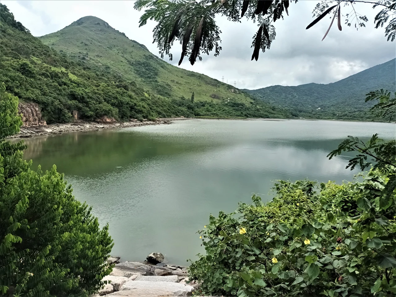

Tai Ho Wan
In 1999, a government biologist surveying Tai Ho Stream discovered something that shouldn't have been there: ayu, a sweetfish whose known range spans the rivers of Japan and Hokkaido. Finding Plecoglossus altivelis in a Hong Kong stream was so unexpected that the government designated the waterway the 63rd Site of Special Scientific Interest in the territory that same year. It was also reportedly the stream supporting the greatest diversity of freshwater and brackish-water fish anywhere in Hong Kong. The bay the stream drains into — Tai Ho Wan, on the northern coast of Lantau Island — had been earmarked for large-scale development since 1989. The ayu, and the ecology around it, complicated those plans considerably.
The San Heung Community
Before highways and planning committees, Tai Ho Wan was a rural coast shaped by three villages: Pak Mong, Ngau Kwu Long, and Tai Ho Village, known together as Tai Ho Tsuen. These three settlements historically formed what was called the San Heung community — a term roughly meaning the three villages — and they remain recognised under the New Territories Small House Policy, the arrangement by which male indigenous villagers can apply to build low-rise houses on their ancestral land. As of the 2011 Census, the entire area held about 150 people. The villages are small and old, their presence predating every modern thing that surrounds them: the North Lantau Highway, the Airport Express, the Tung Chung line of the MTR — all of which now cross reclaimed land at the bay's edge.
The Planned Station That Never Came
In 1989, the British Hong Kong Government announced the Airport Core Programme: a massive suite of infrastructure projects tied to the planned new airport at Chek Lap Kok. One component was the North Lantau Highway, routed along the bay's northern shore. Another was the extension of new town development into Tai Ho itself, complete with a proposed Tai Ho station on the Tung Chung rail line. For a few years, the area's future seemed to be firmly in the direction of high-density urban growth. Then the development slowdown of the late 1990s intervened, followed by environmental opposition and questions about whether population growth would actually materialise at the rate predicted. The Tai Ho station was never built. Large-scale construction remains on hold. The bay was partially reclaimed in the 1990s to carry the highway and rail lines, but the villages and stream behind them survived.
A Stream Worth Protecting
Tai Ho Stream runs from the slopes of Lin Fa Shan down through the villages of Tin Liu, Tai Ho San Tsuen, and Ngau Kwu Long before reaching the bay. Its fish list reads like a specialist's field notes: giant mottled eel (Anguilla marmorata), Japanese eel (Anguilla japonica), the goby Awaous melanocephalus, the snake eel Pisodonophis boro. The ayu stands apart from all of them — a fish otherwise known only from Hokkaido that found some niche in this particular valley and stayed. The stream also supports tokay geckos, the red lacewing butterfly (Cethosia biblis), Romer's tree frog (Liuixalus romeri), and the short-legged toad (Megophrys brachykolos). The density of rare and unusual species in a single small watershed within one of Asia's most developed territories is striking enough that the 1999 SSSI designation covering both the stream and the inner bay — prompted by the ayu discovery — was not the end of the story, but a formal acknowledgment of what had long been visible to anyone paying attention.
Land, Protest, and Slow Time
By 2000, two of Hong Kong's largest property developers — Sun Hung Kai Properties and Swire Properties — had been quietly accumulating land in the Tai Ho area for years. By 2014, reports indicated that roughly 70 per cent of private land in the area belonged to developers, with Sun Hung Kai holding the majority. Villagers pushed back, sometimes by blocking roads and footpaths that crossed their land. Some protested aspects of environmental protection plans that they felt constrained their own traditional rights to farm and build. In 2014, some villagers cut down mangroves — a drastic move that drew government investigation. The tensions between development pressure, indigenous land rights, and ecological protection have never fully resolved. Three graded historic structures stand in the area: the Grade II watchtower of Pak Mong, and Grade III designations for the watchtower of Tai Ho and the Entrance Gate of Pak Mong. They are listed, protected, and surrounded by uncertainty about everything else.
From the Air
Tai Ho Wan lies at 22.2993°N, 113.9783°E on the north shore of Lantau Island, west of Siu Ho Wan. From Hong Kong International Airport (VHHH), the bay is approximately 8 km to the east-southeast. On departure from VHHH, the North Lantau Highway bridges and the distinctive divided bay are visible to the southeast at low altitude. The Airport Express rail bridge, which crosses the reclaimed land at the bay's edge, is a useful visual reference. The bay itself is shallow and partially reclaimed; Tai Ho Stream enters from the south. Recommended viewing altitude: 2,000–3,000 feet AGL for a clear view of the bay, villages, and surrounding hill slopes. ICAO: VHHH.
Nearby Stories
- Lok Ma Chau Loop 2.3 km away
- Portas do Cerco 2.3 km away
- Kweilin Incident 17 km away
- Wanshan Archipelago Campaign 34 km away
- Nanxiong Formation 115 km away
- Battle of Nanpeng Island 148 km away
- Heyuan 169 km away
- Cape Maobitou 632 km away