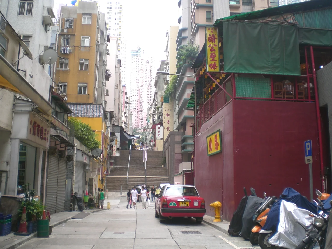

Tai Ping Shan Street
The name means "Peace Hill." In 1894, nothing about it was peaceful. Tai Ping Shan Street ran through the densest Chinese residential district in colonial Hong Kong, a neighborhood built partly from displacement — Chinese residents forced out of the area then called Choong Wan and relocated here after the British arrived in the 1840s. When bubonic plague reached the street that May, it spread through these crowded lanes with terrible efficiency. What followed reshaped not just the neighborhood, but Hong Kong's understanding of public health.
How the Street Came to Be
Tai Ping Shan is an alternative name for Victoria Peak, and the street running along its lower northern slope inherited the name. When Hong Kong Island passed from Qing China to British control in the 1840s, the colonial government reorganized its use of space in ways that displaced the existing Chinese population. Residents from the area known as Choong Wan — present-day Central — were relocated to Tai Ping Shan Street and its surroundings. The result was density: a crowded urban neighborhood growing rapidly on a hillside, with the population surging again after the Eight-Nation Alliance's invasion of China in 1900 pushed more refugees into the colony. The Chinese writer Wang Tao, visiting in 1860, described the street as full of brothels with "gaudy houses, sporting brightly painted doors and windows with fancy curtains." Whatever the moral character Wang Tao observed, it was a neighborhood unmistakably alive.
The Plague of 1894
Bubonic plague had been moving through southern China for years before it reached Hong Kong in May 1894. Tai Ping Shan Street became the outbreak's epicentre. The precise death toll in the district is difficult to establish with certainty, but the 1894 Hong Kong plague killed thousands across the colony and triggered one of the most aggressive public health responses the colonial government had ever mounted. Streets were cleaned. Infected homes were disinfected or demolished. The colonial administration carved Blake Garden out of the district by tearing down houses — eliminating the overcrowded residential blocks and replacing them with open space. The Bacteriological Institute, which still operates today as the Hong Kong Museum of Medical Sciences, was established as a direct response to the crisis. The plague didn't leave Tai Ping Shan Street unchanged; it erased significant parts of it and rebuilt others in their place.
What the Street Holds Now
Walking Tai Ping Shan Street today, the geography of the 1890s survives in outline even where the buildings don't. The street runs parallel to Hollywood Road — the two lanes threading the mid-levels with the compact logic of a neighborhood that predates cars. At the western end near Po Yan Street, Tung Wah Hospital, founded in 1872, remains in operation. The ladder streets that connect these parallel lanes still carry pedestrians up the slope, stone steps worn smooth by generations of daily use. The temples tell their own story of continuity: Shui Yuet Kwun Yam Tong at No. 7, Tai Shui Temple at No. 9, Tai Ping Shan Kwun Yum Tong at No. 34, and Kwong Fook Tsz at No. 40 have made Tai Ping Shan Street a node of traditional religious life for more than a century.
Art in the Ruins of History
Contemporary Tai Ping Shan Street is known for something its 19th-century residents couldn't have predicted: it has become one of Hong Kong's liveliest corridors for contemporary art. Pop-up galleries appear alongside traditional medicine shops and antique dealers. The street sits within what is now considered Sheung Wan's creative district, a neighborhood where the density of history seems to attract rather than repel new work. The art scene here operates in dialogue with what came before — not because the galleries are overtly historical in theme, but because the physical fabric of the street makes the past unavoidable. You can look at a contemporary work on a gallery wall and then step outside onto stones that were laid during the colonial era, in a neighborhood rebuilt after an epidemic that killed thousands. Tai Ping Shan Street's layers don't disappear; they accumulate.
From the Air
Tai Ping Shan Street is located at 22.2847°N, 114.1484°E on the lower northern slope of Victoria Peak in the Sheung Wan district of Hong Kong Island. Approaching from the harbour at 1,500 feet, the ladder streets and mid-levels terracing are visible as diagonal lines cutting across the hillside grid below the Peak. Victoria Peak (552 m) provides a clear directional marker to the south-southeast. VHHH (Hong Kong International Airport) lies approximately 30 km northwest at Chek Lap Kok. The Western Harbour and the Macau Ferry Terminal are useful coastal orientation points at low altitude.
Nearby Stories
- Lok Ma Chau Loop 2.3 km away
- Portas do Cerco 2.3 km away
- Kweilin Incident 17 km away
- Wanshan Archipelago Campaign 34 km away
- Nanxiong Formation 115 km away
- Battle of Nanpeng Island 148 km away
- Heyuan 169 km away
- Cape Maobitou 632 km away