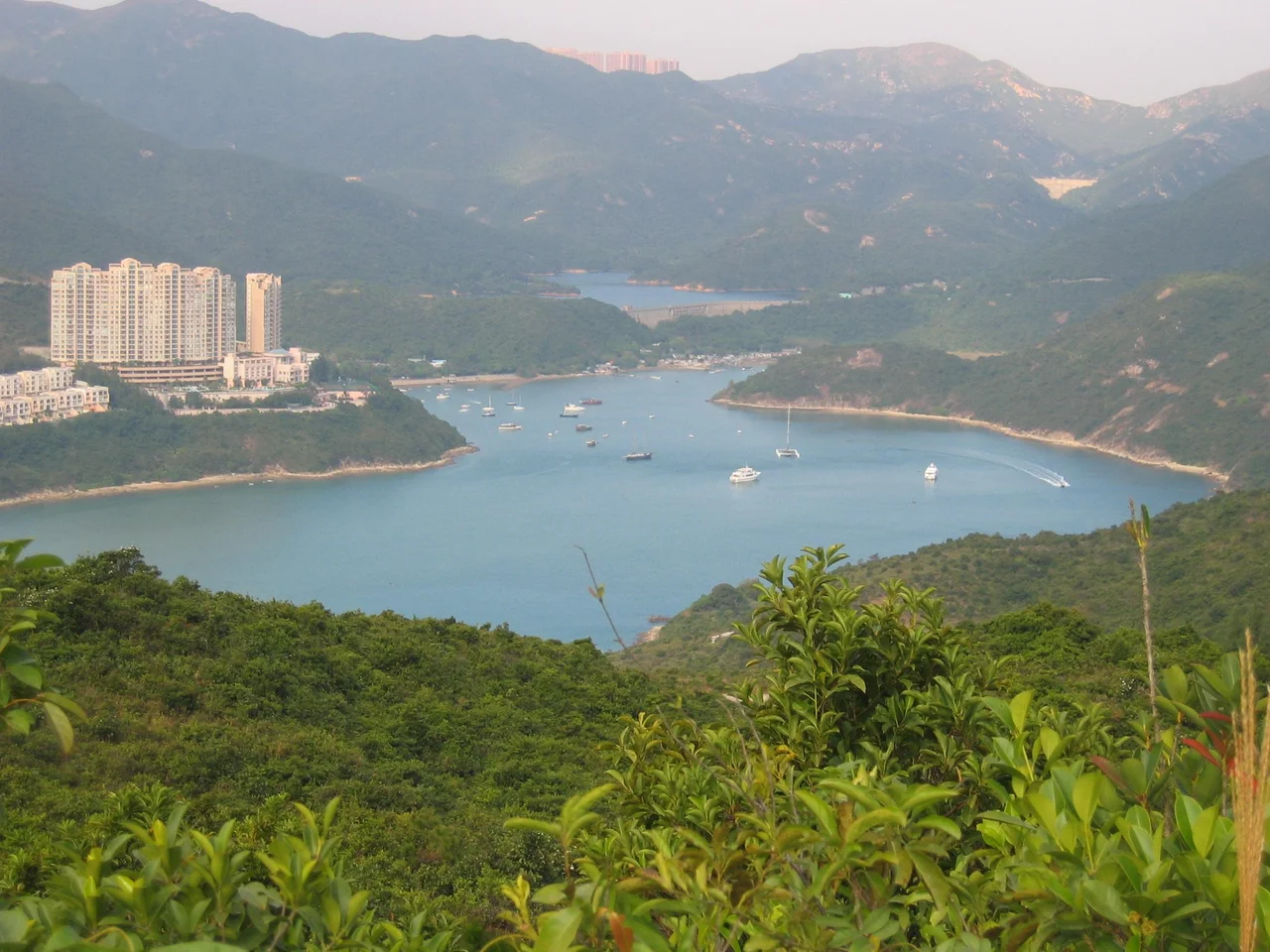

Tai Tam Harbour
At the time of the 1911 census, Tai Tam Tuk had 76 residents. Lan Nai Wan had 4. To Tei Wan had 54. These aren't the numbers of a remote wilderness — they're the quiet tallies of a working shoreline, where small fishing communities had established themselves along the narrow inlet that cuts into the southeastern edge of Hong Kong Island. Tai Tam Harbour was never large or busy, but it was inhabited, and the villages along its western shore have a history that the surrounding country park now quietly contains.
The Shape of the Harbour
Tai Tam Harbour is not a harbour in the conventional sense — no commercial shipping, no deep anchorage. It is a narrow inlet, roughly 200 metres wide and 2 kilometres long, with an average depth of about 3 metres, connecting the inner bay of Tai Tam Bay with the sea to the south. It sits at the mouth of the Tai Tam Tuk stream, in the innermost reach of Tai Tam Bay on Hong Kong Island's southeastern coast. The harbour's southern end opens to open water; its northern end reaches into a gentle northwest inner bay where the stream meets the sea and mangroves take hold in the shallow mud. The Redhill Peninsula closes off the southwestern edge, a round-shaped landmass where the upmarket estates of Red Hill Park, Turtle Cove, Le Palais, and Villa Rosa now occupy what were once emptier slopes.
Five Villages and Their Histories
Five villages line the western coast of Tai Tam Harbour, known collectively as the Five Lan Nai Wan Villages. Running north to south, they are: Lan Nai Wan Village, Tung Ah Village, Tung Ah Pui Village, Ngan Hang Village, and a fifth village at the southern end. These communities were small by any measure — the 1911 census figures tell that story plainly — but their presence stretched back generations. Tai Tam Tuk Village, which sat at the estuary, was resited when the construction of Tai Tam Tuk Reservoir inundated its original location. The village relocated rather than disappeared, establishing itself along the western shore of the inner bay. Resiting rather than erasure: it's a recurring pattern in Hong Kong's relationship with its water infrastructure, where communities adapted to the demands of reservoirs and reclamation rather than simply ceasing to exist.
Pillboxes Among the Trees
The villages aren't the only layer of history visible along the shore. Among the Five Lan Nai Wan Villages, the remains of military installations — lookouts and concrete pillboxes — survive in the landscape. These defensive structures were built to guard the island's southern approaches during the colonial period. During the Battle of Hong Kong in December 1941, the southeastern coast saw little of the direct fighting that devastated the north and west of the island, but the installations testify to the planners' awareness that the entire coastline was vulnerable. The pillboxes are overgrown now, their concrete weathered, their gun ports aimed at a sea no longer threatened by the dangers that put them here. Walking the section of Hong Kong Trail that traces the harbour's northern and western outline — Stage 7, running from Tai Tam Road to To Tei Wan — you encounter them as interruptions in the landscape, evidence of an era most visitors to the country park don't think much about.
A Protected Estuary
The inner bay of Tai Tam Harbour has been designated a Site of Special Scientific Interest since 1975 — recognition of the ecological value of its estuary, where mangroves colonize the shallow tidal mud at the stream's mouth. Mangroves in Hong Kong support a distinct suite of birds, fish, and invertebrates that depend on the transitional zone between freshwater and saltwater, and they are not common on Hong Kong Island itself. The northwestern inner bay is the richest part of the harbour, where the stream slows and sediment accumulates and roots take hold. A public pier near the Tai Tam Tuk Raw Water Pumping Station gives access by water. Most visitors come on foot, following the trails that wind through the country park to arrive at the harbour's edge almost by surprise — the water suddenly visible through the trees, quiet and reflecting, a world away from the city that begins just a few kilometres north.
From the Air
Tai Tam Harbour is located at 22.2370°N, 114.2312°E on Hong Kong Island's southeastern shore, within Tai Tam Country Park. From the air at 2,000 feet approaching from the south, the narrow inlet is clearly visible cutting into the island's southern coastline, with the Redhill Peninsula forming its southwestern edge and the reservoir system visible in the valley behind it. Tai Tam Bay opens to the southeast. VHHH (Hong Kong International Airport) lies approximately 40 km to the northwest. The distinctive silhouette of the Dragon's Back ridge to the north provides a useful navigational landmark when approaching from over the South China Sea.
Nearby Stories
- Lok Ma Chau Loop 2.3 km away
- Portas do Cerco 2.3 km away
- Kweilin Incident 17 km away
- Wanshan Archipelago Campaign 34 km away
- Nanxiong Formation 115 km away
- Battle of Nanpeng Island 148 km away
- Heyuan 169 km away
- Cape Maobitou 632 km away