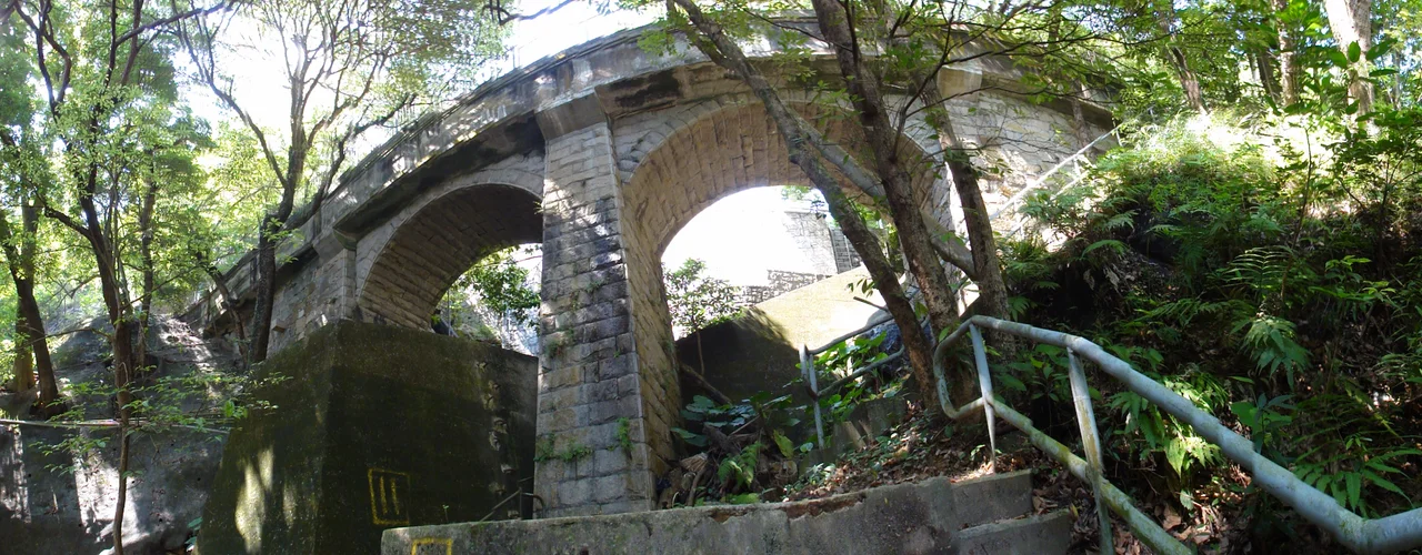

Tai Tam Waterworks Heritage Trail
Most heritage trails lead you to things that used to do something. The Tai Tam Waterworks Heritage Trail leads you to things that are still doing it. The 22 structures strung along this five-kilometre route — valve houses, pumping stations, masonry bridges, staff quarters — were declared monuments in September 2009, not because they stopped working but precisely because they never did. Walking the trail means moving through a functioning piece of colonial infrastructure that has operated, largely unchanged, since the 1880s. The water flowing through these pipes and chambers supplies Hong Kong Island right now.
Walking Into the Victorian Machine
The trail begins at Wong Nai Chung Gap, near Hong Kong Parkview, or alternatively at the junction of Tai Tam Road and Tai Tam Reservoir Road — two entry points for the same five-kilometre loop that takes about two hours on foot. Ten information stations are positioned along the route to explain what each structure does and how old it is. The experience shifts quickly from the urban texture of the gap road into something quieter: the canopy closes, the traffic fades, and the granite stonework of the waterworks appears among the ferns and trees as though it simply grew there. Valve houses squat beside the trail at measured intervals, their cast-iron fittings still controlling water that once served a city of a few hundred thousand people and now serves one of several million.
A System Built in Stages, Held Together by Granite
The structures along the trail span several decades of construction. The oldest, associated with the Tai Tam Reservoir itself (built 1883–1888), already show the characteristics that define the whole system: Italianate Renaissance detailing applied to utilitarian Victorian civil engineering. Arches, columns, and careful stonework appear on pump houses and bridges that could easily have been plain concrete boxes. The colonial government chose granite — quarried locally — and chose to ornament it. The result is that these buildings wear their age well. Later phases added the Tai Tam Byewash Reservoir and Tai Tam Intermediate Reservoir between 1904 and 1907, and finally the Tai Tam Tuk Reservoir from 1912 to 1917, each phase extending the trail's narrative further in time while maintaining the same design vocabulary.
What It Meant for Hong Kong's Growth
It is easy to walk past a valve house without registering what it enabled. The Tai Tam system was not only about quenching thirst — it was about where the city could go. Before the reservoirs were operational, urbanisation on Hong Kong Island was largely confined to the areas around Victoria Harbour: Central, Sheung Wan, the Western District. The water from Tai Tam released pressure on those crowded districts and made it possible for Causeway Bay, North Point, and Shau Kei Wan to develop as residential and commercial areas. Water moved the city eastward. The trail, in that sense, is a walk through the physical mechanism of urban growth — the infrastructure that determined where hundreds of thousands of people would eventually live.
The Pumping Station and Its Chimney
Most of the trail's 22 declared structures can be viewed freely. The Tai Tam Tuk Raw Water Pumping Station and its chimney shaft are exceptions — they are not accessible to the general public, though participants of the official guided tours, which the Commissioner for Heritage's Office has organised since September 2009, are permitted inside. The chimney is the trail's most visually arresting feature from a distance: a Victorian industrial stack rising unexpectedly from subtropical greenery. The guided tours target young people aged 12 to 18, encouraging them to engage with the centenary monuments rather than read about them at a remove. The combination of permitted access and trained interpretation gives the tower visits a weight that placards alone cannot.
Conservation Without Restoration
What makes this trail unusual in the wider story of Hong Kong heritage conservation is the absence of reconstruction. Forty-one pre-World War II waterworks structures across six reservoir areas island-wide were declared monuments in 2009 — the full network spanning Pok Fu Lam, Aberdeen, Kowloon, Shing Mun, Wong Nai Chung, and Tai Tam. Most heritage projects require significant investment in stabilisation, replication of lost fabric, or interpretive infrastructure. Here, almost nothing physical was added. The structures were intact and operating. The trail was established alongside them, not for them. That self-sufficiency — a heritage project that required no extra resources precisely because the original infrastructure never needed saving — is genuinely rare.
From the Air
The Tai Tam Waterworks Heritage Trail runs along the eastern flank of Hong Kong Island at approximately 22.239°N, 114.223°E. From the air, the trail corridor is visible as a narrow green strip threading through the Tai Tam Country Park hills, with the reservoir surfaces providing clear reference points. The trail's northern entrance near Wong Nai Chung Gap sits at roughly 150 metres elevation; the southern end at the Tai Tam Tuk Pumping Station is near sea level. Nearest major airport: Hong Kong International Airport (VHHH), approximately 34 km northwest on Lantau Island. The green country park contrasts sharply with the dense built fabric of Quarry Bay and Chai Wan visible to the north and east at lower altitudes. Best viewed on approach from the northwest at 2,000–4,000 feet in clear weather.
Nearby Stories
- Lok Ma Chau Loop 2.3 km away
- Portas do Cerco 2.3 km away
- Kweilin Incident 17 km away
- Wanshan Archipelago Campaign 34 km away
- Nanxiong Formation 115 km away
- Battle of Nanpeng Island 148 km away
- Heyuan 169 km away
- Cape Maobitou 632 km away