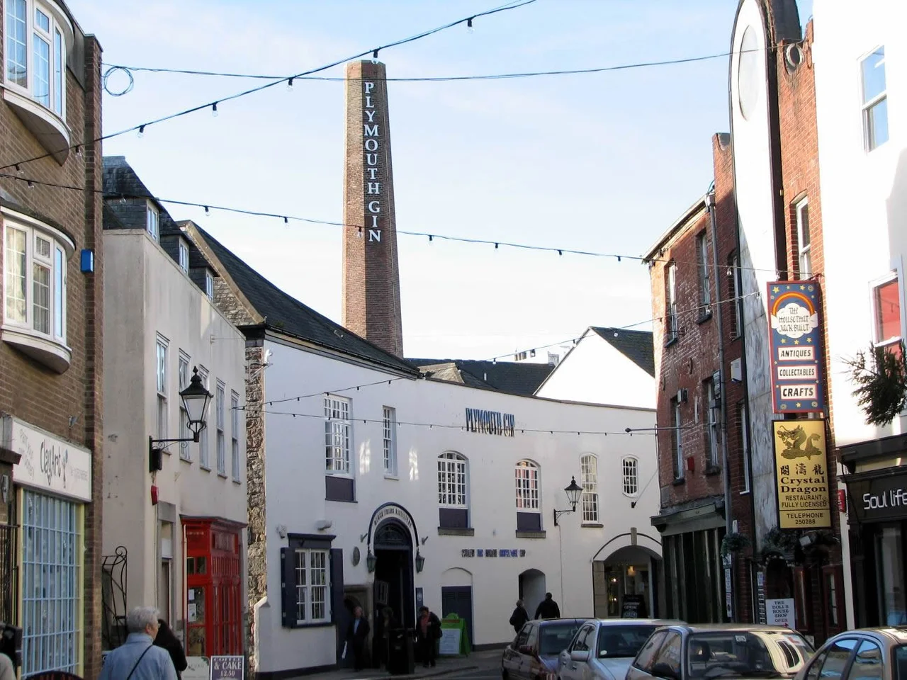

The Barbican, Plymouth
When the Luftwaffe came for Plymouth, they came hard. Wave after wave of bombers across the spring of 1941 erased almost the entire medieval city, leaving Charles Church standing as a roofless memorial to what was lost. But on the western edge of Sutton Harbour, a knot of cobbled streets somehow survived. Today this neighbourhood, known as The Barbican, holds Britain's largest concentration of cobbled streets and a hundred listed buildings, more than a few of which were standing here when the Pilgrim Fathers boarded the Mayflower in 1620. It is the only piece of Tudor Plymouth that you can still walk through.
What the Name Remembers
A barbican is a fortified gateway, the outer defence of a castle, and that is exactly what gave this district its name. Plymouth Castle once guarded the entrance to the Cattewater, the deep-water anchorage that made Plymouth one of England's most important Tudor and Stuart ports. The Castle Barbican was the fortress's outer gate. The castle is long gone, replaced by the Royal Citadel that Charles II built in the 1660s on the headland to the south. But the name stuck to the streets below, and the medieval walled town of Sutton that the castle once protected is roughly the same footprint as the Barbican of today. New Street, one of the oldest in Plymouth, was once called Rag Street. The Elizabethan House on it dates from around 1584 and is now a museum.
From Slums to Survival
The story of how the Barbican survived is partly a story of what happened to other places. Through the late nineteenth century and the first half of the twentieth, much of historic Plymouth was demolished. Wealthy merchants had moved out to country estates, leaving their grand Elizabethan townhouses to be subdivided into desperately overcrowded slums. A government survey after the Public Health Acts found that overcrowding in Plymouth Sutton was among the worst in western Europe, comparable only to Warsaw, with families of up to ten living in single-room tenancies. Demolition followed. Then came the Blitz. By the time the rebuilding committees turned to what remained, the Barbican's surviving fabric was rare enough to fight for. The Plymouth Barbican Association restored what it could and still owns and maintains many of the oldest buildings on the streets today.
Pilgrims, Gin, and a Famous Aquarium
The Mayflower Steps mark the spot, more or less, where the Pilgrims boarded their ship for the New World in September 1620. The actual original quay is gone, but the visitor centre nearby tells the story and the memorial stone still draws Americans tracing ancestral threads. A short walk away on Southside Street, the Plymouth Gin Distillery has been making Plymouth Gin since 1793. The Royal Navy carried it around the world for over two centuries, and by the 1930s it was the most widely distributed gin in the world. It once held a Protected Designation of Origin, but that status lapsed in 2015 and was not renewed — the brand and its Black Friars home remain, but the formal geographic protection is gone. The National Marine Aquarium opened across the harbour at Coxside in 1998, one of Britain's largest aquaria with one of the deepest tanks in Europe. The painter Robert Lenkiewicz lived and worked on the Barbican for decades, painting his neighbours and turning his studio into a gallery that drew its life from the streets around it.
The Working Harbour
The Barbican is not a museum piece. In 1993 a lock was installed across Sutton Harbour, designed to keep a constant depth of water for fishing and pleasure craft and to reduce flood risk for the low-lying buildings nearby. That same year the Victorian fish market closed on Southside Street and a modern facility opened across the water at Coxside, where the auctions remain among the busiest on the south coast. Trawlers still come in. The quay is still working. Walk the Parade in the evening and you find the cobbles paved over by glass-sided enclosures with infra-red heaters and square umbrellas, the modern Plymouth equivalent of a Mediterranean piazza. There has been argument over the new flats now ringing Sutton Pool, which some say have spoiled the seaward gateway into the city centre. The Barbican knows that argument well. It has been the negotiation point between Plymouth's past and Plymouth's future for nearly five hundred years.
From the Air
The Barbican sits at 50.37 N, 4.14 W, on the western shore of Sutton Harbour on the south side of Plymouth. From the air the harbour is easy to pick out, with the Royal Citadel's pentagonal star fort guarding the seaward approach and Plymouth Hoe rising to the west. Plymouth City Airport (EGHD) closed in 2011; nearest active fields are Exeter (EGTE) about 35 nm northeast and Newquay Cornwall (EGHQ) 40 nm west. Best low-level viewing is 1,500 to 2,500 feet AGL on a clear morning with sun behind, framing Plymouth Sound and the breakwater to the south.
Nearby Stories
- Davidstow Circuit 3.7 km away
- Golden Hind 3.9 km away
- Powderham Castle 4.4 km away
- Fowey Lifeboat Station 5.1 km away
- Okehampton Castle 12 km away
- Battle of Plymouth (1652) 19 km away
- Goonhilly Satellite Earth Station 44 km away
- German Submarine U-672 73 km away