![Photo: .mw-parser-output .ubx-floatdefault[dir="ltr"],.mw-parser-output .ubx-floatopposite[dir="rtl"],.mw-parser-output .ubx-floatleft{float:left}.mw-parser-output .ubx-floatdefault[dir="rtl"],.mw-parser-output .ubx-floatopposite[dir="ltr"],.mw-parser-output .ubx-floatright{float:right}.mw-parser-output .ubx-floatnone{float:none} Iflwlou製作 | CC BY 2.0](https://commons.wikimedia.org/wiki/File:Hongkongisland.png)
The Twins, Hong Kong
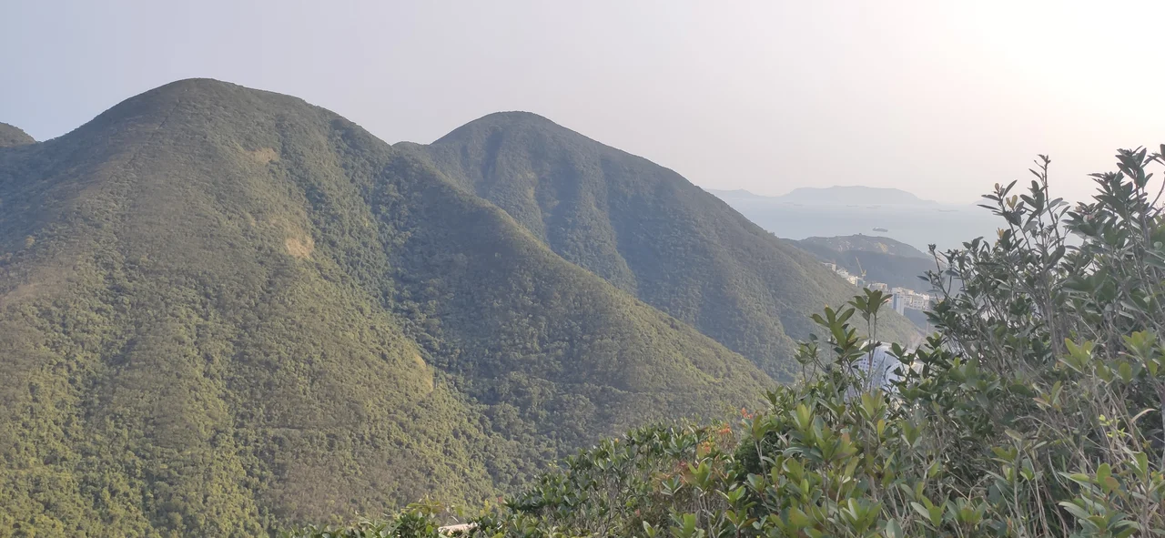
Locals call them the Twins, but the official name is Ma Kong Shan — and both names describe the same thing: two peaks of almost identical height, lined up north to south along the spine of Hong Kong Island, rising from the hills above Stanley and Repulse Bay. Together they form one of the island's signature hikes, a route distinguished less by distance than by sheer verticality. Getting from the base to the ridge means climbing more than 1,000 steps, straight up. There is no gentle approach, no gradual ascent. The staircase simply goes up, and then it goes up some more.
Two Peaks, Nearly Matched
The Southern Twin is the higher of the pair at 386 metres, the Northern Twin close behind at 363 metres. For context, both are shorter than Victoria Peak — the dominant summit of Hong Kong Island at 552 metres — but they feel taller on the ground because the terrain around them drops steeply to sea level on multiple sides. The peaks are oriented north to south, and from the top of either one the relationship between the island's geography becomes legible: the built mass of Aberdeen and Wong Chuk Hang to the northwest, the reservoir system of Tai Tam to the east, the headlands and beaches of Stanley to the south. On clear days the South China Sea stretches to the horizon. To the north of the Twins, the ridge continues toward Violet Hill, another prominent summit that forms part of the same hiking corridor.
The Steps That Define the Hike
The route most hikers take starts near Repulse Bay or Stanley and ascends the staircase — more than 1,000 steps cut directly into the hillside. The South China Morning Post has listed it among the city's most demanding stair climbs, the Hong Kong equivalent of the stadium steps that urban athletes use for training. In a city where vertical gain is a fact of daily life, the Twins still manage to be exceptional. The stairs were not built for casual visitors; they are a serious piece of trail infrastructure, and on weekends they fill with a particular subset of Hong Kong residents: fitness enthusiasts, hikers working through the Wilson Trail, and people who simply want the views badly enough to earn them. First-timers often underestimate the ascent. Return visitors tend to pace themselves from the start.
The Wilson Trail's First Section
Section 1 of the Wilson Trail runs through the top ridges of The Twins, making them part of one of Hong Kong's long-distance trail networks. The Wilson Trail covers 78 kilometres in total, crossing Hong Kong Island before continuing north through the New Territories. Its southernmost section begins near Stanley and climbs through the Twins before descending toward Tai Tam — a route that takes in the full drama of the island's southern terrain in a few compact kilometres. For through-hikers working the trail from south to north, the Twins come early: the opening challenge, the first real test of what the trail demands. The ridge walk between the two summits is the reward — exposed to the wind on both sides, with the harbour visible to the north and the open sea to the south.
Three Ways In
There are three main approaches to the Twins: from Stanley to the south, from the Tai Tam Reservoirs to the east, or from Repulse Bay to the west. Each suits a different kind of visit. The Stanley approach begins in a market town with colonial history and a tourist-friendly waterfront; the Tai Tam approach starts among the reservoirs and forested catchment areas that supply part of Hong Kong's fresh water; the Repulse Bay approach begins steps from one of the island's most famous beaches. All three converge at the foot of the steps. What differs is the scenery on the way in. What stays constant is the ascent — more than 1,000 steps upward, always upward, until the ridge appears and the full sweep of southern Hong Kong comes into view.
From the Air
The Twins sit at 22.2307°N, 114.2053°E on the southern part of Hong Kong Island, between Stanley Peninsula to the south and Tai Tam Country Park to the east. From the air, the two matching summit profiles are visible along the island's spine, south of the Happy Valley and Causeway Bay areas. The South China Sea is directly visible to the south. The nearest major airport is Hong Kong International Airport (VHHH), approximately 35 km to the northwest on Lantau Island. Recommended viewing altitude: 2,000–3,000 feet for the full south-coast perspective. The Tai Tam Reservoirs provide a clear geographic reference to the east.
Nearby Stories
- Lok Ma Chau Loop 2.3 km away
- Portas do Cerco 2.3 km away
- Kweilin Incident 17 km away
- Wanshan Archipelago Campaign 34 km away
- Nanxiong Formation 115 km away
- Battle of Nanpeng Island 148 km away
- Heyuan 169 km away
- Cape Maobitou 632 km away