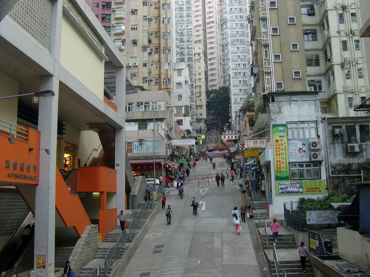

Third Street, Hong Kong
The street is called Third Street, which tells you almost nothing and everything. It is the third in a sequence — First, Second, Third — laid out by colonial planners on the Sai Ying Pun slope in the nineteenth century, running east to west across the hillside while Centre Street and Western Street plunge north toward the waterfront below. The grid was orderly on paper. On the ground, Sai Ying Pun was a neighborhood that grew around it in every direction, filling the lanes and stairways with the dense particularity of Hong Kong life.
A Street of Small Concerns
What makes Third Street interesting is the inventory of what it actually contains. The Wikipedia article on the street, which appears to have been compiled with the patient attention of someone who walked its length counting doors, lists the businesses: ten food retailers (two specializing in bean curd), seven food wholesalers, six cafés, a Chinese liquor factory, the Yu Kwan Yick chili sauce factory outlet, five tutors, five music schools, five electrical shops, two laundries, seven real estate agents, two restaurants, five auto mechanics, four green grocers, three decoration shops, four clothes shops, two beauty salons, three builders, and a drink shop, a florist, a cleaning products shop, a hair dresser, a pet products store, a vet, an art school, a carpet shop, a stationer, a paper goods shop, a hardware store, a paper recycler, an Indonesian products shop, and a refuse collection depot. This is not a trendy street. It is a street where people get things done.
The Buildings That Anchor It
The street's notable buildings give it more depth than most Hong Kong streets its size. The Sai Ying Pun Market anchors the corner at Centre Street — a tiered structure whose upper level opens directly onto Third Street, where the fish mongers and butcher stalls operate. Across from the market, at the corner with Western Street, stands the Old Tsan Yuk Maternity Hospital, a colonial-era institution that may be designated as a Hong Kong monument. Opposite it sits Kau Yan Church, a Christian congregation that has been part of Sai Ying Pun's street life for generations. Further along, at number 179, St. Louis School occupies the corner with Kwong Fung Lane. Scattered among these landmarks, at numbers 145, 147, 149, 151, and 153, a row of tong lau — the distinctive shophouse form that defines old Hong Kong neighborhoods — still stands, narrow and vertical, their facades layered with decades of paint and signage.
The Lanes That Lead Away
Third Street is as much defined by what leads off it as by what runs along it. The side lanes read like a private vocabulary of neighborhood navigation: Kwong Fung Lane drops down to Queen's Road West; Yau Yee Lane extends south to a playground and basketball court; Fuk Sau and Sheung Fung Lanes connect to Second Street below; Yu Lok Lane can be reached by climbing steps up from Centre Street. Un Fuk Lane, which once went straight through to Second Street, now stops at the Tong Nam Mansion. These interruptions and continuations, the steps and passages, the lanes that go through and the lanes that don't — they describe a neighborhood that was never entirely planned but accumulated over time, each generation filling gaps and carving shortcuts as needed.
Getting There and Getting Around
An escalator connects First and Second Street to Third Street through the market, the kind of practical infrastructure that reveals how seriously Hong Kong takes the business of moving people up and down steep slopes. The Green Mini Bus 12 runs along the street. A Red Mini Bus labeled Daimaru — a reference to the now-closed Japanese department store that was once a Causeway Bay landmark — heads east. The TVB drama A Journey Called Life set a major character, Fat Boss (played by Kent Cheng), as the Security Guard of No. 3 Street, using the neighborhood as shorthand for a particular kind of working-class Hong Kong community life. Fiction and street reality overlap here, as they do in most places where people have actually lived for a long time.
From the Air
Third Street lies in the Sai Ying Pun neighborhood on the northwest slope of Hong Kong Island, centered near coordinates 22.2857°N, 114.1405°E. Approaching VHHH (Hong Kong International Airport) on an eastbound arrival, the hillside neighborhoods of the island's northern shore come into view below — Sai Ying Pun sits west of Sheung Wan, identifiable by its grid of streets descending steeply toward the harbor. At 2,000 feet, the rectilinear street layout of the planned colonial grid is visible against the irregular contours of the hill. The area lies roughly 35 kilometers east of the airport on Lantau Island.
Nearby Stories
- Lok Ma Chau Loop 2.3 km away
- Portas do Cerco 2.3 km away
- Kweilin Incident 17 km away
- Wanshan Archipelago Campaign 34 km away
- Nanxiong Formation 115 km away
- Battle of Nanpeng Island 148 km away
- Heyuan 169 km away
- Cape Maobitou 632 km away