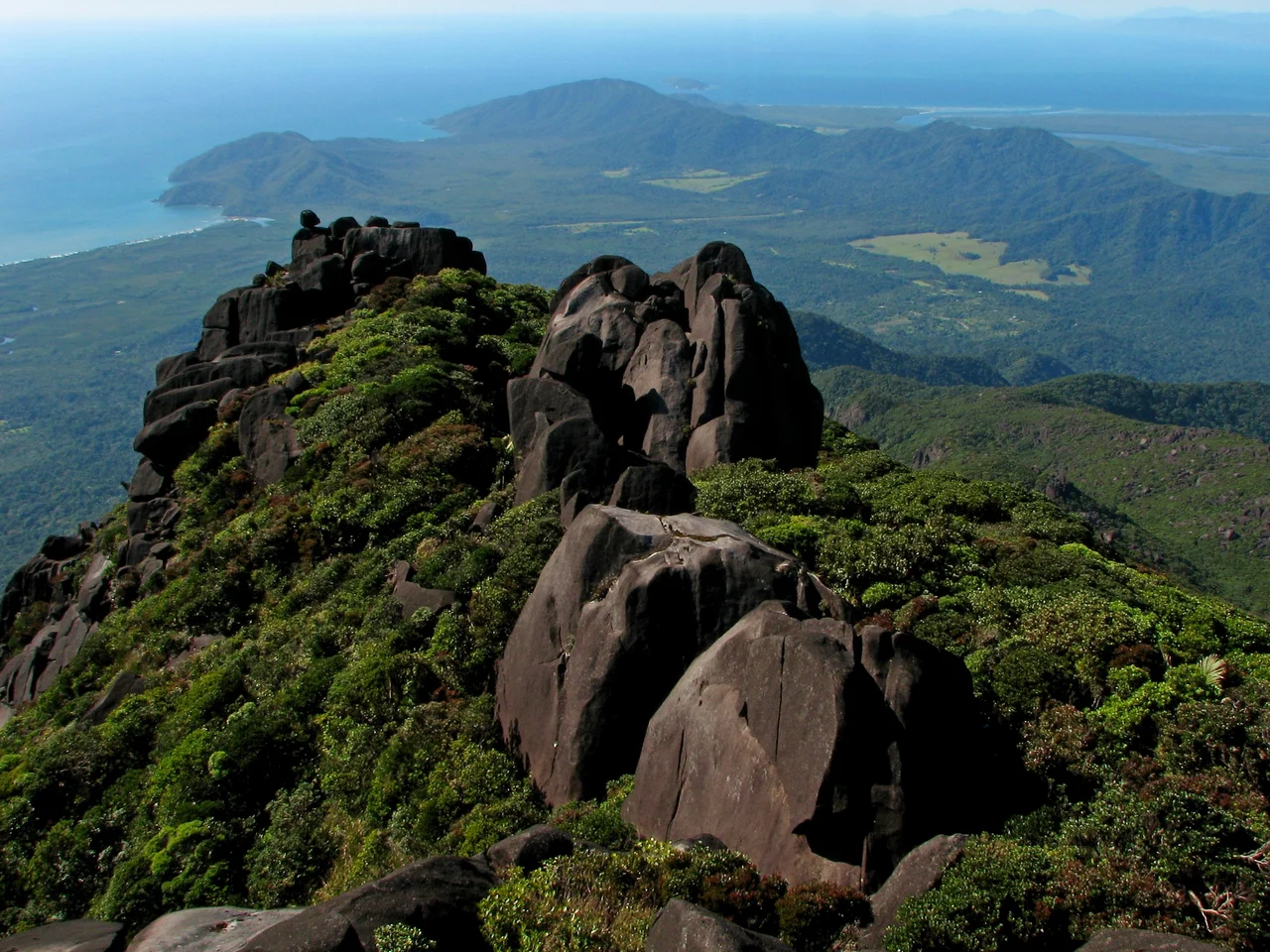

Thornton Peak
From the warm green floor of the Daintree, the land does something it almost never does on the Australian coast: it goes nearly straight up. Thornton Peak climbs from sea-level lowlands to 1,374 metres in a single uninterrupted heave of rainforest and grey granite, its summit so often wrapped in cloud that crews flying the coast use the white cap as a marker. The Eastern Kuku Yalanji people, who have walked this country for thousands of years, call the mountain Wundu. It holds spiritual significance for them, and standing beneath it you sense why a place this commanding would belong, first and always, to story.
Wundu, the Watcher
Thornton Peak is the fourth-highest mountain in Queensland, trailing only Bartle Frere at 1,622 metres, Bellenden Ker at 1,593, and Mount Superbus at 1,375 — and unlike those inland giants, it falls almost to the sea, which makes it one of the most abrupt coastal peaks on the continent. To the Eastern Kuku Yalanji it is Wundu, a presence rather than a landmark. Their connection to this range is not a chapter that closed with European arrival; it is a living relationship, formally recognised in their 2007 native title determination over the Eastern Kuku Yalanji lands. When low cloud snags on the summit and pours down the gullies in slow grey rivers, the mountain looks exactly like what its custodians have always understood it to be: awake, and watching.
An Island in the Sky
Mountains in the wet tropics behave like islands. Their high slopes are cooler and wetter than the lowlands, and the creatures adapted to that chill cannot simply walk to the next peak across the hot valleys between. Thornton Peak is one of only three places on Earth — alongside the Carbine and Mount Windsor Tablelands — where the cinereus ringtail possum survives, a soft grey marsupial that threads the canopy by night and exists nowhere else in the world. Around it lives a whole community of endemic species, plants and animals stranded on this cool summit since the rainforest shrank back during ancient dry epochs. Each is a survivor of a vanished, wetter world, holding on at the top of the only mountain it has ever known.
A Refuge Running Out of Up
That isolation is also the danger. As the climate warms, the cool band these species need creeps higher up the slope — and a mountain only has so much height to give. Scientists studying the wet tropics have floated a striking idea: that Thornton Peak, high and cold and steep, might one day serve as a refuge for species being pushed off lower, gentler ranges, a deliberate ark where cool-adapted animals could be moved to ride out a hotter century. It is a sober thought to carry up a mountain this beautiful. The summit that has sheltered ancient life for millennia may soon be asked to shelter it on purpose, the last cold rung on a ladder the warming world is slowly pulling away.
What the Mountain Keeps
Thornton Peak does not give itself up easily. There is no road to the top and no comfortable trail; the granite boulder-fields near the summit are a maze of house-sized rock and clinging cloud-forest, and the mountain has swallowed more than one traveller. In April 2001, the wreckage of a small Aero Commander 500, missing on a flight along this coast, was finally located on its slopes. The peak rewards distance and respect rather than conquest. From the Daintree River mouth or the warm sand at Cape Tribulation, you look up at a single green wall vanishing into weather — a mountain that has held its secrets, its species, and its sacred name for longer than memory.
From the Air
Thornton Peak stands at 16.16°S, 145.37°E, summit elevation 1,374 m (4,508 ft) — a steep, isolated coastal peak rising directly from the Daintree lowlands roughly 126 km northwest of Cairns. The summit is very frequently capped or shrouded in orographic cloud, which builds rapidly as moist easterlies are forced up the slope; expect turbulence and reduced visibility on the windward (eastern) side. Use a generous terrain-clearance buffer above the published elevation. Nearest airports: Cairns (YBCS, international) about 90 km south; Cooktown (YCKN, single runway 11/29) to the north serves as the regional Cape York gateway. Best clear viewing is early morning before cloud builds; the green wall of the peak and the Daintree River mouth are the key visual references along this coast.
Nearby Stories
- Byerstown 15 km away
- St Mary's by the Sea, Port Douglas 18 km away
- Kuku Nyungkal 21 km away
- Quinkan Rock Art 46 km away
- Green Island (Queensland) 47 km away
- Ngarrabullgan 59 km away
- HMS Mermaid (1817) 131 km away
- Kapa Kapa Trail 692 km away