Tigray Region
The obelisks of Aksum still stand where workers raised them seventeen centuries ago, granite fingers pointing at a sky that has watched empires rise and fall. One of them, shipped to Rome by Mussolini in 1937 and returned to Ethiopia in 2005 — and re-erected in 2008 — came home to a region that was about to remember, with terrible clarity, what war means. Tigray occupies the northernmost stretch of Ethiopia, roughly 53,000 square kilometers bordered by Eritrea and Sudan. The Tigrinya-speaking highlanders who farm its terraces have called this place home for three millennia. And between 2020 and 2022, roughly 600,000 of them died in a war that most of the world barely watched.
The Cradle Story
Ethiopians often call Tigray the cradle of their civilization, and the archaeology backs them up. Near the modern town of Yeha stand the ruins of a great temple complex built when the kingdom of D'mt flourished three thousand years ago, its people already irrigating fields, working iron, and writing in an ancestor of the Ge'ez script. From D'mt rose Aksum, the trading empire that by the first century CE had made itself one of the four great powers of the ancient world, coining its own currency alongside Rome, Persia, and China. In 325 CE, King Ezana converted Aksum to Christianity and stamped a cross on his coins, an act that made the empire the first state in history to do so. The obelisks at Aksum, carved from single blocks of granite and standing thirty meters tall, marked the graves of kings whose names the rest of the world forgot.
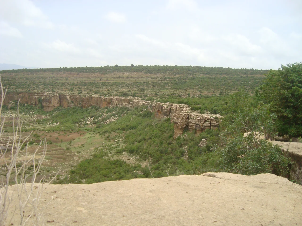
Rock and Ink
The landscape itself preserves memory. In the Gheralta mountains, churches carved into sandstone cliffs can only be reached by climbing rock faces with bare hands. Monks there still keep Ge'ez manuscripts written in ochre and charcoal ink, painted with egg tempera, some of them a thousand years old. The highest peaks in the region climb past 3,900 meters, and the air on the Dogu'a Tembien massif is thin enough that farmers plowing terraces say you can see the weather change before it reaches you. Detailed bird inventories list 170 species across Tigray, including the wattled ibis, the black-winged lovebird, and the Abyssinian woodpecker. The endemic gelada baboon, with its bleeding-heart chest patch, grazes on the highest mountain meadows like a herd of solemn philosophers.
Emperors and Rebels
Tigray's emperors and its rebels have shaped Ethiopian history out of all proportion to the region's size. Emperor Yohannes IV, crowned in 1872, ruled a united Ethiopia from this northern highland until his death at the Battle of Metemma in 1889. In 1943, Tigrayan peasants rose against Haile Selassie in the first Woyane rebellion under the slogan, 'there is no government; let's organize and govern ourselves.' They formed their own village assemblies, elected their own leaders, and held out for months before imperial forces crushed them. Four decades later, the Tigray People's Liberation Front launched a guerrilla insurgency from these same mountains that eventually toppled the Derg regime in 1991. For the next twenty-seven years, the TPLF dominated Ethiopian politics.
The War
In November 2020, federal forces and Eritrean troops crossed into Tigray. What followed was catastrophic. An estimated 600,000 people died, according to independent researchers, making it one of the deadliest wars of the twenty-first century. Famine returned to the region as food convoys were blocked. In the Western Zone, Tigrayan civilians were driven from their homes in a campaign Human Rights Watch and Amnesty International documented as ethnic cleansing. Humera, Addi Remets, and Dansha were emptied of their Tigrinya-speaking residents. The November 2022 peace agreement at Pretoria ended the formal fighting, but the Western Zone remained occupied by Amhara forces, and in 2025 internal power struggles within the TPLF threatened renewed conflict. The war did not end the way the maps suggest it did.
What Still Stands
The surviving monasteries at Debre Damo can still only be reached by climbing a leather rope up a sheer cliff, and the monks still haul supplies the same way. In the southeastern Tembien, farmers terrace the slopes in dry-stone walls they call gedeba, a practice so old that nobody knows when it began. The Antalo Limestone holds ammonite fossils that predate the mountains themselves. And in thousands of villages across the region, people are rebuilding, mourning, and waiting to see whether the peace will hold. The obelisks are still standing.
From the Air
Coordinates: 13.58°N, 39.09°E. Recommended viewing altitude: 11,000-15,000 feet AGL to appreciate the scale of the Tigrayan highlands. The Simien Mountains rise to the south and west. Nearest airport: Mekelle Alula Aba Nega Airport (HAMK), at roughly 2,200m elevation. Aksum Airport (HAAX) sits near the ancient obelisks. Expect dust haze in the dry season (October-May) and afternoon buildups in the wet season (June-September).
Nearby Stories
- Debre Maryam Qorqor 18 km away
- Simien Mountains 29 km away
- Battle of Amba Aradam 35 km away
- Simien National Park 69 km away
- Dallol (hydrothermal system) 73 km away
- Dedebit Elementary School airstrike 83 km away
- Danakil Depression 93 km away
- Wollo Province 209 km away