Simien Mountains
In the 3rd century AD, an Aksumite inscription called the Monumentum Adulitanum described the Simien Mountains as "inaccessible mountains covered with snow" where soldiers walked up to their knees in it. Many centuries later the Scottish traveler James Bruce denied that any such snow existed. He was wrong, and the 19th-century explorer Henry Salt explained why on April 9, 1814, when Salt saw snow in the Simiens himself and pointed out that Bruce had simply never ventured past the foothills. This is what the Simiens do to visitors. They are higher, colder, sharper, and stranger than almost anyone approaching them from the Ethiopian lowlands is prepared for.
An Ancient Shield Volcano
Between 40 and 25 million years ago, during the Oligocene, massive lava flows spread across what is now northern Ethiopia, depositing a basaltic layer 3,000 to 3,500 meters thick on top of the Precambrian crystalline basement. The source was a Hawaiian-type shield volcano that covered more than 5,000 square kilometers. The Simien Mountains are what remains of it. Ras Dejen, at 4,550 meters Ethiopia's highest peak and one of the highest in Africa, was formed from the outer core. So were Kidis Yared at 4,453 meters, Mount Biuat at 4,437 meters, Bwahit, and Silki. The central feature - the Kidus Yared peak - sits roughly at the middle of the old shield. Around 75 million years ago, a massive tectonic uplift raised the whole region and set the stage for the dramatic 2,000-meter escarpment that drops from the plateau edge to the Tekeze valley. The Simien were here long before the Great Rift Valley began to open below them.
Snow in the Tropics
The Simien are one of the few places in tropical Africa where snow regularly falls. Only South Africa's Drakensberg range, formed in the same basaltic-plateau way, produces similar winter whiteness at comparable latitudes. In the Simien the snow dusts the high plateaus at dawn during the cold months, melts by afternoon, and leaves the alpine meadows in a pattern that has defined the ecosystem. Humic Andosols - volcanic soils rich in organic matter - dominate at around 3,000 meters elevation. Shallow Andosols, Lithosols, and Haplic Phaeozems occupy the zones from 2,500 to 3,500 meters. Above 3,500 meters the cold-adapted grasslands and giant lobelia stands take over. The park became a UNESCO World Heritage Site in 1978 and was added to the biosphere reserve list in 2017.
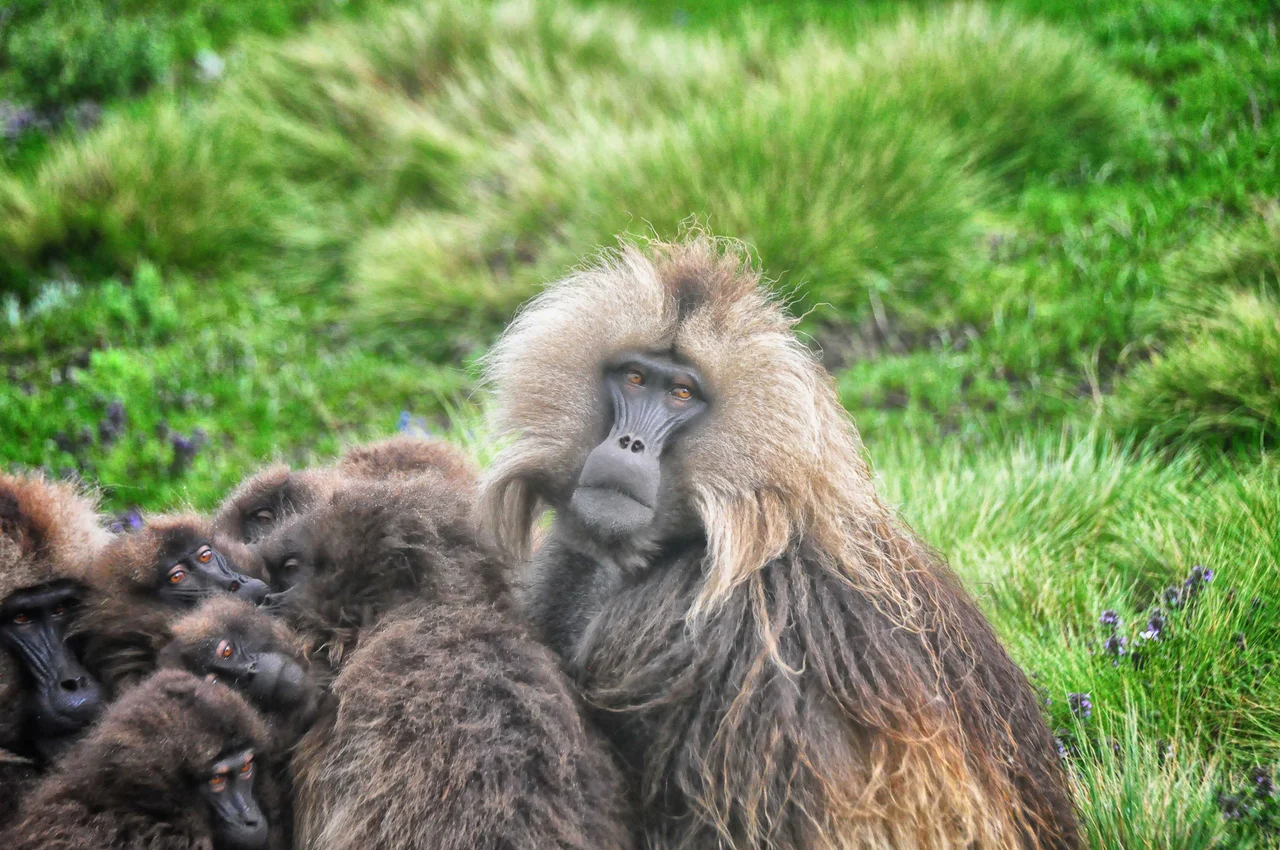
Walia, Gelada, and the Rarest Canid
The walia ibex exists only here. A wild goat with curving horns and a stocky build, it clings to the most precipitous sections of the escarpment and has survived because those cliffs are mostly inaccessible to livestock and hunters. Gelada baboons - often called bleeding-heart monkeys for the red patch on their chests - roam in troops of several hundred across the plateau grasslands, feeding almost exclusively on grass, a diet unusual among primates. The Ethiopian wolf, the rarest canid on earth, prowls the high meadows hunting giant mole rats. With perhaps a few hundred individuals remaining across all of Ethiopia, the wolf is Africa's most endangered carnivore. The caracal passes through. The endemic Ethiopian wolf's presence in the Simien is precarious but real. Together these species make the park one of the most distinctive ecological islands on the continent.
People on the Plateau
The Simien have been inhabited by humans for thousands of years. The Aksumite kings used them as a place of exile - Cosmas Indicopleustes noted this in the 6th century. Ethiopian Orthodox monasteries have clung to the escarpment edge since medieval times. Farmers have carved terraces into the lower slopes for centuries, growing barley, wheat, and tef using techniques that have changed only gradually over generations. Villages sit along tracks that wind between peaks, accessible by mule, some only by foot. The park's existence has complicated things - conservation goals sometimes conflict with subsistence needs, and park authorities and local residents have negotiated, sometimes contested, what the landscape is for. Tourism income helps; tourism access also requires trade-offs.
Folklore of the Genwarar
Nathaniel Pearce, who lived in Ethiopia for years in the early 19th century and kept detailed journals, recorded a folklore tradition from the Simien about certain short trees called Genwarar. The trees rarely reached eight feet in height, and from a distance their silhouettes sometimes suggested a human form. Local people refused to cut them. The belief held that Genwarar trees contained evil spirits previously cast out of human beings. Left alone, the spirits remained harmless. Cut the tree, and the spirits would enter a person out of vengeance. The tree also produced a milky substance that was used as ink for writing protective charms - charms worn on the body to keep evil at bay, or to cure someone already afflicted. The milk was also used medicinally for lingering illnesses. It is the kind of specific, layered belief that survives in mountain cultures where the world has always felt both beautiful and dangerous.
Flight Over the Escarpment
From the air the Simien resolve into enormous flat-topped mesas separated by deep canyons that have been carving into the basalt for millions of years. The 2,000-meter escarpment on the northern edge is among the most dramatic in Africa - a wall of rock that drops essentially vertically to the Tekeze valley far below. Troops of gelada may be visible on the plateau tops as dark moving patches. Alpine lakes reflect the sky. Villages with circular stone huts cluster on the safer slopes. In clear winter weather the mountains feel close enough to touch and the whole of northern Ethiopia opens out.
From the Air
Located at 13.49°N, 38.44°E in northern Ethiopia's Amhara region. Peaks rise to 4,550 meters (Ras Dejen). Recommended viewing altitude FL200-260; maintain clearance above terrain. Expect strong mountain weather - significant turbulence, rapid weather changes, afternoon convective activity in rainy season (June-September). Best flying conditions October through February. Gondar Airport (HAGN) approximately 100 kilometers southwest provides nearest aviation services. The 2,000-meter northern escarpment is a spectacular feature visible from altitude.
Nearby Stories
- Tigray Region 16 km away
- Debre Maryam Qorqor 43 km away
- Dedebit Elementary School airstrike 43 km away
- Simien National Park 47 km away
- Axum 52 km away
- Welkait 77 km away
- Ethiopian Empire 84 km away
- Lalibela 128 km away