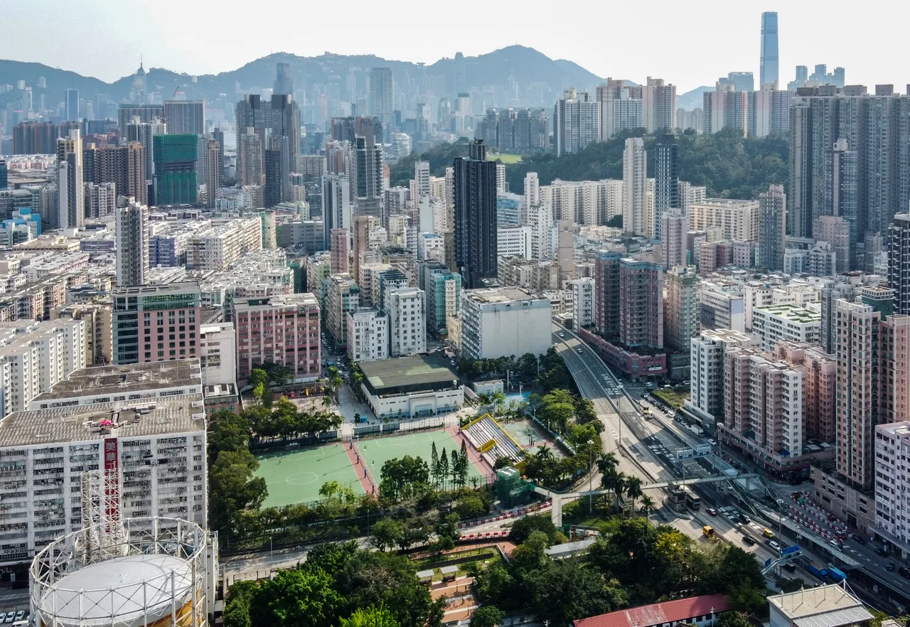

To Kwa Wan
For decades, the buildings of To Kwa Wan were not allowed to be tall. The old Kai Tak Airport lay just to the east, and height restrictions meant that construction stopped at ten floors or fewer across most of the neighborhood. When the airport closed in 1998, those limits lifted — but the low-rise character had already taken hold, woven into the street life and community spirit of a neighborhood that had never been forced to become something it wasn't. To Kwa Wan is not famous. It is not on most tourist itineraries. What it has, and what its residents describe with unusual pride, is a sense of cohesion that denser, taller, newer Hong Kong neighborhoods often lack.
A Bay Absorbed
To Kwa Wan means, roughly, place of the earthen pot bay — a name that points to the waterfront identity this part of Kowloon once held. At the 1911 census, the entire population was 1,072 people. Most of them were men: 766 of the total. It was a working waterfront settlement on the eastern shore of the Kowloon peninsula, sitting between the neighborhoods of Hok Yuen, Hung Hom, Ma Tau Chung, and Ma Tau Kok. The bay itself, in the early 1970s, was swallowed by land reclamation — Hoi Sham Island, which had sat in the adjacent water, was incorporated into the peninsula and became the green heart of Hoi Sham Park. The park still faces Kowloon Bay, a reminder of what used to be there, though the island it absorbed is now indistinguishable from the surrounding land.
The Airport's Long Shadow
Kai Tak Airport, in its final decades, was one of the most notorious airports in the world — not for danger, exactly, but for spectacle. Planes descended through the urban grid of Kowloon on the checkerboard approach, threading between apartment buildings before touching down on a runway that jutted into the harbor. To Kwa Wan lay directly in that approach path. The height restrictions that shaped the neighborhood were a direct consequence of aviation safety requirements: no building could block the flight path. The result, unintentionally, was a neighborhood that preserved a mid-20th-century Hong Kong street scale long after the rest of the city had moved on to curtain-wall towers. The airport closed in July 1998. New buildings in To Kwa Wan have grown taller since — especially along Ma Tau Wai Road — but the older fabric persists alongside them, giving the neighborhood a layered texture unusual in Hong Kong.
Toys, Textiles, and the Postwar Economy
After World War II, light industry came to To Kwa Wan. Small factories made toys and textiles, products that Hong Kong exported to the world in the 1950s and 1960s as the city built its reputation as a manufacturing powerhouse. Housing and factory buildings rose together, sharing the same low-rise streets, creating the mixed residential and commercial character the neighborhood still carries. In the 1970s, public housing estates were added to relieve overcrowding elsewhere in Kowloon, bringing larger populations into a neighborhood that had previously been small-scale and industrial. The balance that resulted — factories giving way to workshops, workshops giving way to small commercial units, public estates alongside private buildings — is visible in the streetscape today, a palimpsest of Hong Kong's economic transitions.
Roads, Rails, and a V-Shaped Corridor
To Kwa Wan is not easy to cross quickly. The street network is mostly residential side streets, with To Kwa Wan Road and Ma Tau Wai Road forming the main V-shaped corridor through the district. Above them, the East Kowloon Corridor elevated highway passes through the middle of the neighborhood — functional but divisive, as elevated highways tend to be. The Kowloon City Pier Bus Terminus to the north serves local routes. For years, the area lacked an MTR station; residents relied on buses. That changed with the To Kwa Wan station on the Tuen Ma Line, part of the Sha Tin to Central Link project, which finally provided a direct rail connection. Development accelerated noticeably in anticipation of the station's arrival, with new projects along the main corridors reshaping streetscapes that had been stable for decades.
What Cohesion Looks Like
Community analysts and longtime residents describe To Kwa Wan with a word you don't often hear applied to Hong Kong neighborhoods: cohesive. The scale imposed by the airport, maintained by habit and economics long after the airport's closure, meant that To Kwa Wan never became anonymous in the way that high-density vertical developments can. Neighbors know each other. Markets, temples, and small businesses serve local needs on local streets. The To Kwa Wan Recreation Ground and Hoi Sham Park give the district breathing room unusual in this part of Kowloon. The Cattle Depot Artist Village, a converted 19th-century government cattle depot that became a hub for Hong Kong's arts community, adds a dimension of creative life within a neighborhood otherwise defined by its everydayness. To Kwa Wan will change — the city will ensure that — but it has held its character longer than most.
From the Air
To Kwa Wan sits at approximately 22.3188°N, 114.1910°E on the eastern shore of the Kowloon peninsula, directly west of the former Kai Tak Airport site (now the Kai Tak Development Area). From the air at 2,000–3,000 feet, the neighborhood is identifiable as the lower-density urban fabric between the harbor on the south, Hung Hom to the west, and the elevated East Kowloon Corridor running through it. The old Kai Tak runway site — now partly built out, partly under development — is the open land to the east. Hoi Sham Park is visible as a strip of green against the Kowloon Bay waterfront. Hong Kong International Airport (VHHH) on Lantau Island is approximately 27 km to the west-southwest. Cross-harbor views from Victoria Peak are possible on clear days; the To Kwa Wan district appears as the transitional zone between the harbor edge and the hills of the New Territories.
Nearby Stories
- Lok Ma Chau Loop 2.3 km away
- Portas do Cerco 2.3 km away
- Kweilin Incident 17 km away
- Wanshan Archipelago Campaign 34 km away
- Nanxiong Formation 115 km away
- Battle of Nanpeng Island 148 km away
- Heyuan 169 km away
- Cape Maobitou 632 km away