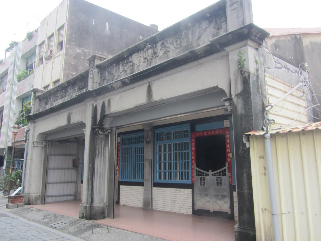

Toucheng Old Street
The name says something the founders meant literally: Toucheng means 'First Town.' When Han settlers pushed into the Lanyang Plain during the Qing dynasty, this was the point of entry — the harbor where goods arrived and from which the interior was opened. The street that served those early traders still stands, its arcade facades marking a rhythm of covered walkways that kept merchants dry in Yilan's famously wet climate. What happened to the town after its golden age is a story of disasters that compounded — floods, a shipwreck, more floods — until the center of commerce drifted away and the street found itself stranded in amber.
The Years of Commerce
During Qing dynasty rule, Toucheng's fortunes rose with its harbors. The Wushih and Touwei Harbors funneled trade between the Lanyang Plain's agricultural surplus and the ports of mainland China and northern Taiwan. Rice, indigo, and camphor moved out; manufactured goods and settlers moved in. The street that served this trade — known then as Touwei Street — developed the covered arcades that are its most distinctive feature today, a practical architecture for a town where the monsoon arrives reliably and the typhoon season demands shelter. Buildings went up close together, their front eaves extended over the pavement to create a continuous pedestrian passage. The merchants who built them intended to stay.
A Harbor Blocked by a Ship
The first blow came in 1878, when a significant flood damaged the Wushih Harbor. The channel silted and the approach became treacherous. Then, in 1883, an American ship ran aground and sank at the harbor entrance, blocking what remained of navigable passage. The harbor never fully recovered. Trade volume shifted gradually toward Toucheng Harbor, a partial solution that bought the town a few more decades of relevance. But Toucheng Harbor itself flooded in 1924, and by then the railways and provincial highways were offering the agricultural interior a more reliable route to markets. Each blow was survivable in isolation; the accumulation was not. The street that had bustled with merchants and porters quieted year by year, its arcades sheltering fewer and fewer transactions.
Architecture Across the Decades
What the departing commerce left behind is something that urban renewal elsewhere in Taiwan has not always preserved: a compressed record of architectural change. The buildings along Toucheng Old Street span Qing-era construction, Japanese colonial-period modifications, and early postwar additions — each layer readable in the facade treatment, the width of the arcade columns, the style of the decorative brickwork. Some facades show the Minnan (southern Fujian) aesthetic that dominated early Han settlement, with elaborate tile inlays and curved gable ends. Others reflect the more restrained Japanese colonial influence: simpler facades, Western-style pediments, a preference for straight lines. Walking the street with attention to the buildings rather than the shops is like reading a compressed history of the island's successive administrations.
New Life in the Arcades
In recent years, the central government invested NT$9 million in a project to install 3D murals along the old street's covered walkways, creating optical-illusion paintings that interact with the architecture — trompe-l'oeil scenes that make walls appear to fall away into ocean depths or historical dioramas. The initiative brought renewed foot traffic and a generation of visitors who come for the photographs and stay for the texture of the old buildings themselves. The street is accessible on foot from Toucheng Station of Taiwan Railway, making it a natural stop for travelers heading into or out of Yilan County. The Hsuehshan Tunnel, which paradoxically made the northeast coast more accessible while concentrating traffic toward Jiaoxi and Yilan City, has not entirely overshadowed Toucheng — if anything, the ease of arrival has given the old street a second chance.
From the Air
Toucheng Old Street sits at approximately 24.86°N, 121.82°E in Toucheng Township, near the northern edge of the Lanyang Plain where it meets the coast of northeastern Taiwan. From the air approaching Taipei Songshan (RCSS) from the east, Toucheng is visible as a coastal township at the mouth of the plain, roughly 50 km southeast of Songshan. The Pacific coast and the mouth of the Lanyang River are visible from 3,000 feet AGL in clear conditions; Turtle Island (Guishan Island) appears offshore to the northeast. Altitude 2,000–4,000 feet offers a clear view of the coastal lowlands and the abrupt transition to forested mountains inland. Nearest major airport: Taipei Songshan (RCSS), approximately 50 km northwest.
Nearby Stories
- Daxi Wude Hall 0.9 km away
- National Museum of Marine Science and Technology 1.8 km away
- Suao 3.6 km away
- Mount Dabajian 16 km away
- 2022 Chinese Military Exercises Around Taiwan 82 km away
- Sinking of MV Sewol 1068 km away
- Yellow Sea 1128 km away
- Sibuyan Island 1356 km away