
Tresaith
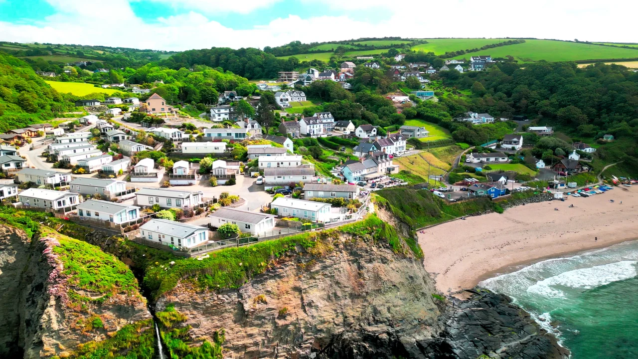
The River Saith does not meander to the sea. It walks to the edge of a cliff, and falls. The waterfall is the single feature that makes Tresaith unmistakable: a slim white column of fresh water dropping directly off the rock onto the sand and into the salt. Down on the beach you can stand close enough to feel the spray, the river ending its short life in the most theatrical way available. Coastal geography does not arrange this often. Tresaith is one of the few places in Britain where a waterfall meets the sea this directly, and the village that grew here grew specifically around what the fall and the sheltered cove together created.
Two Buildings on a Beach
Until the mid-19th century, Tresaith consisted of two buildings. There was a thatched cottage. There was the Ship Inn. The inn was run by the Parry family, who were also shipowners, and who in 1827 built their first vessel, the New Hope, directly on the beach below the inn. They launched her into the surf and put to sea. Later they ran several smacks of around twenty-five tons, the standard small trading vessel of the Welsh coast, hauling coal and limestone and culm - the smaller, dustier coal used for burning lime in the kilns above. The economics were perfectly local: bring the coal in, burn the limestone with it, spread the lime on the fields to sweeten the acidic Ceredigion soil. Repeat. A single inn-keeping family could, with one or two boats and a cliff-foot kiln, sustain an entire micro-economy.
The Second Brighton
In the last decades of the 19th century, Tresaith reinvented itself. The Victorians had discovered that sea-bathing was good for you, that fresh air had medicinal value, and that the railways could now bring tourists to almost any coast in Britain in a single day. Tresaith was small but it had what mattered: a south-facing cove, clean sand, the dramatic waterfall, and the kind of cliff scenery that watercolourists adored. Contemporary newspapers, with the cheerful boosterism of the period, took to calling it the Second Brighton. The original Brighton, fashionable since the Prince Regent's day, had nothing to fear from the comparison. But the label tells you something about how the village re-presented itself: not as a working harbour but as a destination. Cottages went up. Boarding houses opened. The Ship Inn kept trading. The boats were gone but the visitors had arrived.
Dolphins and the Living Coast
Tresaith sits on the Ceredigion Heritage Coast and inside the Cardigan Bay Special Area of Conservation - a marine protected area that holds the largest resident bottlenose dolphin population in Europe. On a summer afternoon, dolphins can be sighted from the beach almost daily, sometimes within fifty metres of the shore. Grey seals haul out on the rocks at the cove edges. Puffins, kittiwakes, choughs and peregrines work the cliffs. The Ceredigion Coast Path runs along the headlands above the village, two miles east to Aberporth, a mile and a half west to Penbryn. The Tresaith Mariners, the local sailing club, keep a mixed fleet of dinghies and catamarans drawn up on the beach above the high-water mark. Tresaith is a European Blue Flag beach, lifeguarded in summer, popular with surfers when a clean Atlantic swell lines up with the cove.
The Waterfall in the Aerial View
Most coastal villages reveal their shape from the cliffs above. Tresaith reveals it from the beach. Stand on the sand at the eastern end and look up. The cliff face is sheer and dark; the waterfall drops from a notch near the top, the river curling out of the wooded valley behind. To the west, the cove arcs round to a rocky point. To the east, the cliff continues, and at low tide you can walk along the sand to caves and another sandy bay, eventually all the way to Penbryn. The whole geography of the place can be read in one slow turn of the head. There is no harbour wall, no pier, nothing built out into the sea. Two centuries ago the Parry family launched their ship from this same sand. The dolphins offshore predate all of it.
From the Air
Located at 52.13N, 4.51W, on the Ceredigion coast between Aberporth and Llangranog. The narrow river valley dropping over the cliff to the cove is unmistakable from low altitude. Nearest aerodrome is Haverfordwest (EGFE) about 28 nm south-southwest; Swansea (EGFH) and Pembrey (EGFP) lie further south on the Carmarthen Bay coast.
Nearby Stories
- RAF Haverfordwest 3.7 km away
- Great Western Railway in West Wales 7.7 km away
- West Wales 9.9 km away
- Fishguard Lifeboat Station 13 km away
- Battle of Mynydd Hyddgen 15 km away
- Strata Florida Abbey 18 km away
- Neath and Tennant Canal 21 km away
- HMS Tyler 44 km away