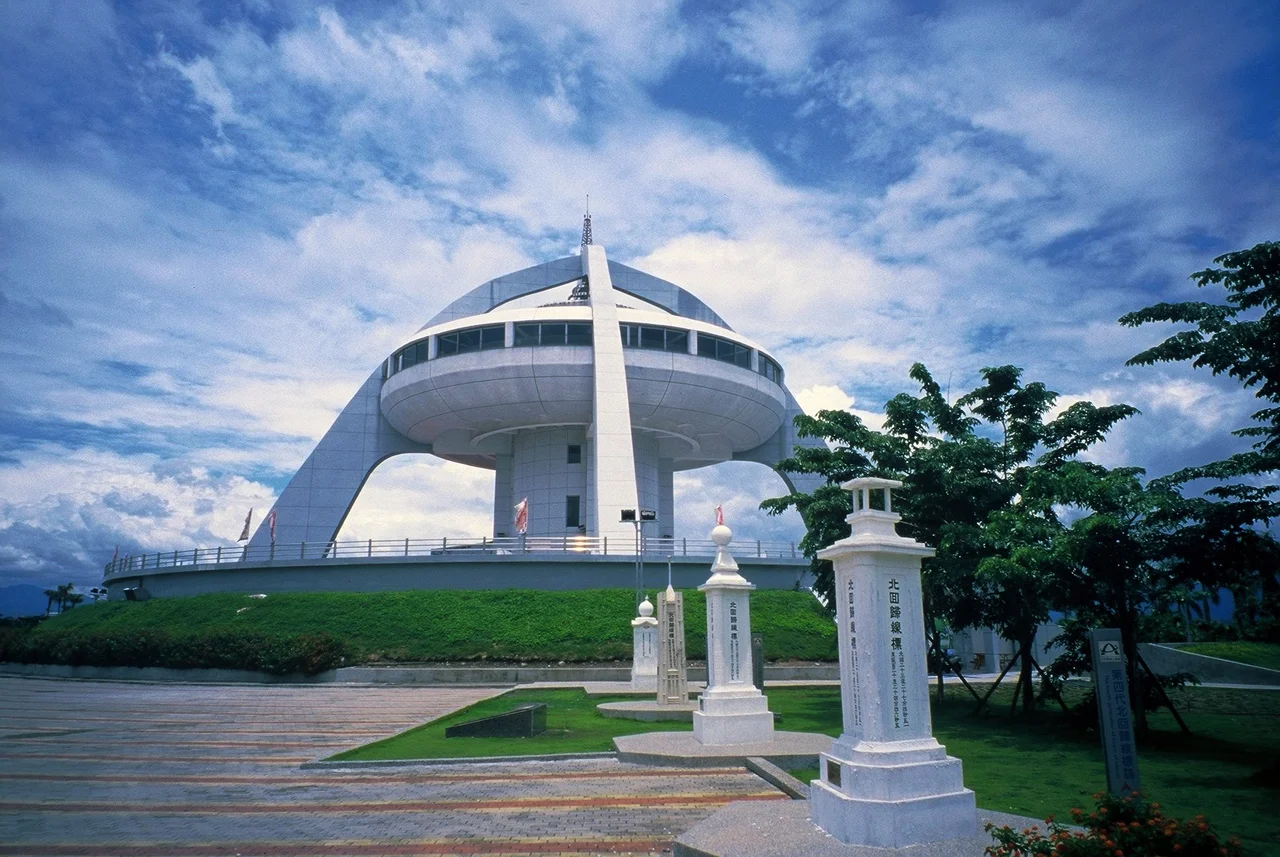

Tropic of Cancer Monument
Somewhere in the flat farmland of Shuishang Township, the tropical world ends. The Tropic of Cancer — latitude 23.5 degrees north — crosses the island of Taiwan roughly here, and for more than a century, someone has felt compelled to put a marker on the spot. The monument you see today is the sixth generation of an idea that began with a Japanese colonial government in 1908 and has been rebuilt, relocated, renamed, and expanded into a small complex over the intervening decades. The line itself doesn't move visibly; the monuments around it have.
A Railway Reaches the Tropics
The first marker went up in 1908, and its occasion was not astronomical but political and infrastructural. The Japanese colonial government had just completed the island's north-to-south railway — a major engineering achievement that connected Keelung in the north to Kaohsiung in the south. The line crossed the Tropic of Cancer in Shuishang, and the colonial authorities marked the spot, celebrating both the completion of the railway and, implicitly, their reach into Taiwan's tropical south. The first marker stood beside the tracks; in 1921, a second-generation marker was rebuilt on the same site. Two years later, in 1923, a third-generation marker was constructed about 50 meters west of the original, moving from the railway's edge to the east side of the provincial highway. That third marker was more substantial — concrete and stone, with a classical structure and a stone orb, built with greater permanence.
Six Generations of Stone
The Tropic of Cancer doesn't actually stay fixed in one place. The Earth's axial tilt shifts slowly over time, meaning the precise latitude of the solstice sun drifts over centuries. In practice, the monument has moved for more mundane reasons — road projects, reconstruction, changing administrative priorities — while the line it marks has also shifted slightly. By 1935, the third-generation marker had been reinforced and repaired. The fifth generation, completed by 1942, bore the inscription "North Tropic of Cancer Line Marker" and, notably, had the coordinates removed from its face. The current structure, the sixth generation, was completed in 1995 and represents the most ambitious version yet: what was once a roadside stone obelisk has grown into a building complex, a small campus of astronomy and geography that draws visitors from across Taiwan and abroad. The monument now anchors the Tropic of Cancer Solar Exploration Center.
Where the Sun Stands Still
The Tropic of Cancer marks the northernmost latitude at which the sun reaches directly overhead at noon — this happens at the summer solstice, around June 21 each year. North of the tropic, the sun never quite reaches the zenith; south of it, the sun crosses overhead twice annually. At Shuishang on the solstice, the sun at noon casts no shadow directly beneath a vertical pole — a phenomenon called zero shadow day that has fascinated astronomers and travelers for millennia. The word "tropic" comes from the Greek tropos, meaning turn: it is where the sun, metaphorically, turns back. Taiwan sits almost exactly on this boundary between the tropical and subtropical zones, and the difference is visible in the landscape — rice paddies and sugar cane giving way, on the island's mountain slopes, to temperate forests and cool mist.
Chiayi's Invisible Border
For travelers crossing Taiwan by train or road, the Tropic of Cancer is one of those markers that announces a shift without making it visible. The lowland plains around Shuishang are agricultural — flat, green, laced with irrigation channels — and the monument appears at the roadside like a punctuation mark in the landscape. The township itself is better known for Chiayi Airport (RCKU) nearby than for geography, but the monument has made Shuishang a destination in its own right. The site includes educational displays about solar angles, the Earth's axial tilt, and the phenomenon of the solstice, making it as much a science center as a historical landmark. Local schoolchildren visit for the astronomy lessons; tourists stop for the photograph of standing exactly where the tropics begin.
From the Air
The Tropic of Cancer Monument is located at approximately 23.454°N, 120.417°E in Shuishang Township, Chiayi County. Chiayi Airport (RCKU) is about 3 km to the northeast — the monument is one of the first landmarks visible when departing or arriving on the runway 09/27 axis. At low altitude on approach, the flat Chiayi plain spreads in every direction; the monument's distinctive tower structure is visible from 1,000 feet in clear conditions. The Alishan mountains rise steeply to the east, roughly 30 km away. The Tropic of Cancer line runs east–west across the island; at this latitude, the tropical green of the lowlands gives way on the slopes to temperate terrain.
Nearby Stories
- Paiyun Lodge 1.2 km away
- Wushantou Reservoir 4.3 km away
- 1999 Jiji Earthquake 6.5 km away
- Xiluo 7.4 km away
- Bunun Cultural Museum 27 km away
- TransAsia Airways Flight 222 28 km away
- Mudouyu Lighthouse 29 km away
- Daya Bay 551 km away