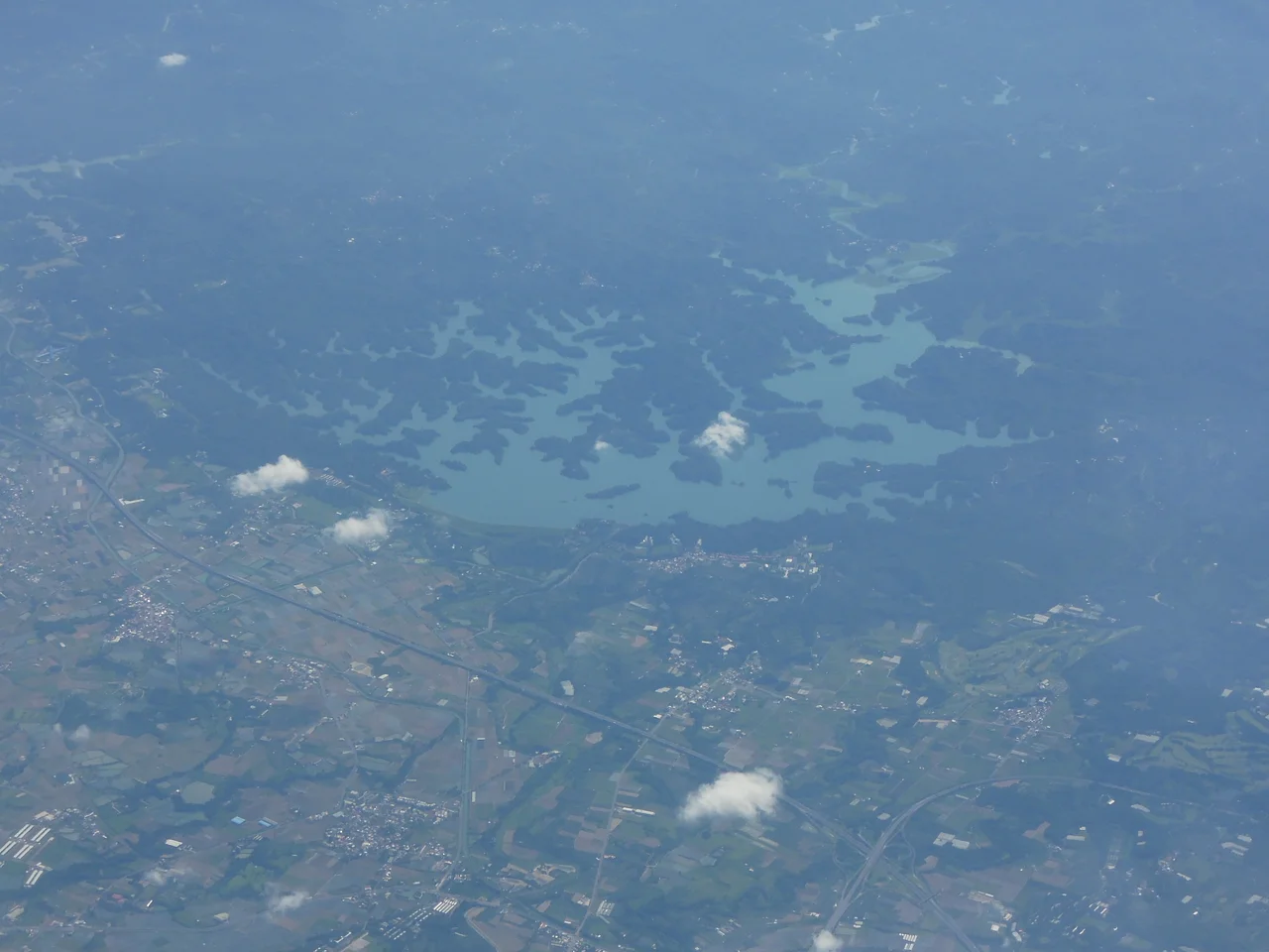

Wushantou Reservoir
Yoichi Hatta had a problem that water could solve. The Chianan Plain in southern Taiwan was fertile but chronically dry — farmers could coax one rice crop a year from its soil, if the rains cooperated. Hatta, a Japanese civil engineer dispatched by the colonial government, conceived something audacious: a reservoir in the hills above Tainan that would store enough water to irrigate more than 100,000 hectares, transforming the entire plain into productive farmland capable of producing three rice harvests a year. Construction began in 1920. When Wushantou Reservoir was completed in 1930, it was the largest reservoir in Asia. Nearly a century later, it is listed as a potential UNESCO World Heritage Site, and it remains in operation.
A Technique Like No Other
What makes Wushantou technically singular is how it was built. Hatta used the semi-hydraulic fill method — a process in which earth is loosened by high-pressure water jets and then carried as slurry into the dam's structure, where it settles and compacts layer by layer. The technique was expensive. It was slow. And it produced a dam of extraordinary structural integrity. Wushantou Reservoir is now the only dam in the world built with this method that remains in active use. Taiwan sits on some of the most seismically active terrain in Asia, yet the dam has held through a century of earthquakes that would have tested weaker construction. Hatta chose the hard way, and the result is still holding water nearly a hundred years later.
Coral Lake and the Shape of a Shoreline
The reservoir is also known as Coral Lake — a name that has nothing to do with the sea. When the basin filled with water in 1930, its zigzagging shoreline created a form that, from above or on the water, resembles the branching patterns of coral. Today the reservoir and its surrounding landscape form a scenic area, with the fingers of the lake extending into the hills and the surface reflecting the sky in long, irregular strips. The reservoir is located across Lioujia District and Guantian District in Tainan — rural communities that benefited directly from the irrigation network Hatta created and that continue to live alongside the lake he left behind.
The Chianan System and the Rice That Fed Two Nations
Wushantou didn't work alone. Hatta designed the reservoir as the centerpiece of the Chianan Irrigation System, a network of canals that distributed water across the plain in a rotation system that gave different areas access on a scheduled basis. The Chianan Canal — also Hatta's design — carried water from the reservoir to farms that had never before been reliably irrigated. The result was transformative. The Chianan Plain became capable of producing three rice harvests per year, and its output fed both Taiwan and imperial Japan during the decades that followed. The scale of the agricultural shift is difficult to overstate: a single engineering project rewrote what the land could do.
Hatta Yoichi and What He Left Behind
Yoichi Hatta is remembered in Taiwan with unusual warmth for a figure associated with Japanese colonial rule. His dedication to the project — he reportedly lived on-site throughout the decade of construction — and his evident care for the Taiwanese workers and farmers who depended on the system earned him lasting respect. A statue of Hatta stands near the reservoir today. When he died in 1942, his wife Toyoki followed him in spirit: after Japan's surrender in 1945, facing forced repatriation, she jumped from the reservoir's spillway gate; both are commemorated near the site. The reservoir and the irrigation system he built are maintained by Taiwan's government and considered part of the country's cultural and engineering heritage. In 2009, the site was nominated as a potential World Heritage Site — recognition that what Hatta built here belongs not just to Taiwan's history but to the world's.
From the Air
Wushantou Reservoir sits at approximately 23.2022°N, 120.368°E, in the hills at the boundary of Lioujia and Guantian Districts, northwest of central Tainan city. From the air at 4,000–7,000 feet, the reservoir's distinctive branching "coral" shape is clearly visible — multiple elongated fingers of water extending into the surrounding hills. The flat Chianan Plain spreads to the south and west, crisscrossed by the canal network that Hatta's irrigation system created. The nearest regional airport is RCNN (Tainan Airport), approximately 25 km to the southeast. The major hub is RCKH (Kaohsiung International Airport), roughly 50 km to the south. Clear days offer exceptional visibility across the plain to the Taiwan Strait.
Nearby Stories
- 1941 Chungpu Earthquake 7.5 km away
- Paiyun Lodge 9.8 km away
- Fo Guang Shan Buddha Museum 11 km away
- Yakou Mountain Pass 17 km away
- National Museum of Prehistory (Taiwan) 19 km away
- Dongji Island 26 km away
- TransAsia Airways Flight 222 33 km away
- Daya Bay 548 km away