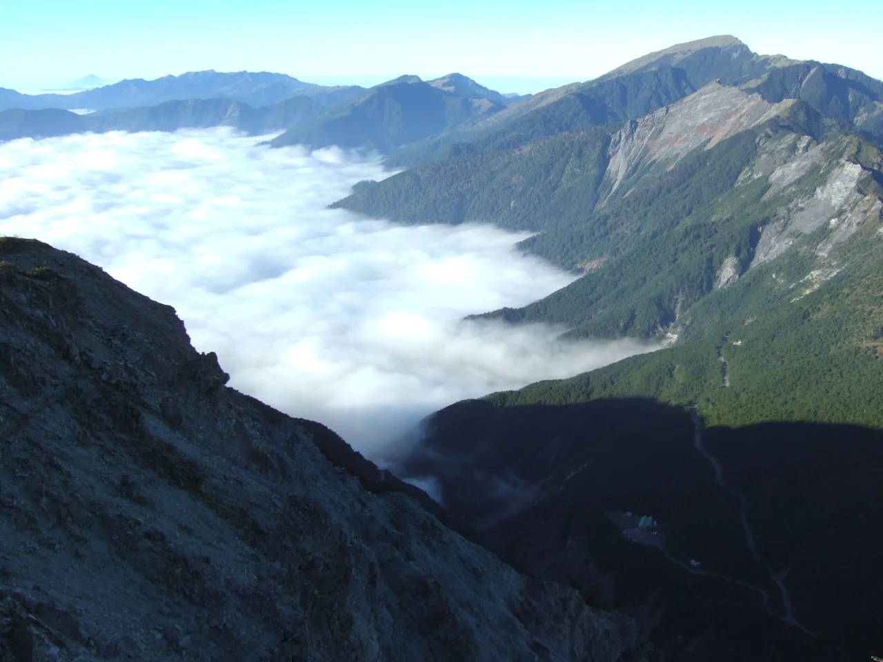

Yakou Mountain Pass
The name says everything and nothing at once: *Yakou* simply means 'mountain pass' in Chinese. And yet this particular pass, slicing through the Central Mountain Range inside Yushan National Park, has accumulated a history so layered — Bunun trails, Japanese colonial roads, Cold War highway construction, and then catastrophic typhoon destruction — that the plain name feels like understatement. Yakou is where the Southern Cross-Island Highway reaches its highest point, where the east side of Taiwan collects its famous sea of clouds, and where, since 2009, the road simply ends. To reach it today, you walk.
The Pass the Bunun Knew First
Long before engineers arrived with dynamite and concrete, a Bunun path crossed Yakou. The Bunun people have inhabited Taiwan's central mountains for centuries, moving through high terrain with a geographic knowledge accumulated over generations. This particular crossing — linking the eastern and western slopes of the island through one of the Central Mountain Range's clefts — was part of a network of routes that connected Bunun communities across the mountains. When Japanese colonial administrators took control of Taiwan in the late nineteenth century and sought to extend their authority into the interior, they widened existing Bunun paths into roads that could carry troops. The Yakou crossing was among them. The act of widening erased nothing of the route's original logic; it simply changed who could use it and how quickly.
Building the Highway in the Clouds
After Japan's defeat in 1945 and the establishment of the Republic of China government on Taiwan, the widened colonial road became the foundation for something more ambitious: the Southern Cross-Island Highway, a paved route that would link the western city of Tainan with the eastern coast near Hualien. Construction ran from 1968 to 1972, a four-year project through some of the island's most difficult terrain. At Yakou, workers established a campsite; that campsite eventually became a hostel operated by the China Youth Corps, offering shelter at the highest point of the entire highway. The Daguanshan Tunnel, a short one-way bore through the rock at the summit of the pass, became the highest tunnel in Taiwan. For decades, driving through it meant emerging on the other side into a different climate, a different sky.
Sea of Clouds
Yakou's reputation among Taiwanese travelers rested on its east-facing views. The Pacific Ocean lies roughly 60 kilometers to the east, and when moist air pushes inland from the coast, the mountains force it upward — the meteorological process called orographic lift. As the air rises and cools, clouds form in the valleys below the pass while the peaks above remain clear. The result, seen from Yakou, is a sea of white spreading from ridge to ridge below you, the distant peaks poking through like islands. On mornings when conditions aligned, the cloud sea filled the entire eastern horizon. Travelers who stopped at the hostel specifically to watch the sunrise over this phenomenon understood that some things justify the long drive up.
What Typhoon Morakot Took
In August 2009, Typhoon Morakot struck Taiwan with catastrophic force. It brought rainfall records that still stand — some areas received over 2,000 millimeters in a single week. The Southern Cross-Island Highway, engineered through steep and geologically unstable terrain, could not survive. Multiple sections collapsed. Immediately east of Yakou, a landslide buried the Daguanshan Tunnel's east entrance and its adjacent parking lot, destroying 300 meters of highway. The hostel, though not directly struck, closed after the typhoon. For years, the section of highway running from Meishan in the west to Xiangyang in the east was closed to outside traffic. After thirteen years of repair, it finally reopened to the public on May 1, 2022 — with restrictions: the section is only accessible on non-maintenance days, and motorists must enter between 7 a.m. and 2 p.m. The pass exists again on an open road, but the mountain has left its marks on the route.
The Border Country
Administratively, Yakou sits at the intersection of three jurisdictions: Taoyuan in Kaohsiung City to the west, and Haiduan in Taitung County to the east. This boundary-marking quality suits it. Mountain passes are inherently liminal — places where one drainage becomes another, one watershed gives way to the next. At Yakou, you stand between the rivers that flow west to the Taiwan Strait and the rivers that flow east to the Pacific. The wind at the pass comes from both directions and belongs to neither. The Bunun path, the Japanese road, the Cold War highway, and now the closing silence of a landslide-severed route — Yakou has always been the place where things transition.
From the Air
Yakou Mountain Pass is located at 23.2652°N, 120.9580°E within Yushan National Park, at the crest of the Central Mountain Range. The pass elevation is well above 2,000 meters; the Daguanshan Tunnel at the summit is Taiwan's highest tunnel. Nearest reference airports: RCYU (Hualien Airport) approximately 60 km to the east-northeast; RCMQ (Taichung International) roughly 70 km to the northwest on the western plain. Approach from altitude — the surrounding terrain is steep and the ridgelines around the pass rise sharply. The eastern slopes frequently collect clouds from Pacific moisture; the western side tends to be clearer. The pass appears as a notch in the ridgeline, with the highway scar visible on aerial imagery even though the road is currently closed to traffic. Minimum safe viewing altitude approximately 3,500 meters above the terrain.
Nearby Stories
- 2025 Tainan–Chiayi Earthquake 7 km away
- Guanshan, Taitung 8.3 km away
- Gukeng 11 km away
- 2016 Southern Taiwan Earthquake 12 km away
- 1999 Jiji Earthquake 28 km away
- 1951 East Rift Valley Earthquakes 39 km away
- 2021 Hualien Train Derailment 103 km away
- Mavulis Island 215 km away