
Tsat Tsz Mui
Seven girls made a pact. They were Hakka, living in a village on the northeastern shore of Hong Kong Island, and the pact was absolute: they would be sisters for life, they would die on the same day, and none of them would ever marry. When the third sister's parents arranged her wedding, she said nothing to her parents and everything to her companions. The night before the ceremony, all seven went to the sea. The next morning, seven rocks appeared in the bay. The village knew what they were. The rocks were named Tsat Tsz Mui Shek — Seven Sister Rocks — and the village became Tsat Tsz Mui Tsuen, Seven Sister Village. In 1934, the rocks were buried under reclamation fill for urban development. The name remained.
The Earliest Settlement
Tsat Tsz Mui is considered the earliest settlement in North Point, though when exactly the village was founded is not recorded. The 1819 Gazetteer of Xin'an County makes no mention of it, but local tradition insists the village was centuries old by then. The first documentary confirmation comes from a Qing dynasty census in 1849 and an 1888 survey map. The original village stood in eastern North Point at the location now occupied by Healthy Garden residential development on Tsat Tsz Mui Road. By the 1911 census, the population was 297 people, 193 of them male — a gender imbalance that reflected the migration patterns of the time, when men moved to the city for work while women and children stayed in the village.
Seven Sisters and a British Engineer
In January 1921, a 21,000-square-foot plot of land north of the village — on the hillside of Kai Yuen Hill above present-day North Point — was put to auction. The buyer was Mr. James Dalziel, a British chief naval engineer who had worked at the Taikoo Sugar Refinery Company and lived in Hong Kong for more than 40 years. Between 1921 and 1924, Dalziel built a large residential property on the land and named it 'Seven Sisters,' after the village below. The name acknowledged the legend even as the colonial city was beginning to erase the landscape that had inspired it. Dalziel's house eventually disappeared too, but the name lingered in streets and maps long after both the rocks and the building were gone.
Erasure by Reclamation
The land reclamation of North Point in the 1920s began reshaping the bay, and the development of King's Road in 1934 sealed the fate of the village itself. Tsat Tsz Mui Tsuen was gradually demolished as the colonial government expanded the urban footprint eastward. Some residents left voluntarily. Others were evicted under the Crown Lands Resumption Ordinance — a legal mechanism that gave the government authority to take private land with compensation, but left tenants and village residents with little recourse. The shoreline that had been home to the seven legendary rocks, the fishing families, the tight community of Hakka women and men, was filled in and built over. What had been a bay became a neighbourhood.
The December Landing
In December 1941, Japanese forces invaded Hong Kong. Among the landing points for troops crossing to Hong Kong Island was the Tsat Tsz Mui Swimming Shed — a public bathing facility on the reclaimed waterfront. The soldiers who landed there were part of the assault that would lead to British surrender on 25 December 1941, and the beginning of nearly four years of Japanese occupation. The swimming shed, a mundane piece of civic infrastructure, became a point of military history in one of the shortest and most consequential battles in Hong Kong's colonial experience. For the residents of what remained of Tsat Tsz Mui by that point, already displaced and already living among the concrete of the expanding city, the invasion was one more upheaval in a neighbourhood that had experienced little else.
What the Name Holds
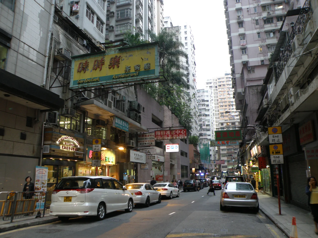
Today, Tsat Tsz Mui is a neighbourhood rather than a village, its old identity visible mainly in the name on the street sign: Tsat Tsz Mui Road, running through what is now a dense urban area of apartment buildings, shops, and transit connections. The Hakka village is gone. The seven rocks are gone, buried since 1934. But the name still carries what the landscape lost: the specific weight of seven girls who chose their own ending over someone else's beginning. Hong Kong has a way of preserving tragedy in its place names long after the places themselves have been replaced. Tsat Tsz Mui is that — a ghost written in Cantonese on a road that leads through the city that swallowed its story.
From the Air
Tsat Tsz Mui sits on the northeastern shore of Hong Kong Island at 22.294°N, 114.197°E, east of North Point. From the air, the area is a dense urban grid between the MTR's Island Line and the harbour. The King's Road corridor is the main east-west artery. Victoria Harbour lies to the north; the hills of Hong Kong Island rise steeply to the south. Nearest major airport: Hong Kong International Airport (VHHH), approximately 30 km to the west on Lantau Island. Recommended viewing altitude 2,000-4,000 ft for urban context. Kowloon is visible across the harbour to the north.
Nearby Stories
- Lok Ma Chau Loop 2.3 km away
- Portas do Cerco 2.3 km away
- Kweilin Incident 17 km away
- Wanshan Archipelago Campaign 34 km away
- Nanxiong Formation 115 km away
- Battle of Nanpeng Island 148 km away
- Heyuan 169 km away
- Cape Maobitou 632 km away