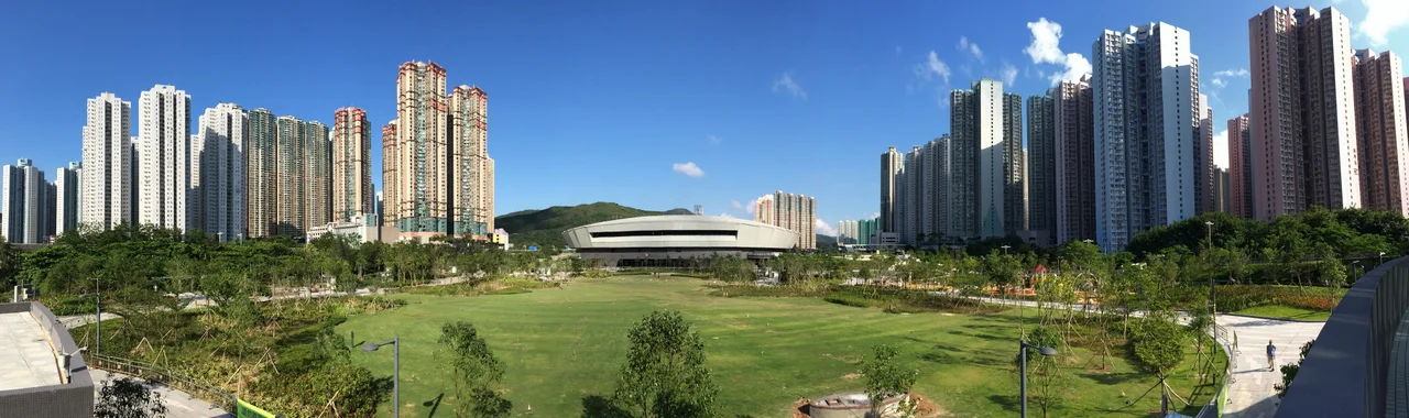

Tseung Kwan O
Until the 1980s, Junk Bay was exactly what its name suggested: a long, narrow inlet in southeastern Hong Kong where fishing villages dotted the coastline and small shipbuilding operations ran along the shore. Then the government decided to fill it in. The scale of reclamation required was daunting — the bay was deep, and the engineering considerable — which is why the project had been discussed for years before it actually began. Phase I was endorsed by the Governor-in-Council in 1983. By 1988, the first residents had moved in. By 2016, approximately 398,000 people called the result home. Tseung Kwan O — named for one of those original fishing villages — is what Hong Kong does when it needs more room: it makes land from water, then builds a city on top.
From Fishing Village to New Town
The land at the head of Junk Bay was the first to be reclaimed, directly in front of the original villages of Tseung Kwan O and Yau Yue Wan. Po Lam Estate, completed in 1988, was the earliest residential development. Metro City Plaza, the shopping complex that grew up around the Po Lam MTR terminus, became the largest mall in the new town and remains so. Hang Hau, to the southeast, was once a small market town serving the Clear Water Bay Peninsula and a hub for ship-breaking industries. Its original residents were resited to the Hang Hau Town Resite Area at the northern edge of the neighbourhood; the reclaimed land around them became apartment towers and district facilities. The new town grew southward from these points, eventually reaching the shoreline of Junk Bay itself.
The Refugee Village That Became a Neighbourhood
Before Tseung Kwan O existed, Tiu Keng Leng — then called Rennie's Mill — was a place apart. From the 1950s until the 1990s, it housed Kuomintang loyalists who had fled to Hong Kong after the Chinese Civil War and chosen not to return to the mainland under Communist rule. They lived in a cottage settlement, somewhat isolated, maintaining their political allegiances in a city that was nominally neutral. When the new town's Phase II development required clearing the village, the Kuomintang residents were relocated as part of the handover arrangements. The area was then incorporated into Tseung Kwan O and redeveloped into mid-rise residential towers. It is now called Tiu Keng Leng, and the community it houses has no particular memory of what the land held before.
The Internet's Landfall
Tseung Kwan O Industrial Estate might not be the most celebrated part of the new town, but it carries a remarkable piece of hidden geography: three of the eight submarine communications cables connecting Hong Kong to the broader world make landfall here. This concentration has made the industrial estate one of the densest data centre clusters in Asia, drawing companies that need low-latency connections to global internet infrastructure. TVB City, headquarters of Hong Kong's largest television broadcaster, also sits here. The practical implication — that a significant fraction of Asia's internet traffic passes through what was a deep bay forty years ago — is the kind of fact that makes Tseung Kwan O more interesting than its shopping complexes and transit maps might first suggest.
Sport, Speed, and a Marine Viaduct
The new town has acquired cultural infrastructure at a pace that outstrips most Hong Kong neighbourhoods. Tseung Kwan O Sports Ground was built for the 2009 East Asian Games and now hosts top-division football. The Hong Kong Velodrome, completed in 2013, has hosted world-class events including the 2017 UCI Track Cycling World Championships. The LOHAS shopping mall at LOHAS Park station contains the largest indoor ice rink in Hong Kong. And spanning Junk Bay itself, the Tseung Kwan O Cross Bay Bridge — Hong Kong's first marine viaduct — carries carriageways, a cycle track, and a footpath across the water, connecting the new town's southern neighbourhoods and offering views of the bay that was once filled to create them.
A City That Doesn't Quite Know Its District
Tseung Kwan O is officially part of Sai Kung District, administered by the Sai Kung District Council. In practice, it identifies more readily with Kowloon. Its MTR line terminates at North Point on Hong Kong Island, but runs through Kwun Tong; its police district is part of the Kowloon East Police Region; its hospitals belong to the Kowloon East Cluster of the Hospital Authority. The two hotels in town are both named 'Kowloon East.' This is not confusion so much as the natural friction of a planned city that grew up at the edge of existing administrative boundaries. Tseung Kwan O is too new to fit neatly into the inherited geography of Hong Kong, and so it sits, slightly to one side of the categories made for older places, a city of 400,000 people still working out what it belongs to.
From the Air
Tseung Kwan O occupies the reclaimed northern half of Junk Bay at approximately 22.304°N, 114.249°E, on the southeastern edge of the Kowloon Peninsula. From the air, the bay's reclaimed geometry is clearly visible — straight shorelines, regular tower spacing, and the Tseung Kwan O Cross Bay Bridge spanning the water. The Clear Water Bay Peninsula rises to the southeast. The Tseung Kwan O Tunnel emerges from the hills to the northwest, connecting to Kwun Tong. Nearest major airport: Hong Kong International Airport (VHHH), approximately 40 km to the west on Lantau Island. Recommended viewing altitude 3,000-6,000 ft for the full urban layout. LOHAS Park station is visible at the southern end of the MTR line spur.
Nearby Stories
- Lok Ma Chau Loop 2.3 km away
- Portas do Cerco 2.3 km away
- Kweilin Incident 17 km away
- Wanshan Archipelago Campaign 34 km away
- Nanxiong Formation 115 km away
- Battle of Nanpeng Island 148 km away
- Heyuan 169 km away
- Cape Maobitou 632 km away