
Tung Lung Chau
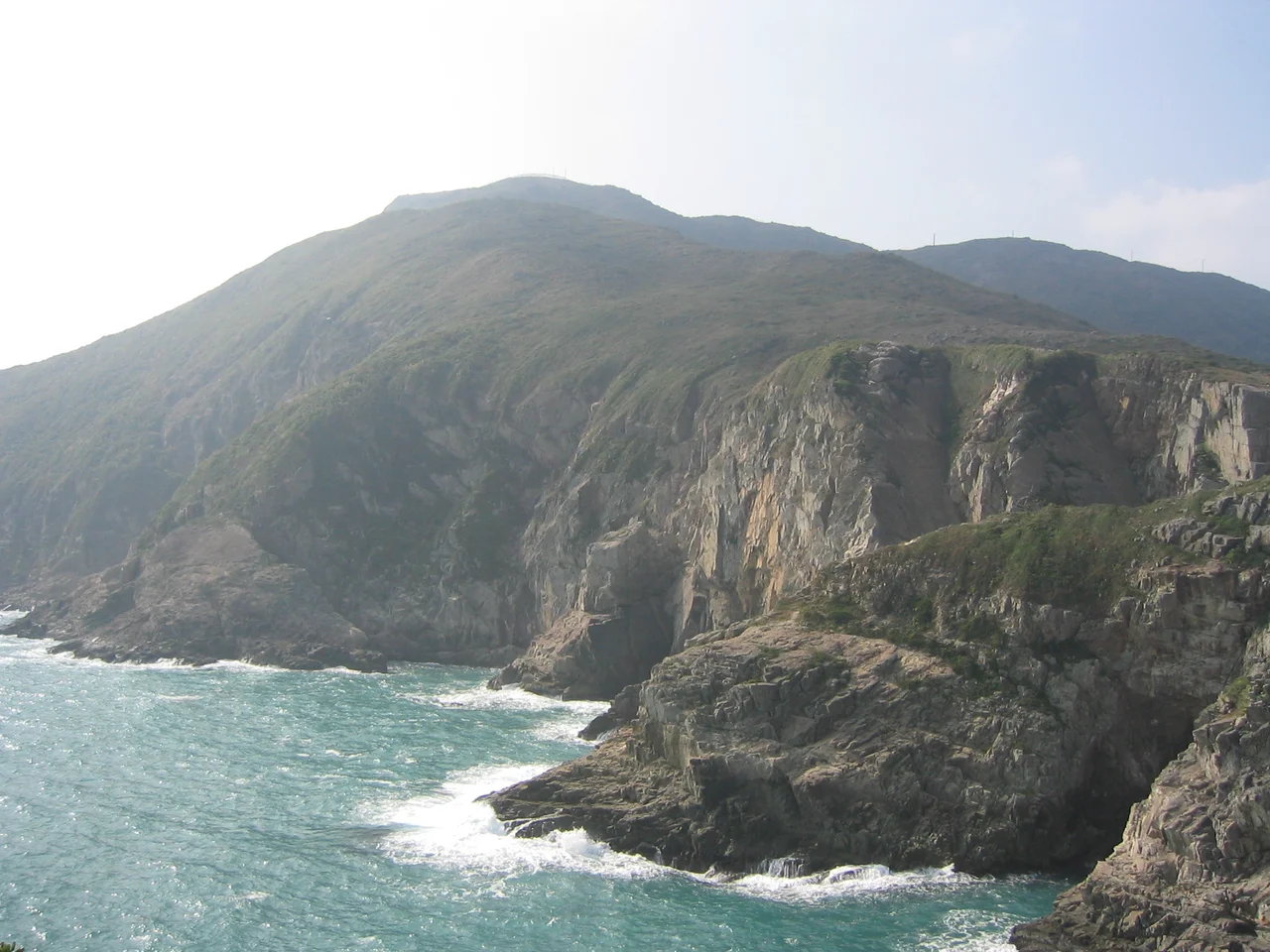
A fleeing emperor sheltered here. Qing dynasty soldiers stood watch from its cliffs. Allied bombers targeted it during World War II. Tung Lung Chau, a 2.42-square-kilometre island at the southeastern edge of Hong Kong's New Territories, has accumulated history the way small islands accumulate wrecks — quietly, layer by layer, with no particular plan. Today it is largely uninhabited and reachable only by weekend ferry, which is perhaps why its collection of forts, prehistoric carvings, and sport climbing walls feels less like a curated attraction than a private archive the island has been keeping to itself.
The Emperor Who Came by Boat
In the dying years of the Southern Song dynasty, Emperor Duanzong — a child emperor on the run from Mongol forces pressing south — made his way through what is now Hong Kong, sheltering at various points on the coast. One of those points was Kwu Tap on Tung Lung Chau. The island was already called by different names then; it would not appear on Western maps as Tung Lung Chau until around 1845, when the British were beginning to chart these waters in earnest, superseding an older romanization, Tam-too. The emperor's stay was brief and his dynasty ended regardless — the last Song court made its final stand at the Battle of Yamen in 1279, where the remnants of the imperial fleet were destroyed. But the memory persisted. Hong Kong accumulated these fragments of dynastic history the way it accumulated everything else: densely, in a small space.
Stone Before History
Older than the fort, older than the dynasty, older than any recorded name for the island, is a carving in the rock near the northeastern shore. Measuring 180 centimetres by 240 centimetres, it is the largest ancient rock carving in Hong Kong — a swirling, spiralling image whose exact age and meaning remain matters of scholarly debate, but whose craftsmanship is evident even to a casual eye. The carving was notable enough to be documented in the 1819 Gazetteer of Xin'an County, the regional administrative record for what is now Shenzhen and Hong Kong, which means it was already considered a significant local landmark two centuries ago. Both the carving and the fort are declared monuments of Hong Kong. They sit within the Tung Lung Fort Special Area, designated in 1979 under the country parks framework and covering 3 hectares, which includes a campsite for those who arrive in the evening and want to be on the island when the morning ferry is still hours away.
What the Island Guards
The narrow Fat Tong Mun Channel separates the northern tip of Tung Lung Chau from the southern tip of the Clear Water Bay Peninsula. To the west, the island forms the eastern wall of Tathong Channel, which funnels shipping north toward Victoria Harbour through the gap at Lei Yue Mun. Whoever controlled this island controlled the sea lane. That strategic reality explains the Qing-era fort on the northeastern promontory, 35 metres above the water with cliffs on three sides. The fort commands both the channel and the bay beyond; its builders understood the geography. At its peak, the garrison numbered around 25 men. A World War II Japanese gun emplacement near Tathong Point guarded the same channel for the same reason, more than two centuries later. The Allies eventually bombed the island; historians believe the gun emplacement was the target. The ruins of both installations remain.
The Hung Shing Temple and the Holy Rock
At Nam Tong, a hamlet site on the island, stands a Hung Shing Temple built before 1931. Inside, in the right chamber, a large rock protrudes from the rear wall — called the Holy Rock by worshippers who have venerated it for decades. The temple is a common feature of Hong Kong's coastal settlements, Hung Shing being a Tang dynasty official elevated to deity status and associated with seafarers, fair winds, and southern China's maritime communities. On a largely uninhabited island, the temple is a reminder that Tung Lung Chau was not always empty. Fishing communities used the island's shores, built a temple, named a peak — and eventually left, leaving the structures behind as evidence of the life that was lived here.
The Vertical Island
Rock climbers discovered Tung Lung Chau's potential years ago, and the island now hosts some of the most popular sport climbing venues in Hong Kong. Technical Wall and Sea Gully Wall are the two main areas — sea-cliff climbing above open water, the kind of setting that makes falling in a direction other than down seem briefly plausible. The ferry from Sam Ka Tsuen near Lei Yue Mun runs on weekends, a 30-minute crossing that delivers climbers, hikers, and history-seekers to the same pier. The island has no shops, no hotels, and no café. What it has is the fort, the carving, the temple, the rock walls, and the channel wind that never entirely stops. For a place reachable only by boat, it is remarkably full.
From the Air
Tung Lung Chau lies at approximately 22.249°N, 114.290°E, east of the Clear Water Bay Peninsula and southeast of Kowloon. From the air at 2,000–4,000 feet, the island is easily identified by its elongated shape and the sheer eastern cliffs that drop directly into the South China Sea — particularly dramatic in low-angle morning light. The narrow Fat Tong Mun Channel between the island's northern tip and the peninsula is clearly visible, as is the broader Tathong Channel to the west. Lei Yue Mun, the eastern gateway to Victoria Harbour, is approximately 10 km to the northwest. Hong Kong International Airport (VHHH) is approximately 28 km to the west-southwest. Nam Tong Peak at 250 m is the island's highest point, visible as the dominant elevation in the southern part of the island. Good visibility runs from November through March.
Nearby Stories
- Shek Pik 1.7 km away
- Tung Ping Chau 4.8 km away
- Hong Kong 12 14 km away
- Wanshan Archipelago Campaign 16 km away
- Pearl River Delta 18 km away
- Battle of Penghu 478 km away
- Penghu Air Raids 487 km away
- Cape Maobitou 596 km away