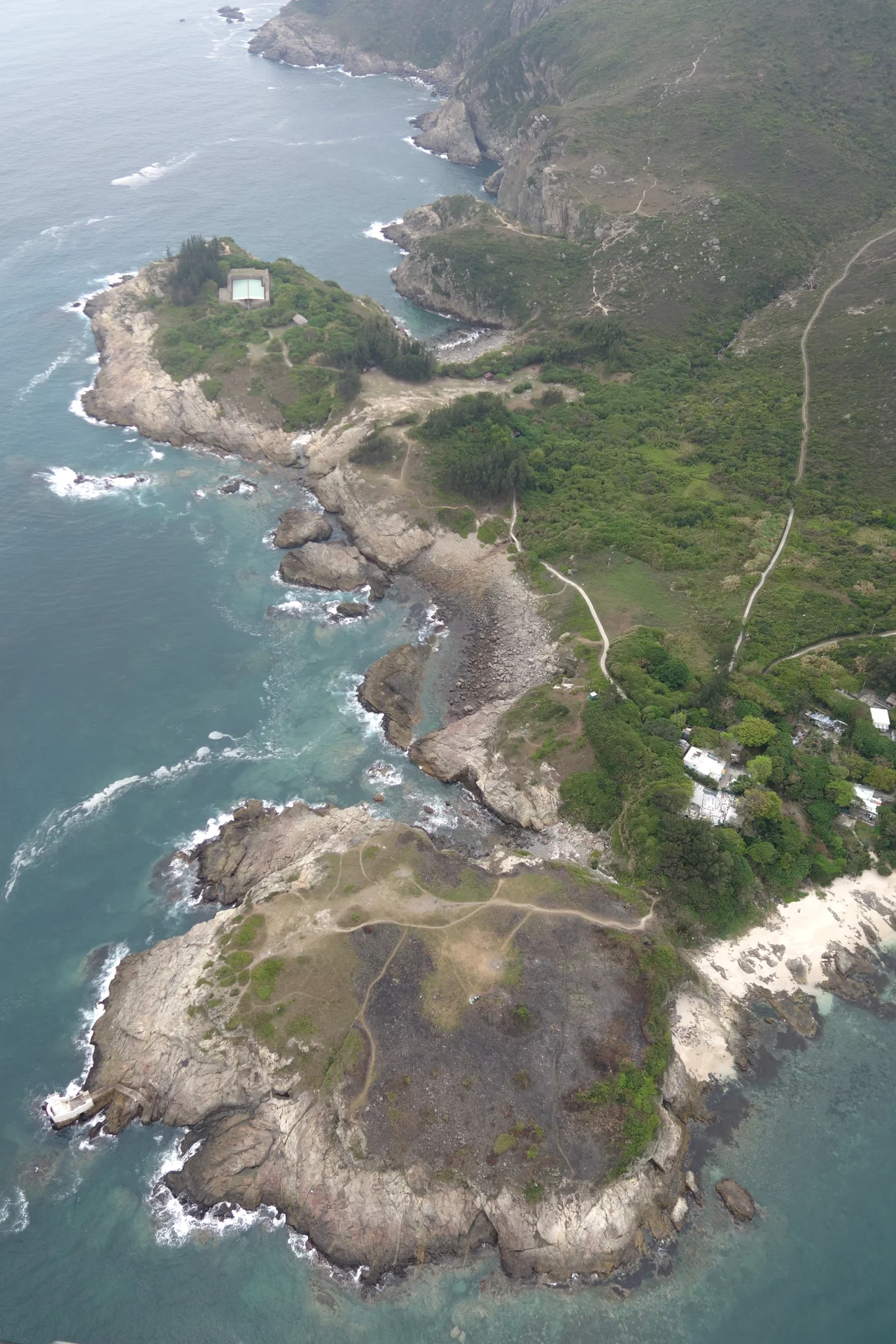

Tung Lung Fort
The garrison at Tung Lung Fort never numbered more than 25 men. From a rectangular enclosure of rubble-stone walls — ten feet high, fitted with an arch-shaped brick gate — they watched every vessel that moved through the Fat Tong Mun Channel below. No ship could enter or leave Joss House Bay without being observed. For nearly a century, from its construction in the early 1720s until its abandonment in 1810, that small force held one of the most strategically placed lookout posts in what would eventually become Hong Kong. The fort is in ruins now. The channel view remains unchanged.
Built Against Pirates
The fort was constructed between 1719 and 1724, during the reign of the Kangxi Emperor — one of the longest and most consequential reigns in Qing dynasty history. Its construction was triggered, at least in part, by the defeat of the Koxinga Administration in Taiwan, which ended the last organized resistance to Qing authority and sent armed, stateless maritime forces spilling into South China's coastal waters. Pirates operating off the Pearl River Delta and its approaches were a persistent threat to merchant shipping. The Qing response was a system of coastal fortifications, and Tung Lung Fort was one node in that network. The Tai-pang-hsi navy supplied its personnel — a regional naval command responsible for these waters. Twenty-five men, on rotation, watching the channel through whatever weather the South China Sea delivered.
The Pirates Who Came Anyway
The fort was reportedly attacked by at least three pirate figures of historical note: Cheng Lien Chang, Cheng I, and the legendary Cheung Po Tsai. Cheung Po Tsai operated across the Pearl River Delta in the early nineteenth century, commanding a fleet that at its height numbered in the hundreds of vessels. Whether the attacks succeeded in breaching the fort or were repelled is not recorded, but the fort's garrison was evidently not sufficient deterrent to the region's most ambitious pirates. The fort also served as a signal station, relaying messages by visual means to military headquarters in Kowloon — communication technology of the era being what it was, a clear line of sight and a set of agreed signals. Its position 35 metres above the water, on a promontory with cliffs on three sides, made it well suited to both purposes: observation and communication.
Abandoned and Declared
In 1810, the fort's personnel were transferred to a new coastal defence installation at the tip of the Kowloon Peninsula — a site that would eventually become Kowloon Walled City, one of the most densely inhabited structures in human history before its demolition in the early 1990s. Tung Lung Fort, deprived of its garrison, fell into the slow deterioration that stone walls undergo when no one maintains them. Typhoons, vegetation, and salt air did their work over the following century and a half. In 1977, the Hong Kong government declared the fort a monument, giving it the legal status its age warranted. Restoration work followed in 1988, stabilising the ruins without reconstructing what time had taken. The Tung Lung Fort Special Area was designated in 1979, covering 3 hectares and including both the fort and a campsite on the island.
What Remains
No drawings or written descriptions of the fort from its operational period survive. What archaeologists and conservators have worked from is the physical evidence: the outline of the rectangular plan, the remnant courses of rubble stone, the orientation chosen by builders who understood exactly where they needed to look. The cliffs on three sides were as much a feature as the walls — natural fortification that reduced the perimeter any garrison needed to defend. Looking out from the fort's position today, the channel geometry the Qing planners chose makes immediate sense. Fat Tong Mun narrows between the island and the Clear Water Bay Peninsula; anything passing through moves slowly and in plain sight. The fort did not need to be large. It needed to be here, at this precise point, with this specific view. That calculation still holds.
From the Air
Tung Lung Fort lies at approximately 22.255°N, 114.297°E on the northeastern promontory of Tung Lung Chau island. From the air at 1,500–3,000 feet, the fort ruins sit on the most prominent clifftop on the island's northern coast — look for the rectangular outline of the wall remnants against the green hillside above the sheer drop to the channel. The Fat Tong Mun Channel runs immediately to the north between Tung Lung Chau and the Clear Water Bay Peninsula; the fort commands this entire passage. Joss House Bay opens to the northwest, with the Tin Hau Temple visible at its head. Hong Kong International Airport (VHHH) is approximately 28 km to the west-southwest. The best aerial view of the fort's layout is from the north at moderate altitude, looking south with the channel in the foreground.
Nearby Stories
- Shek Pik 1.7 km away
- Tung Ping Chau 4.8 km away
- Hong Kong 12 14 km away
- Wanshan Archipelago Campaign 16 km away
- Pearl River Delta 18 km away
- Battle of Penghu 478 km away
- Penghu Air Raids 487 km away
- Cape Maobitou 596 km away