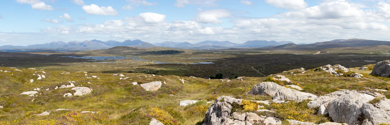

Twelve Bens
In 1684, the Irish historian Ruaidhri O Flaithbheartaigh wrote of mountains so distinctive that mariners coming in from the Atlantic used them as their first sight of Ireland. He called them the twelve stakes of Bennabeola. Today they are known as the Twelve Bens, and they still rise above the bogs and lakes of Connemara exactly as they did then: pale, sharp, unmistakable. The quartzite catches sun and weather in equal measure, so that from one hour to the next the range can look like bleached bone or wet slate, depending on which way the Atlantic chooses to send its weather that afternoon.
Stakes in the Sea
The Bens occupy a specific place in the old maritime memory of the west coast. For sailors approaching from the open ocean, the twelve peaks rose first above the horizon, a navigational landmark long before lighthouses or charts. O Flaithbheartaigh's 1684 description placed them northwest of Ballynahinch and noted exactly this function. The name itself comes from the Irish Beanna Beola, the peaks of Beola, a legendary chieftain. The English version, Twelve Bens or Twelve Pins, preserves the count even though the wider range actually holds 38 identifiable summits above 100 metres. Twelve was simply the number a sailor could count from the deck.
How the Rocks Were Made
The quartzite that gives the Bens their pale, almost luminous quality formed between 700 and 550 million years ago, when sediments settled on the floor of a warm shallow sea. Heat and pressure later transformed those sediments into the hard rock that now resists erosion better than almost anything around it. That resistance is why the peaks stand so prominently: softer rocks have worn down around them, leaving the quartzite cores exposed. The valleys between were carved by glaciers during the last ice age, scooping out the U-shaped corries that now hold dark lakes and give the range its distinctive horseshoe formations.
The Horseshoe Walks
Connemara walkers measure the Bens not by individual summits but by horseshoes, looping ridge walks that traverse multiple peaks in a single day. The Glencoaghan Horseshoe is the classic: 16 kilometres, eight to nine hours of high ridge, six peaks linked by knife-edge connections. Guidebook writers call it some of the most exhilarating mountaineering in Ireland. The longer Owenglin Horseshoe stretches to 19 kilometres and asks for 10 to 12 hours. For those who want everything in one day, the Twelve Bens Challenge covers 28 kilometres and all twelve original peaks in a 24-hour push, an undertaking that crosses from exercise into something closer to endurance pilgrimage.
Carrot Ridge and the Climbers' Corries
On the eastern flank of Bencorr, the Gleann Eighneach valley holds Ireland's most celebrated long rock climbs. Carrot Ridge stretches 275 metres up the spur, graded Diff but demanding for its length alone. Seventh Heaven runs 330 metres at Hard Severe, a sustained line that climbers travel from across the island to attempt. The corrie between Derryclare and Bencorr, called the wood of the big corrie, holds The Knave at 225 metres. These are not the highest cliffs in Ireland, but they are among the longest, and the quartzite gives them a particular pale-on-grey character that climbers describe as unmistakable.
Conservation and Quiet
The wider Twelve Bens area, including the Garraun Complex to the north, was designated a 16,163-hectare Special Area of Conservation. The protection covers blanket bog, heath, and the high-altitude habitats that make the range significant ecologically as well as visually. Connemara National Park occupies a portion of the range and gives walkers organised access to the lower slopes. But the peaks themselves remain what they have always been: exposed, unmarked, and dependent entirely on the walker's own judgement. Atlantic weather rolls in fast over these summits, and the same quartzite that sailors used to find Ireland still tells climbers and walkers exactly where they are, if they know how to read it.
From the Air
Coordinates: 53.50 N, 9.81 W. The Twelve Bens form a compact massif of pale quartzite peaks rising to roughly 730 metres (Benbaun at 729 m is the highest), set in northwest Connemara. From the air the range reads as a tight cluster of bare summits surrounded by darker bog and the dark waters of Lough Inagh to the east. Nearest airports: Ireland West Knock (EIKN) about 80 km north-northeast, Galway (EICM, currently general aviation only) about 70 km southeast. Recommended viewing altitude 4,000 to 6,000 ft to keep clearance from rapidly changing mountain weather; the Atlantic generates fast-moving low cloud and rain showers that can shroud the peaks within minutes.
Nearby Stories
- Salthill 4.4 km away
- Ardoileán 4.7 km away
- Ross Errilly Friary 5.1 km away
- Westport House 8.8 km away
- Kiltimagh 12 km away
- Inishmore 16 km away
- RMS Carinthia (1925) 32 km away
- Blackrock Island, County Mayo 32 km away