
Ulva
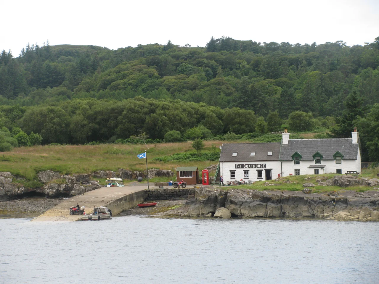
By May 2019, five people lived on Ulva. The island had once supported 859, before the potato famine and the clearances and the long century of departure that followed. Then in June 2018 something rare happened: the residents bought the island back. The North West Mull Community Woodland Company took ownership on 21 June 2018, with a £4.4 million boost from the Scottish Land Fund. The repopulation plan started in 2020. By 2022 the resident population had crept up to six. It is not a recovery yet, only a refusal to disappear. Standing on the pier at Ulva Ferry, waiting for the small boat that runs on demand across the few hundred metres of Caolas Ulbha, the scale of what was lost is hard to read from the geography alone.
Wolf Island
Ulva is twelve kilometres long and four wide, aligned east to west, oval in outline with an indented coastline. The Norse called it Ulvoy, probably wolf island, possibly from the shape, possibly from actual wolves that may once have hunted across it, possibly from a name. Samuel Johnson, who visited in 1773, deduced that the name was not Gaelic in origin. The English Ulva is a corruption of the Scottish Gaelic Ulbha, which itself may corrupt the Old Norse. The island connects to its neighbour Gometra by a bridge across a narrow strait. Mesolithic and Neolithic remains scatter across the moorland interior. Pictish, Dalriadan and post-Norse Gaelic cultures all shaped the place. The shape itself has not changed much since the ice retreated.
Born of Basalt
Ulva's south coast carries some of the same Cenozoic basalt that produced Fingal's Cave on neighbouring Staffa. The lava flows here are called the Staffa Magma Type member, particularly rich in silica. When the molten rock cooled, the surface cracked in a hexagonal pattern as drying mud cracks, and the cracks extended down through the cooling mass, leaving the columns that erosion eventually exposed. The cliffs at Dùn Bhioramuill show them clearly. Glaciation later carved the sea lochs on either side of the island, Loch Tuath to the north and Loch na Keal to the southeast. The land is still rising about two millimetres a year, recovering from the weight of the ice. The relative drop in sea level has left the highest raised sea cave in the British Isles on Ulva, at A' Chrannag. The cave once heard surf. Now it hears only wind.
Father of Australia
Lachlan Macquarie was born on Ulva on 31 January 1762. He rose through the British army, served in India, and in 1810 became Governor of New South Wales. In that role he reshaped the convict colony into something resembling a permanent society, granting land to emancipated convicts, founding towns, commissioning architecture. Australian history calls him the Father of Australia. He came back to Mull and Ulva in 1787 to try to recruit men for the British army. Few Ulvachs had any interest, and he deemed them ungrateful in his journal. Later, from India, he sent significant amounts of money back to support family and neighbours in Ulva and the Highlands. His mausoleum stands at Gruline on Mull, opposite the island where he was born.
Kelp, Famine, Departure
By the early nineteenth century the kelp industry supported much of Ulva's population. Workers gathered seaweed from May to July, dried it outdoors, then burned the dried weed to produce soda ash for fertiliser and iodine for medicine and glass. The work paid two shillings a week and a stone of wheat. Between 1817 and 1828, kelpers on Ulva collected 256 tonnes. Potatoes were the staple food, and Ulva even exported them. In 1841 the joint population of Ulva and Gometra reached 859. Then the Highland potato famine arrived, the kelp market collapsed under competition from imported alternatives, and the landlords cleared their tenants to make room for sheep. By 1848 the population had crashed to 150. A row of abandoned houses near Ardalum became known as Starvation Terrace. The depopulation continued for another 170 years before the community buyout finally turned it around. Recovery, when it comes, will not be quick.
From the Air
Coordinates 56.48°N, 6.205°W, off the west coast of Mull across the narrow Caolas Ulbha. Best viewed at 1,500-3,000 feet AGL with the Loch Tuath fjord to the north, Loch na Keal to the southeast, and Staffa visible 5 nm south. Beinn Chreagach (313 m) is the high point; Gometra connects by bridge to the west. Nearest airports: Glenforsa Airfield (grass) on Mull's east coast 18 nm east, Tiree (EGPU) 25 nm west, Oban (EGEO) 35 nm east. Atlantic weather is unpredictable; basalt cliffs on the south coast attract low cloud.
Nearby Stories
- Lismore Seminary 6.1 km away
- Muck 8.6 km away
- Tiree 12 km away
- Glenfinnan Railway Station 15 km away
- Colonsay 21 km away
- Loch Fyne 29 km away
- German submarine U-722 44 km away
- HMS Audacious 91 km away