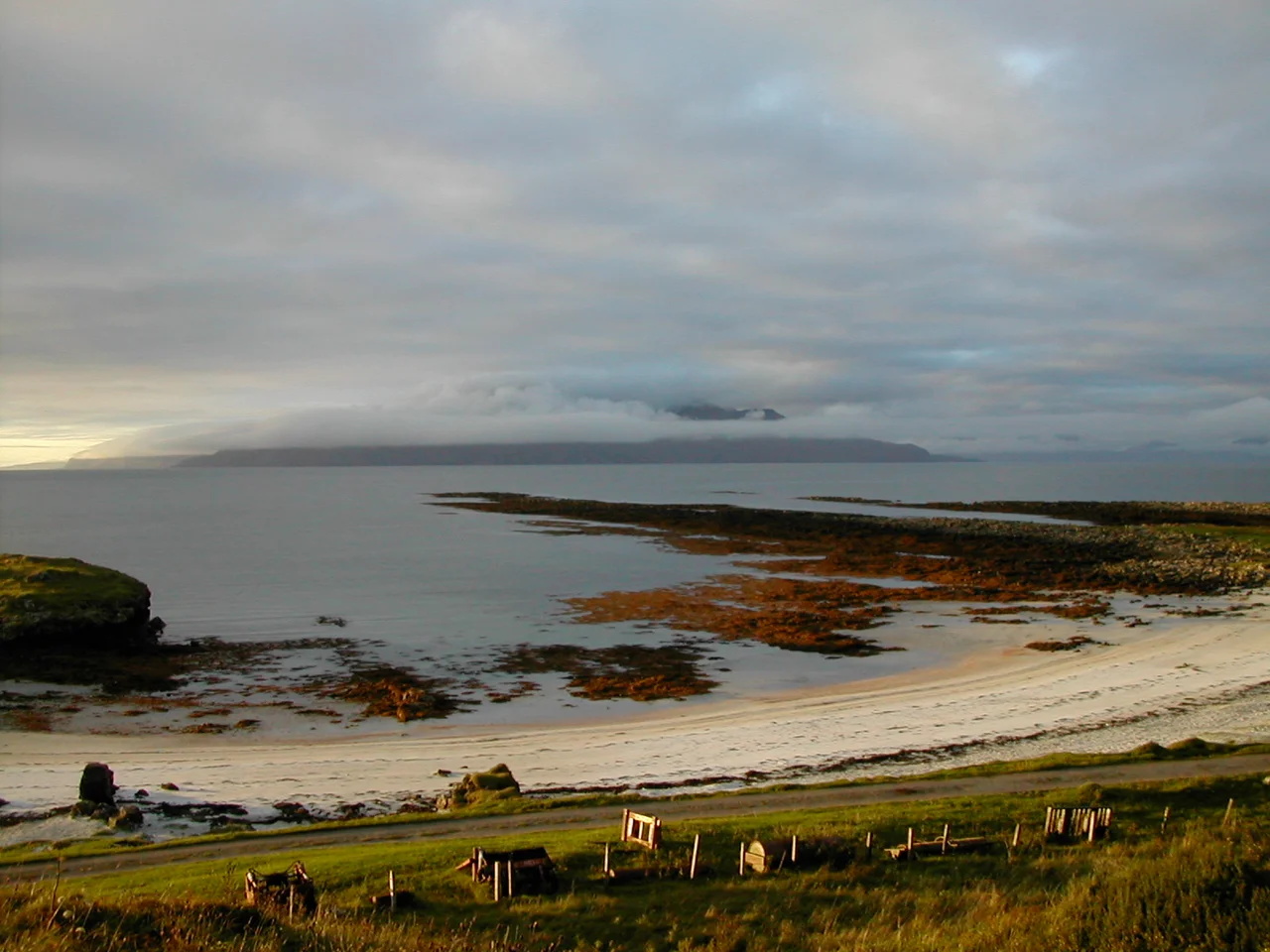

Muck
When Samuel Johnson and James Boswell came visiting the Small Isles in 1773, the owner of Muck made an unusual request. He hated being called Lord of Muck. Could the famous travellers, in their published accounts, please call him Lord of Monk instead? The owners of Muck have been losing this battle for several centuries. The name probably comes from the Gaelic muc, meaning pig, though scholars now think it actually refers to muc-mhara, sea-pig, the Gaelic word for porpoise, which abounds in the surrounding waters. Either way, the laird's family today, the MacEwens, who have lived and farmed here for a century, have given up trying to change the name. They have other things to do, like running an island of forty permanent residents with no shop, no church, and no letter-box.
Two and a Half Miles by One
Muck measures roughly two and a half miles east to west and one mile north to south. A single-track lane runs a mile and a half from Port Mor in the south to Gallanach in the north. There is no point in bringing a bike, and you cannot bring a car: the ferry from Mallaig takes foot passengers only. The eastern half of the island is fertile and gentle, where most of the houses sit and where the summer population doubles to about eighty. The western half is rough grazing on volcanic soil, and at its highest point, Beinn Airein, rises 137 metres above the sea with views across the Small Isles to Rum, Eigg, and Canna. There is no pub, no off-licence, no brewery, no distillery, and the island cafe has closed. Bring your own provisions and your own tea bags.
Keil and the Cleared Village
Near the south of the island lie the faint outlines of A'Chille, also called Keil, the former main village of Muck. In the 19th century the islanders here were evicted during the Highland Clearances, swept off the land by landlords who preferred sheep to tenants. What remains today is little more than low lines in the fields. The name Keil means church, and pieces of 7th and 8th century grave markers, carved when Iona was still a centre of Christian Europe, have been moved into shelter inside the Green Barn. Above the cleared village stands Caisteal an Duin Bhain, a natural rock table fortified in the Iron Age with a drystone wall, with medieval buildings added later. The hierarchy of the island is written in stone: prehistoric defences, early Christian burial, abandoned village, modern farm.
Bronze Age Cairns and Viking Ovals
On the promontory west of Gallanach stand two cairns dated roughly to 2000 BC, the Bronze Age. Part of the north cairn has been adopted as the MacEwen family grave, four millennia of burial use on a single mound. Below is the tidal islet of Eilean nan Uan, Isle of Lambs, with its larger sibling Eilean Horisdale, Isle of Horses, beyond. Elsewhere on the island, archaeologists have traced the faint oval outline of a structure believed to be Viking, with prehistoric pottery found in the soil. The promontory called Aird nan Uan appears to have been walled off in some unknown era to create a defensive dun. There are sea cliffs along this stretch, eagles overhead, and on a clear day the long blue line of the Outer Hebrides on the western horizon.
Cottages, Hebnet, and the Saturday Day Trip
The Gallanach self-catering cottages, owned by the MacEwen estate, are the standard way to stay on Muck. New House is a 1930s timber cottage with one double, two twins and four single rooms. Gallanach Cottage at the end of the road has three bedrooms. Seileachean is a converted stone barn with one double and a top bunk. As of July 2024, the island has 4G from all UK providers, thanks to Hebnet, a community network that relays mainland signals from island to island. On Saturdays in summer, you can catch the Calmac ferry to Eigg for three hours ashore and still be back in time for dinner. The Calmac to Canna is possible too. The only Small Isle you cannot reach directly from Muck is Rum: for that you have to double back to Mallaig and start again.
From the Air
Muck lies about ten nautical miles west of the Ardnamurchan peninsula at 56.8342 degrees north, 6.2489 degrees west. From the air the island appears as a low green oval, larger Eigg and Rum visible to the north, the long ridge of Ardnamurchan to the east. Recommended viewing altitude 2,000-4,000 feet to see the whole island, its sister Small Isles, and the surrounding Sea of the Hebrides. Visual landmarks include Beinn Airein at 137 metres, the single-track road from Port Mor to Gallanach, and the tidal islets of Eilean nan Uan and Eilean Horisdale to the northwest. Nearest airport is Oban (EGEO) about 40 nautical miles southeast. Glasgow (EGPF) is 100 nautical miles south.
Nearby Stories
- Glensanda 6.6 km away
- Calgary, Mull 7 km away
- Dun Telve 7.5 km away
- Loch Coruisk 8.8 km away
- Glenfinnan Railway Station 11 km away
- German submarine U-722 15 km away
- Tiree 16 km away