
Vrilissia
The streets give it away. In a city famous for tangled, narrow lanes, Vrilissia runs unusually wide and straight, lined with gardens and apartment blocks that rarely climb above four floors. Spread across the southwestern foot of Mount Pentelicus on the northern edge of the Athens basin, this suburb of about 32,000 has the feel of a town that planned itself - leafy, low-rise, and noticeably cleaner of air than the cement-heavy districts closer to the city's heart. It sits in the shadow of a mountain whose white stone, quarried in antiquity, became some of the most famous architecture on Earth.
The Mountain of Marble
The name reaches back to antiquity. Ancient writers - Thucydides, Herodotus, Strabo - mention a place called Vrilissos or Vrilittos, and the word most likely means "Great Rock." That rock is Mount Pentelicus, looming just above the suburb, and its marble is the reason the mountain matters far beyond Attica. Pentelic marble, mined from these slopes, faced the monuments of the Acropolis, the Parthenon among them, and later returned to use in the grand 19th-century buildings of modern Athens. The modern town honors this lineage: Vrilissia's logo depicts an ancient Greek treasure, and a great boulder, evoking the megalith-shaped form the name describes, stands in Eleftherias Square - the Square of Freedom - at the city's heart.
From Deme to Municipality
In classical times the land here belonged to the ancient deme of Phlya, a district that stretched from Psychiko to Agia Paraskevi and centered on what is now Chalandri. For most of its modern existence Vrilissia was simply a corner of Chalandri, and it only broke away to become a separate community in 1949. Independence as a full municipality came later still, in 1990 - making Vrilissia, despite its ancient name, a remarkably young town in administrative terms. Its real transformation arrived with the 2004 Athens Olympic Games. The city-wide push to modernize for the Games completed Vrilissia's peripheral road circuit, widened its central avenue, and rerouted traffic away from the interior, while small parks were carved into neighborhood after neighborhood.
Green in a Cement City
What sets Vrilissia apart is breathing room. Most homes spill into private gardens, the apartment blocks stay low, and a pine-clad belt was preserved along the northern edge of the municipality - a natural buffer against traffic and exhaust that helps keep the local air noticeably clean for the Athens basin. For generations, the Pentelicus foothills above the suburb drew Athenians out for day trips: picnics, forest walks, a coffee or a taverna dinner with the city spread below. The Great Penteli Abbey, founded at the mountain's foot in the 16th century, anchored centuries of grazing, monastic farming, and slow settlement before housing estates finally began climbing the slopes.
The Fires of 2007
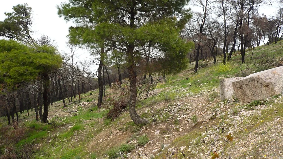
The green that defines Vrilissia has also made it vulnerable. The disastrous Greek wildfire season of 2007 - the same summer that scarred neighboring Mount Parnitha - struck the suburb hard. On 29 June a fire broke out in the contested forest land on the western edge of town, with the national fire service stretched thin across blazes nationwide; it consumed homes and woodland into the evening. A second fire on 16 August spread through dry grass and destroyed dozens more houses, beaten back only at night by firefighters with trucks, helicopters, and planes. Residents joined the fight, and in the aftermath several Attica municipalities, Vrilissia among them, organized volunteer fire-watch patrols to guard what forest remained.
Connected and Comfortable
Today Vrilissia is one of the better-connected suburbs in northern Athens. The A6 northern beltway and the short A621 motorway pass through it; two commuter rail stations and the Doukissis Plakentias metro station tie it into the Attica network, and frequent buses run to neighboring suburbs and central Athens along the spine of Pentelis Avenue toward Chalandri. Life clusters around two renovated squares, Iroon and Analipseos, where small coffee shops fill in the evenings, and around the central Ascension Church. There is a strong sporting streak too: the suburb is home to clubs with national titles in handball and women's volleyball. It is, in the end, a comfortable place - affluent, walkable, and unusually green for a town pressed against the edge of a sprawling capital.
From the Air
Vrilissia lies at 38.039°N, 23.838°E on the northern edge of the Athens basin, at the southwestern foot of Mount Pentelicus (Penteli), about 12 km northeast of central Athens. From the air, look for the marble-quarried slopes of Pentelicus rising immediately to the northeast and a low-rise, garden-rich suburb with notably wide straight streets and a preserved pine belt along its northern border. Recommended viewing altitude 2,500-4,000 ft AGL; the A6 beltway and the metro line toward Doukissis Plakentias aid orientation. Nearest major airport is Athens International (LGAV), about 12 km east - this is busy controlled airspace under Athens approach, so coordinate accordingly. Visibility is generally good, with summer haze possible over the basin.
Nearby Stories
- Great Sand Beach 5 km away
- Battle of Delium 7.7 km away
- Tower of Aliartos 9 km away
- HMHS Britannic 10 km away
- Saronic Gulf 15 km away
- Sousaki Volcano 17 km away
- Sanctuary of Apollo Maleatas 24 km away
- Skyros 66 km away