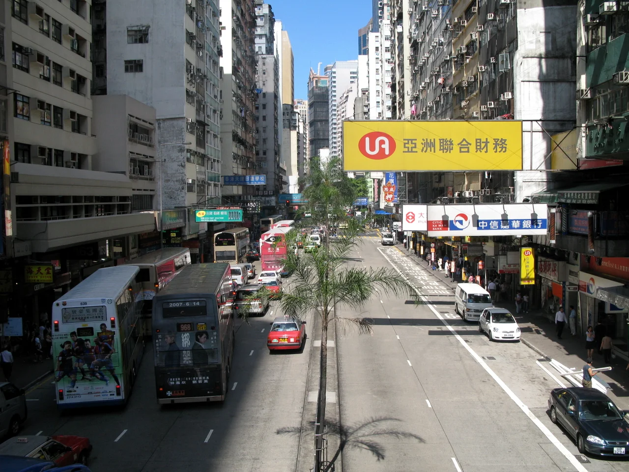

Wan Chai District
Richard Mason set his 1957 novel in Wan Chai. The film adaptation followed three years later. The district's reputation as a place of sailors, bargirls, and neon arrived and stuck, the way reputations do. But Wan Chai was already old when Suzie Wong made it famous. The district runs from the edge of Admiralty east to Causeway Bay along Hong Kong Island's north shore, and the version of it most visitors encounter — harbourfront towers, convention centres, the gold bauhinia sculpture catching the morning sun — is largely built on land that did not exist a century ago. The older Wan Chai climbs the hill behind, quieter and more complicated, running through Happy Valley and up toward Jardine's Lookout and Wong Nai Chung Gap.
A Shore That Kept Moving
Hong Kong's relationship with Victoria Harbour is an ongoing negotiation, and nowhere has the city pushed harder into the water than Wan Chai. The Praya East Reclamation Scheme ran from 1922 to 1929, extending the northern shoreline substantially. Then, between 1965 and 1972, more reclamation moved the coastline again — this time all the way north to what became Convention Avenue and Hung Hing Road. Wan Chai North, the zone of convention centres and high-rises that now defines much of the district's skyline, sits entirely on this reclaimed ground. The Hong Kong Convention and Exhibition Centre, where the handover ceremony was held on 1 July 1997, was built on land that was underwater within living memory. The Cross-Harbour Tunnel, opened in 1972, links the former Kellett Island — absorbed into Wan Chai by the same reclamation — to Hung Hom in Kowloon. The city's coastline is not a fact; it is a choice, continuously revised.
1997 and What Happened Here
At midnight on 30 June 1997, the ceremony transferring Hong Kong from the United Kingdom to the People's Republic of China took place in the then-new wing of the Hong Kong Convention and Exhibition Centre, on the harbourfront in Wan Chai North. The image of that moment — flags lowered and raised, dignitaries in rain, fireworks over the harbour — is among the most replayed in the city's history. Wan Chai became, briefly and permanently, the place where British colonial rule in Hong Kong ended. The Golden Bauhinia Square next to the centre marks the occasion with a large sculpture of the bauhinia flower, Hong Kong's symbol, where a flag-raising ceremony takes place daily and in special form on Chinese National Day. It is a popular destination, particularly for visitors from mainland China — a kind of pilgrimage site to a specific moment in time.
The District Behind the Headline
The administrative Wan Chai District is considerably larger than the neighbourhood most people picture. It takes in Causeway Bay's commercial density, Happy Valley's quiet racecourse hum, the residential streets of Tai Hang, and the green ridgelines above. As of 2021, some 166,695 people lived here — a figure that had grown from 152,608 a decade earlier. About 75 percent of residents are Chinese, but the district hosts a notably diverse population: Filipinos make up 9.8 percent, one of the higher concentrations on the island. Income levels are high relative to Hong Kong as a whole, with roughly one in five residents holding liquid assets above HKD 1 million. The Wan Chai District Council administers all of this, though the chairmanship passed to the District Officer starting in 2023.
Layers Within Layers
Walk five minutes from the exhibition centre's glass and steel and you reach a different city. Bowen Drive, just uphill from the main streets, draws politicians and movie stars alongside ordinary residents for morning runs through light filtered by tropical canopy. Tai Yuen Street, which locals call Toy Street, is lined with shops selling figurines, plastic novelties, and goods that feel unchanged from decades earlier. The Old Wan Chai Post Office, a declared monument, stands quietly on Queen's Road East. Central Plaza — third tallest in the city — punctuates the skyline from Wan Chai North. Mahjong centres and five-star hotels occupy the same few blocks. The red-light district that gave the neighbourhood its postwar reputation still exists, reduced but not gone. Wan Chai does not resolve neatly. It holds all its versions at once, and the resulting texture is part of what makes it feel like Hong Kong.
From the Air
Wan Chai District occupies the north-central portion of Hong Kong Island at approximately 22.2797°N, 114.1717°E. From 2,000–4,000 feet on approach to Hong Kong International Airport (VHHH, about 34 km to the west), the arc of Victoria Harbour's north shore is clearly legible, with the curved roof of the Hong Kong Convention and Exhibition Centre marking Wan Chai North and the vertical spike of Central Plaza visible just east of the main Central cluster. The green hillsides of Happy Valley and Jardine's Lookout rise steeply behind the harbour strip.
Nearby Stories
- Lok Ma Chau Loop 2.3 km away
- Portas do Cerco 2.3 km away
- Kweilin Incident 17 km away
- Wanshan Archipelago Campaign 34 km away
- Nanxiong Formation 115 km away
- Battle of Nanpeng Island 148 km away
- Heyuan 169 km away
- Cape Maobitou 632 km away