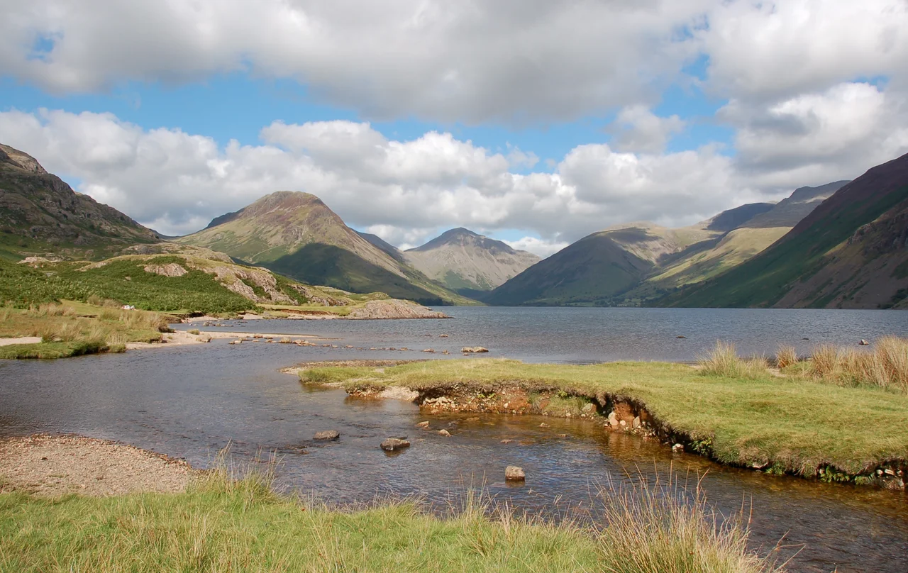

Wasdale
A parish of 127 people. Too few for a parish council, so they hold a parish meeting instead. Too few, since the 2011 Census, for separate population statistics to be published at all. Yet this thin strip of valley floor in west Cumbria contains the deepest lake in England, the highest mountain in England, and the church credited as one of the smallest churches in England. Wasdale is where superlatives collect - quietly, sparsely, in a landscape that demands respect from anyone who comes for them.
Valley of the Water
The name is straightforward in its origins. Wasdale comes from the Old Norse Vatnsdalr, meaning "valley of the water," given by Norse settlers who left their language across the western fells like a quilt of place-names. Through much of the nineteenth century, the alternative spelling Wastdale was common, but the older form has prevailed. The River Irt rises here, drains south-westward through the parish, and reaches its estuary at Ravenglass, where the Romans built one of their westernmost forts. A large part of the main valley floor is occupied by Wastwater - 258 feet deep, the deepest lake in England, its bottom more than fifty feet below sea level. The civil parish was historically a chapelry called Nether Wasdale within the larger ancient parish of St Bees. It became a separate civil parish under the Poor Law Amendment Act 1866, and the name was changed from Nether Wasdale to Wasdale in 2000.
Wasdale Head
At the head of the valley, where the fells crowd in on three sides, sits the hamlet of Wasdale Head. It is small even by Cumbrian standards - a hotel, a few farms, a road that gives up about a mile further on. The mountains around it are a roll-call of the highest peaks in England: Scafell Pike, Scafell, Great Gable, Kirk Fell, Yewbarrow. Clockwise from the north-west, the fellwalker's ridge reads Seatallan, Buckbarrow, Middle Fell, Yewbarrow, Red Pike, Scoat Fell, Pillar, Kirk Fell, Great Gable, Sty Head Pass, Great End, Scafell Pike, Lingmell, Scafell, Illgill Head, Whin Rigg, Irton Pike. Anyone who has spent time on these fells can rebuild that list from memory. They form one of the most concentrated upland landscapes in Britain - and at their feet, in the hamlet, stands St Olaf's Church, one of the smallest churches in England, where slate roof beams are said to come from Viking longships.
Where British Climbing Began
Wasdale's reputation among rock climbers is older and more particular than its reputation among ordinary walkers. The early ascents on Great Gable and Scafell Crag in the late nineteenth century are often counted as the beginning of British rock climbing as a sport rather than as a means to reach a summit. Nape's Needle, on Great Gable - a slender rock pillar that detached itself from the parent crag - was first climbed by Walter Parry Haskett Smith in 1886. That climb is often pointed to as the symbolic moment when British rock climbing began. The Wastwater Hotel became the climbers' gathering place. Generations of pioneers - the Abraham brothers, Owen Glynne Jones, Geoffrey Winthrop Young - learned their craft here, on the rough volcanic rock of the Borrowdale Volcanic Group, in weather that prepared them for anywhere else in the world. The Westmorland Brothers built a cairn south-west of Great Gable's summit, marking what they called "the finest view in the district."
Strands and Gosforth
Further down the valley, past the lake, are the villages of Strands - officially Nether Wasdale - and Gosforth. They sit on flatter ground where farming is possible at a more familiar scale, though the parish never grew the way coastal villages did. Wasdale's population stays where the landscape can support it. The road into Wasdale Head is narrow enough that two cars meeting requires one to reverse to the nearest passing place; in summer, with climbers and walkers heading for the fells, that ballet plays out hundreds of times a day. The valley screes on the south-eastern side of Wastwater, below the summits of Whin Rigg and Illgill Head, are among the most photographed landscape features in the Lake District - a sweep of loose stone tumbling two thousand feet from ridge to lake bed. The path that runs along their base is a tougher walk than it looks. Wasdale rewards effort. It does not pretend to be easy.
From the Air
Centred at 54.425 N, 3.350 W. Recommended viewing altitude 4,000-6,000 ft to clear the surrounding fells. Visual landmarks: Wastwater - long, narrow, dark - runs northeast-southwest along the valley floor. Scafell Pike (978 m) and Scafell (964 m) at the valley head, Great Gable to the north-east, the screes immediately south of the lake. Nearest airports: Carlisle Lake District (EGNC) 35 nm north-northeast, Blackpool (EGNH) 50 nm south, BAE Warton (EGNO) 55 nm south. Mountain weather is volatile; Wasdale receives some of the highest rainfall totals in England and low cloud can drop into the valley with little warning.
Nearby Stories
- Isel Hall 3.3 km away
- Walney Island 7.1 km away
- Kendal 9.7 km away
- Lancaster Priory 10 km away
- Raeberry Castle 15 km away
- Cross Fell 21 km away
- Ramsey Bay 29 km away
- Santon Railway Station 47 km away