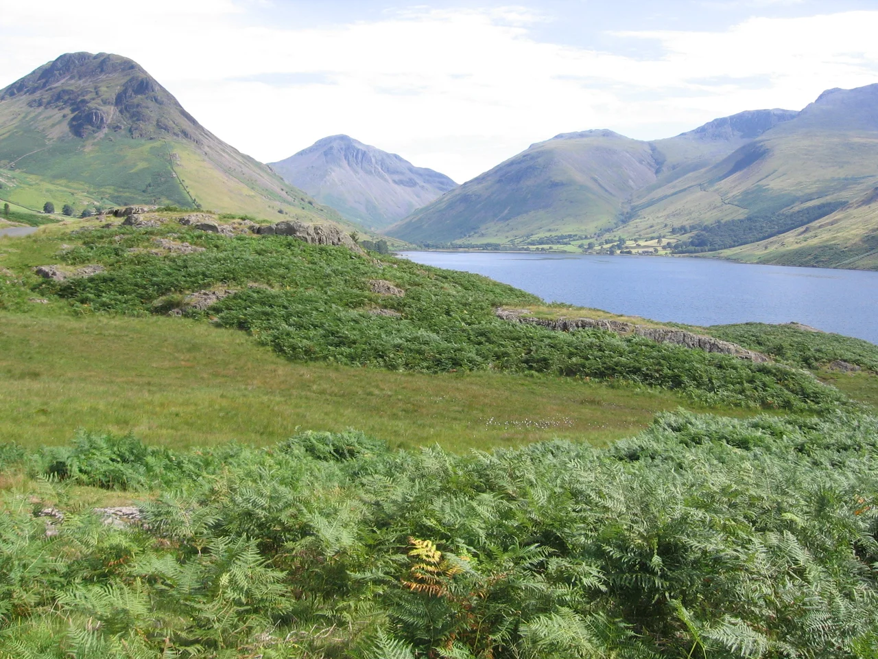

Wast Water
The bottom of this lake is below sea level. The surface of Wast Water sits about 200 feet above the Irish Sea, but the lake bed plunges more than fifty feet below that horizon - meaning that at its deepest point, you could walk down through 258 feet of cold, dark, oligotrophic water before you reached the floor. It is the deepest lake in England. The glaciers that carved this Cumbrian valley during the last Ice Age over-deepened it spectacularly, scouring far below the surrounding terrain. What they left behind is owned by the National Trust, protected as a Site of Special Scientific Interest and a European Special Area of Conservation, and unusually difficult to see all of even from the air.
Valley of the Lake
The name Wast Water is a reduced form of Was(t)dale Water - the lake belonging to Wasdale, the valley around it. The valley name comes from the Old Norse Vatnsdalr, meaning "valley of the lake." The Norse who settled this coast after AD 885 left their language across the landscape, and the lake's name is one of the clearest examples - layered Norse pointing back at itself. Wast Water is almost three miles long, glacially over-deepened, and at the lower end it feeds the River Irt, which flows south-west to the Irish Sea near Ravenglass. The head of the valley above the lake is surrounded by some of the highest mountains in England, including Scafell Pike, Great Gable and Lingmell - a horseshoe of summits whose dark grey rock and steep flanks define the basin.
The Screes
The southeastern shore of Wast Water is famous for the Wastwater Screes - or, on some maps, just "The Screes." They are a sweep of scattered, jagged stone falling from the summits of Whin Rigg and Illgill Head down into the lake. Top to base, they measure roughly two thousand feet, with the base extending about two hundred feet below the lake's surface. The rock is the Borrowdale Volcanic Group, hardened from Ordovician volcanic ash and lava some 450 million years ago, then broken by ice, frost and time into this characteristic loose carpet. A path runs the length of the lake at the base of the screes, picking through boulders and scrambling over old stone. It looks straightforward; it is not. Walking the screes path takes longer than the map suggests, and the loose stone shifts underfoot. On the opposite shore are the cliffs of Buckbarrow, part of Seatallan, and the upturned-boat profile of Yewbarrow.
The Lady in the Lake
In 1976, a Cumbrian woman named Margaret Hogg was killed by her husband. He weighted her body and disposed of it in Wast Water, more than a hundred feet deep, in cold, oxygen-poor water where decay almost stops. Eight years later, divers found her. The body had been preserved like wax by the conditions, the soft tissue intact, the features recognisable. The case became known locally as the "Wasdale Lady in the Lake." The conviction that followed depended in part on what those eight years of cold water had not done to her. It is a grim story, and worth remembering as a story about a woman with a name and a life rather than as a curiosity about the lake. Margaret Hogg's family lived with the absence for those eight years before they had a body to bury.
Gnomes, Divers, and Depth
Wast Water is also a recreational dive site - the depth, the clarity and the cold draw divers from across Britain. Somewhere on the lake bed in the 1990s, someone placed a "gnome garden," complete with a picket fence, as a curiosity for divers to find at depth. It became a destination. In the late 1990s, three divers died at Wastwater. The official assessment was that they had spent too long too deep, searching for the ornaments - decompression failure brought on by the lure of a punchline. The gnomes were removed. Police divers later reported a rumour that the garden had been replaced at a depth beyond the lowest the police themselves were permitted to dive - 50 metres - which is to say, a depth where finding it would carry the same risk that had killed its earlier admirers. The story is funny only until you remember the three families. PC Kenny McMahon of the North West Police Underwater Search Unit became, for a time, one of the public faces of the search work. The depth of Wast Water is not a joke.
From the Air
Located at 54.442 N, 3.292 W. Recommended viewing altitude 4,000-6,000 ft for valley context. Visual landmarks: a long, dark, narrow lake oriented southwest-northeast, the dramatic screes filling its southeastern shore, Scafell and Scafell Pike rising to over 950 m immediately east. The lake's unusually dark surface (a function of the oligotrophic clarity over volcanic geology) makes it instantly recognisable from altitude. Nearest airports: Carlisle Lake District (EGNC) 35 nm north-northeast, Blackpool (EGNH) 50 nm south, Isle of Man Ronaldsway (EGNS) 60 nm west. Mountain weather is volatile; Lake District frontal weather often produces low cloud filling the valley.
Nearby Stories
- Isel Hall 3.3 km away
- Walney Island 7.1 km away
- Kendal 9.7 km away
- Lancaster Priory 10 km away
- Raeberry Castle 15 km away
- Cross Fell 21 km away
- Ramsey Bay 29 km away
- Santon Railway Station 47 km away